Thornham Circular
Norfolk Walk
County/Area - Norfolk
Author - Lou Johnson
Length - 5.0 miles / 8.1 km Ascent - 100 feet / 30 metres
Time - 2 hours 40 minutes Grade - easy
Maps 

| Ordnance Survey Explorer 250 | Sheet Map | 1:25k | BUY |
| Anquet OS Explorer 250 | Digital Map | 1:25k | BUY |
| Ordnance Survey Landranger 133 | Sheet Map | 1:50k | BUY |
| Anquet OS Landranger 133 | Digital Map | 1:50k | BUY |
Walk Route Description
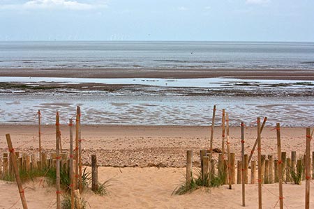
Click image to see photo description.
A pretty Norfolk coastal walk from the village of Thornham that takes in lovely countryside as well as salt marshes and one of Norfolk's more remote sandy beaches at Holme Dunes. The route passes a Wildlife Trust and café in the pine trees by the beach and explores the Old Harbour at Thornham. Then well-known and ancient taverns of the Lifeboat and Orange Tree are also along the route as well as a Thornham Deli. Directions are from Anna's House Boutique Bedrooms on the High Street at Thornham, although you can join the walk at any point.
The start is on the A149 main road between Hunstanton and Wells-next-the-Sea (grid ref. TF731433). Turn right out of Anna's House and walk towards Hunstanton. Cross the road to Thornham Deli. Take footpath by the Cricket Pitch running adjacent to the main road towards Holme. Reaching a tarmac side road follow the blue arrow footpath sign.
Cross the main A149 and follow the footpath sign. Go past the 'Holme Hurst' house and walk down to the far gate. Go through the side gate and head down the tree-lined path. After just over a kilometre, go left at the Norfolk Coast Path (grid ref. TF722444). Just after Broad Water (on your left) bear left. Keep left and head to the pine trees. Walk through the pine trees adjacent to the Wildlife Centre. Turn left for a detour to Trust café or right onto the beach.
Leave the beach and return to the Norfolk Coast retracing your steps to where you first joined this National Trail. Turn left staying on the Norfolk Coast Path. Continue on this path past the Old Harbour and Coal store. Just path a small parking area on your right, turn left to continue along the Norfolk Coast Path. Alternatively continue straight ahead for 300 metres to reach the Lifeboat Inn. After 500 metres you reach a path junction (with trees ahead of you). The Coast Path turns sharp right. At this point go left and continue along the path (with salt marshes to your left). Continue for about 800 metres to reach a track. Turn right and continue to a road (The Green). Turn right again and follow this road around to the left. The Green leads into Church Street passing the Orange Tree on your right to reach High Street. Turn left for the Chequers Inn or right to return to the start.
Other walks nearby
| Walk 3306 | Holme next the Sea and Thornham | easy/mod | 7.5 miles |
| Walk 3514 | Brancaster to Burnham Overy Staithe | easy | 6.0 miles |
| Walk 2922 | Old Hunstanton to Thornham by the Coast Path | easy | 4.5 miles |
| Walk 3416 | Hunstanton from South Beach, Heacham | easy | 6.0 miles |
| Walk 1035 | Burnham Market | easy | 5.5 miles |
| Walk 3256 | Great Bircham & Fring Circular | easy/mod | 8.4 miles |
| Walk 1640 | Snettisham Beach RSPB reserve | easy | 4.0 miles |
| Walk 1908 | Wells-next-the-Sea & Holkham Park | easy/mod | 8.0 miles |
| Walk 2101 | Holkham Park circular | easy | 4.5 miles |
| Walk 3254 | Holkham & Holkham Park Circular | moderate | 10.2 miles |
Recommended Books & eBooks
No suggestions for this area.Messaging & Social Media
Message Walking Britain and follow the latest news.

Mountain Weather
Stay safe on the mountains with detailed weather forecasts - for iOS devices or for Android devices.