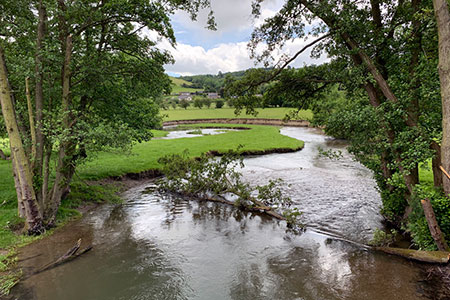
LLan-fawr & Lugg Valley from Whitton
Powys Walk
County/Area - Powys - Powys Central
Author - Lou Johnson
Length - 7.5 miles / 12.2 km Ascent - 1400 feet / 424 metres
Time - 5 hours 10 minutes Grade - moderate
Maps 

| Ordnance Survey Explorer 201 | Sheet Map | 1:25k | BUY |
| Anquet OS Explorer 201 | Digital Map | 1:25k | BUY |
Walk Route Description
Click image to see photo description.
This Powys walk starts from the village of Whitton in the Lugg Valley a few miles from the English border. The route ascends Llan-fawr for an excellent view of the surrounding landscape with its rolling hills and beautiful valleys. The route then continues to join the Offa's Dyke Path for a scenic section back to the start.
Parking is available at St. David's Church car park in Whitton (grid ref. SO270673). After parking return to the road, turn right and continue to the crossroads. Turn right along the B4357 and continue to cross Whitton Bridge over the River Lugg. Just past the cottage on the right, turn right along the track (signed as a bridleway). Continue along the track past Litton Cottage, through a gate by a cattle grid to a junction (grid ref. SO258674). Turn left uphill between fences and into a field. Follow the right-hand side of the field and turn right through a gate. Entering woodland (open access land), turn left and follow the ascending path onto the open hillside. The path bears to the left and to reach a track (grid ref. SO259666).
Turn left along the track for 400 metres and then bear half left following a path to the OS trig point on Llan-fawr where you can enjoy the view over the beautiful landscape. To start the descent bear left and descend steeply in places down to a track (grid ref. SO255660). Turn right along the track (bridleway) and descend through a broad valley, ignoring a footpath on the left. Continue through the buildings at the Rectory and bear left to join a tarmac lane. Follow this lane to a T-junction (grid ref. SO249657).
Turn left along this lane and continue for two kilometres to reach the B4357. Go straight across at the junction, pass Yew Tree Farm on your left to reach the waymarked Offa's Dyke Path (grid ref. SO272651). Turn left and follow the hedge on your right. Nearing the River Lugg, bear right to a gate in a fence. Turn left and follow the field boundary on the left to cross the Dolley Old Bridge over the River Lugg. The path continues up to the B4356 west of Dolley Green.
Turn right along the B4356. After 200 metres, bear sharp left onto a track just before the Dolley Green sign on the right staying on the Offa's Dyke Path. Follow the clear track as it climbs the southern flank of Furrow Hill. The path eventually levels out with a great view of the Lugg Valley and surrounding hills. The path continues over Gilfach Hill and soon reaches a bridleway (grid ref. SO283674). Turn left, signed to Whitton. Drop down to a gate and then continue down with a hedge on the left to a tarmac lane. Turn left and almost immediately right through a gate. (Note the field boundaries in this area have altered since the OS 1:25k map was published.) Descend between fences to a gate and then follow right-hand field boundary to pass through another gate and into a field. Go straight across to the gate on the far side and join a track. Follow this down to the B4356. Turn right, go straight across the junction, and return to the car park.
Other walks nearby
| Walk 3631 | Panpunton Hill & Stowe from Knighton | moderate | 7.8 miles |
| Walk 2816 | Kinsley Wood, Stowe and Offa's Dyke | moderate | 12.0 miles |
| Walk 1907 | Stowe & Offa's Dyke from Kinsley Wood | moderate | 7.0 miles |
| Walk 3023 | Great Rhos & the Radnor Forest from New Radnor | moderate | 9.0 miles |
| Walk 1998 | Harley's Mountain from Lingen | easy/mod | 7.5 miles |
| Walk 3614 | Herrock Hill from Kington | moderate | 8.0 miles |
| Walk 3285 | The Hergest Ridge and Huntington from Kington | moderate | 12.0 miles |
| Walk 3300 | The Hergest Ridge from Kington | moderate | 8.5 miles |
| Walk 3565 | The Hergest Ridge from Gladestry | easy/mod | 6.1 miles |
| Walk 1673 | Shobdon Hill and Croft Ambrey from Shobdon Estate | moderate | 12.5 miles |
Recommended Books & eBooks
The Cambrian Way
 Guidebook to the Cambrian Way, a challenging three-week mountain trek through Wales from Cardiff to Conwy. The 470km un-waymarked route is presented from south to north. Often sticking to long, beautiful ridgelines, it crosses wild and rugged terrain and visits many of Wales's highest mountains, including Snowdon.
More information
Messaging & Social Media
Message Walking Britain and follow the latest news.

Mountain Weather
Stay safe on the mountains with detailed weather forecasts - for iOS devices or for Android devices.