Stour Valley & Dedham from Flatford Mill
Suffolk Walk
County/Area - Suffolk & Essex
Author - Lou Johnson
Length - 3.5 miles / 5.7 km Ascent - 150 feet / 45 metres
Time - 1 hours 50 minutes Grade - easy
Maps 

| Ordnance Survey Explorer 196 | Sheet Map | 1:25k | BUY |
| Anquet OS Explorer 196 | Digital Map | 1:25k | BUY |
Walk Route Description
Click image to see photo description.
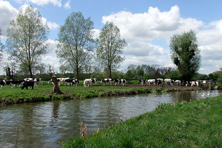
This easy walk explores the Stour Valley between Flatford Mill (Suffolk) and Dedham (Essex). The route includes much of interest including the River Stour, the attractive village of Dedham and the many attractions at Flatford Mill which was the subject of John Constable's best-loved paintings. The walk uses sections of the Stour Valley Path and St. Edmund Way.
The start is the National Trust pay and display car park at Flatford (grid ref. TM076366). To start the walk, exit the car park at the north end and turn left along Flatford Road. After 200 metres take the signed footpath on the right. The path runs parallel to the road for about half a kilometre to re-join the lane. Turn right along the lane and almost immediately left down a narrow track (signed to Fen Bridge and Dedham).
Follow the track past a house on your left and continue to cross a bridge. 100 metres beyond the bridge turn right onto the St. Edmund Way and continue to the B1029 in Dedham (grid ref. TM058366). Turn left along the B1029, cross the river, and continue past Dedham Mill on your right. Continue into the centre of Dedham. Reaching a T-junction with the church opposite, turn left and continue into Brook Street. Just after Dedham Art & Craft Centre (on your right) the road bends to the right. On the bend, turn left taking the right-hand of two tracks (signed to Flatford). The route passes Dedham Hall on your left and continues to the River Stour. Bear left along the river and continue to Flatford. Reaching the bridge over the river, bear left over the bridge and explore the village before returning to the car park.
Other walks nearby
| Walk 3658 | Manningtree, Flatford Mill and Dedham | easy/mod | 7.1 miles |
| Walk 2096 | Alton Water, Stutton & Tattingstone | easy | 5.5 miles |
| Walk 2149 | Circuit of Alton Water | easy/mod | 7.6 miles |
| Walk 3724 | River Box from Stoke-by-Nayland | easy | 6.0 miles |
| Walk 2374 | Freston Circular | easy/mod | 6.6 miles |
| Walk 2017 | Pin Mill to Shotley Gate | easy | 5.5 miles |
| Walk 1639 | Erwarton, Church End & River Orwell from Pin Mill | easy/mod | 8.0 miles |
| Walk 3642 | Shotley Gate & Ewarton from Chelmondiston | moderate | 10.6 miles |
| Walk 1648 | Church End & Erwarton from Shotley Gate | easy | 6.0 miles |
| Walk 3556 | Arlesford Creek & Brightlingsea Circular | easy | 6.0 miles |
Recommended Books & eBooks
Suffolk Coast and Heath Walks
 Guidebook to three long-distance routes exploring the varied landscapes of the Suffolk Coast and Heaths AONB. The Suffolk Coast Path covers 55 to 60 miles from Lowestoft to Felixstowe. The Stour and Orwell Walk is 40 miles from Felixstowe to Cattawade near Manningtree, while the Sandlings Walk is 59 miles from Ipswich to Southwold.
More information
Messaging & Social Media
Message Walking Britain and follow the latest news.

Mountain Weather
Stay safe on the mountains with detailed weather forecasts - for iOS devices or for Android devices.