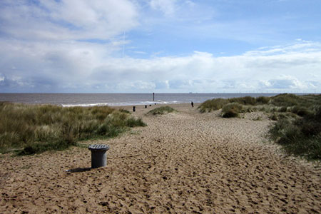
Anderby Creek from Chapel St. Leonards
Lincolnshire Walk
County/Area - Lincolnshire
Author - Lou Johnson
Length - 5.4 miles / 8.8 km Ascent - 100 feet / 30 metres
Time - 2 hours 50 minutes Grade - easy
Maps 

| Ordnance Survey Explorer 122 | Sheet Map | 1:25k | BUY |
| Anquet OS Explorer 122 | Digital Map | 1:25k | BUY |
Walk Route Description
Click image to see photo description.
This Lincolnshire circular coastal walk explores the Lincolnshire Coastal Country Park. The route also offers the chance to visit the North Sea Marine Observatory visitor centre at Chapel Point, Chapel St Leonards. The walk follows the beach north to Anderby Creek before turning inland for the return passing close to several nature reserves which can easily be explored.
The start is the car park adjacent to the North Sea Observatory at Chapel Point (grid ref. TF562732). After parking exit the car park and wall to the sea front. Turn left (with sea on your right) and continue for three kilometres to Anderby Creek. On this section you have the choice of walking along the beach or the waymarked England Coast Path, which runs behind the dunes for part of the way.
Reaching the Main Drain at Anderby Creek (grid ref. TF552760), turn left away from the sea and follow the path on the south side of the drain. After 600 metres the path reaches a road. Turn left and then take the first road on the right. &5 metres beyond the junction, turn left over a stile with sign to Chapel Point. Follow the path along the left-hand field edge. Bear right along the track, cross a cattle grid, and keep straight ahead at a path junction signed to Roman Bank (grid ref. TF549752).
Continue straight ahead. After 650 metres the path turns sharp right. Continue for 300 metres and turn left (signed to Chapel Point). The onward path follows a drain (on your left) and leads to Stone's Lane (grid ref. TF548740). Follow the lane south. At the T-junction turn left. Keep straight ahead at the next junction and soon arrive at the entrance to Nelson Villa caravan park. Go through the gate, bear right alongside a row of conifer trees. Bear left across a small footbridge and follow pavement to a driveway. Turn left and then right at a T-junction to leave the caravan park. Reaching a public road, turn left back to the start.
Other walks nearby
| Walk 1875 | Gunby Hall & Park | easy | 4.4 miles |
| Walk 2809 | Aby & Belleau | easy | 3.0 miles |
| Walk 2712 | Hagworthingham to Horncastle | moderate | 12.5 miles |
| Walk 1509 | Old Bolingbroke & East Keal circular | easy | 6.0 miles |
| Walk 1792 | Somersby and Tetford Circular | easy/mod | 6.0 miles |
| Walk 1129 | Tathwell & Haugham circular | easy | 5.5 miles |
| Walk 1914 | Louth, South Elkington, Hallington & Raithby | easy/mod | 7.5 miles |
| Walk 1325 | Horncastle, Langton & Thimbleby circular | easy/mod | 6.0 miles |
| Walk 2722 | Covenham St. Bartholomew & the Reservoir | easy | 4.8 miles |
| Walk 3306 | Holme next the Sea and Thornham | easy/mod | 7.5 miles |
Recommended Books & eBooks
No suggestions for this area.Messaging & Social Media
Message Walking Britain and follow the latest news.

Mountain Weather
Stay safe on the mountains with detailed weather forecasts - for iOS devices or for Android devices.