New End & Cladswell Circular
Worcestershire Walk
County/Area - Worcestershire & Warwickshire
Author - Millennium Way
Length - 3.5 miles / 5.7 km Ascent - 300 feet / 91 metres
Time - 2 hours 0 minutes Grade - easy
Maps 

| Ordnance Survey Explorer 205 | Sheet Map | 1:25k | BUY |
| Anquet OS Explorer 205 | Digital Map | 1:25k | BUY |
| Ordnance Survey Explorer 220 | Sheet Map | 1:25k | BUY |
| Anquet OS Explorer 220 | Digital Map | 1:25k | BUY |
| Ordnance Survey Landranger 150 | Sheet Map | 1:50k | BUY |
| Anquet OS Landranger 150 | Digital Map | 1:50k | BUY |
Walk Route Description
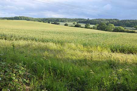
Click image to see photo description.
An enjoyable easy walk enjoying the attractive countryside in Worcestershire and Warwickshire. The route incorporates a short section of the Millennium Way, which has distinctive way markers. The walk starts from New End and passes through varied scenery and the village of Cladswell.
A The walk starts at the Nevill Arms at New End (grid ref. SP051600), on the A441 just south of Redditch. Emerging from the car park of the Nevill Arms turn right into Saltway and continue down to go left into Brandheath Lane. You are already on The Millennium Way and will be guided by the distinctive way markers. After 100 yards, just adjacent to the private driveway ahead, turn right down a hidden narrow passage. Go through metal gate into paddock and exit into a further paddock and continue ahead to take stile into field. Maintain line ahead to take next stile and get right under power cables at the corner of field. Here we leave The Millennium Way and go left, taking the footbridge with wooden rails and metal gates across ditch and into field. Stay ahead with trees and fence right to pass through gap ahead with unused stile adjacent on the right. Stay ahead to pass through metal gate at corner. Continue along narrow path with fence right and trees left (you have a lovely view of the Malvern Hills on your far right). Emerge onto a grass and gravel track and take metal gate (or gap as it is usually open) to reach road.
B Turn right down road to arrive at crossroads. Here turn left into Cladswell Lane and continue along the gently undulating lane for approx. 1/2 a mile. You will continue on past Lower Cladswell Lane and Cladswell Close, the lane rising to a point where it turns sharp left into Church Lane. Do not turn into Church Lane but continue on the same line into the cul-de-sac following the public footpath sign (incidentally you are on the Monarch's Way for about a mile). Stay ahead down the lane between the houses. Where the lane veers right, just by a house called Lambrook, continue straight ahead to take the public footpath signed "Oak Tree Lane" and through a wooden kissing gate ahead. Stay along footpath to exit by wooden kissing gate to road. Go left for 15 paces and take wooden kissing gate on right and continue along path beside large paddock with wood and wire fence on left. Emerge onto a driveway by a house called Crantock and, after 15 paces, take narrow footpath left between fences and laurel to reach main road.
C Cross directly over main road and take way marked bridleway signed Alcester. Stay ahead with pine wood on left. Soon you will emerge into a field with glorious views ahead. Continue through gap ahead and gently down field keeping wood right. Do not be tempted into the woodland but stay ahead for some while going gently downhill and keeping the wood right and a large lonely oak tree in the field on your left. At the bottom right corner, under another big oak tree, a narrow path goes off to the right. At this point stay forward for 15 paces ignoring the path and instead turn left in same field to continue along field edge with hedge right. The path weaves a little left and right, but just go along for a while keeping hedge and trees right. Eventually, 25 paces after a sharp left at a field corner, you will come to a wide gap on your right marked with wooden posts and rail. Take gap and go right following around edge of field keeping hedge right. Shortly you will come to a wooden bridge on your right which crosses a ditch and here you will see the black and white Millennium Way way marker. Do not cross this wooden bridge but continue on with hedge right.
D You are now back on the Millennium Way and will remain so until the end of the walk. Continue along the edge of this vast field ignoring any gaps right and at the end of field continue through into next field with hedge right. After 150 paces, and 30 paces before the power lines, take wide gap on right, continuing to maintain previous direction, passing under power lines, but with hedge left. Exit field by metal gate and cross driveway to take metal kissing gate then go ahead up track. Go left through metal gate at top of track and then bend right, round the base of field mound on an ill-defined path. Continue steeply uphill, well away from fence left, high up just to the right of the trees. Take the new metal gate into a short piece of woodland.
Exit woodland by stile ahead and go left, along field edge, to take further stile, some 30 paces to the right of left-hand corner, into woodland again. There is a picnic table off to the right (notice the Millennium Way way markers are now green as we are back in Worcestershire). Exit woodland by stile and go with hedge right to take another stile to main road. Cross the road carefully, to arrive back at The Nevill Arms, which can provide welcome refreshments.
Other walks nearby
| Walk 1345 | Alcester Town & Country Circular | easy/mod | 7.0 miles |
| Walk 3702 | Coughton Circular | easy/mod | 6.8 miles |
| Walk 3235 | Studley Circular | easy/mod | 8.3 miles |
| Walk 3715 | Holberrow Green & New End from Inkberrow | easy/mod | 8.3 miles |
| Walk 3716 | Morton Bagot & Bannam's Wood from Studley | easy/mod | 8.4 miles |
| Walk 3686 | Dormston from Inkberrow Circular | easy | 5.4 miles |
| Walk 3226 | New End & Holberrow Green from Inkberrow | easy/mod | 8.0 miles |
| Walk 3684 | Flyford Flavell and Dormston circular | easy | 4.5 miles |
| Walk 3246 | River Avon & Cleeve Prior from Bidford-on-Avon | easy | 4.5 miles |
| Walk 3472 | Tardebigge Flight of Locks, Bromsgrove | easy | 5.3 miles |
Recommended Books & eBooks
No suggestions for this area.Messaging & Social Media
Message Walking Britain and follow the latest news.

Mountain Weather
Stay safe on the mountains with detailed weather forecasts - for iOS devices or for Android devices.