Hambledon Hill & Hod Hill from Shroton
Dorset Walk
County/Area - Dorset
Author - Lou Johnson
Length - 6.0 miles / 9.8 km Ascent - 1150 feet / 348 metres
Time - 4 hours 10 minutes Grade - easy/mod
Maps 

| Ordnance Survey Explorer 118 | Sheet Map | 1:25k | BUY |
| Anquet OS Explorer 118 | Digital Map | 1:25k | BUY |
Walk Route Description
Click image to see photo description.
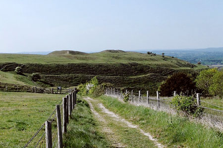
This Dorset circular walk from Shroton is full of interest. The route initially climbs steadily onto Hambledon Hill with its extensive Neolithic ramparts. The walk continues to Hod Hill where remains of an Iron Age hillfort and a Roman Camp can be explored. The walk also offers some wonderful views across the surrounding landscape.
The start is the car park opposite St, Mary's Church on Main Street, Shroton (grid ref. ST860124). After parking exit the car park, cross the road, and turn right. Take the first left into Fairfield Road and follow the road as it bends to the right. A short way after the bend, take the stile on the left and once in the field go half left aiming for the rising chalky track. Follow the track, which is part of the Wessex Ridgeway, and continue through a gate. After the gate turn right onto a clear trac, also part of the Wessex Ridgeway, that rises steadily to reach the trig point on Hambledon Hill (grid ref. ST848123).
The route continues by completing an anti-clockwise circuit of the Neolithic ramparts before returning to the trig point. There are several paths to choose from for this short circuit around this gloriously situated site. In fine weather it is also a perfect place for a picnic.
From the trig point continue southeast for 200 metres to a fingerpost (grid ref. ST849120). Take the left-hand fork signed to Steepleton Iwerne. The path here is a section of the Stour Valley Way. A steady descent of just under a kilometre leads to a barn (grid ref. ST855116) where you turn right and descend to a road near Keeper's Cottage (grid ref. ST855112).
Turn right along the lane and immediately veer left up to a gate. Pass through the gate and continue up a track for about 130 metres and fork right up to another gate - signed National Trust - Hod Hill). Pass through the gate and head half left across Hod Hill where there have been both Iron Age and Roman settlements. The scale of the earthworks is surprising and after following the path for 700 metres you reach the outer ramparts (grid ref. ST858103). After passing through the ramparts, turn left on the lower path and continue for 250 metres to turn right through a gate and then left down a track to a road (grid ref. ST861111).
There is a bridleway running parallel to the road, but it was quite overgrown! Turn left along the road. At the first junction turn left in front a red brick house. Just past the house on the right is a metal gate with a waymark on the gate post. Go through the gate and follow the White Hart Link across the first field with hedge on right. At a path junction (grid ref. ST859116) keep ahead through trees into a field. The path becomes a wider track and reaches a crossroads of tracks (grid ref. ST858118). Go straight across and follow the White Hart Link north to re-join the outward route. Go through the gate continue north downhill to the stile and turn right into Fairfield Road. Follow the road back to Main Street and turn right with the car park on the left.
Other walks nearby
| Walk 3743 | Win Green from Tollard Royal | easy/mod | 5.4 miles |
| Walk 3673 | Rawlsbury Camp, Lower Ansty, Hilton & Bulbarrow | easy/mod | 7.2 miles |
| Walk 2448 | Ackling Dyke from Sixpenny Handley | easy/mod | 8.6 miles |
| Walk 3679 | Wardour Castle, Ansty Down & Wardour Park | easy/mod | 7.5 miles |
| Walk 2733 | Plush & Wessex Ridgeway | easy/mod | 4.7 miles |
| Walk 3748 | Southover Heath from Tolpuddle | easy | 5.0 miles |
| Walk 1748 | East Knoyle & Hindon from West Knoyle | moderate | 9.6 miles |
| Walk 1868 | Plush from Piddletrenthide | easy/mod | 6.0 miles |
| Walk 2343 | Higher Pertwood & Wessex Ridgeway from Hindon | easy/mod | 8.1 miles |
| Walk 3237 | Bowerchalke & the Ox Drove | easy/mod | 8.0 miles |
Recommended Books & eBooks
Walking the Jurassic Coast
 This guidebook includes 30 walks on the Jurassic Coast of Devon and Dorset. Covering the coast between Exmouth and Bournemouth, these delightful routes range from 3 to 16 miles (5 to 24km), exploring and explaining the spectacular geology of this World Heritage area with clear, easily understood descriptions, cross-sections and timelines.
More information
Messaging & Social Media
Message Walking Britain and follow the latest news.

Mountain Weather
Stay safe on the mountains with detailed weather forecasts - for iOS devices or for Android devices.