Loughrigg Fell from Skelwith Bridge
Lake District Walk
Nat Park - Lake District - Lake District Central Fells
Wainwrights - Loughrigg Fell
County/Area - Cumbria
Author - Charlotte Starkey
Length - 4.5 miles / 7.3 km Ascent - 1070 feet / 324 metres
Time - 3 hours 20 minutes Grade - easy/mod
Maps 

| Ordnance Survey Explorer OL7 | Sheet Map | 1:25k | BUY |
| Anquet OS Explorer OL7 | Digital Map | 1:25k | BUY |
| Ordnance Survey Landranger 90 | Sheet Map | 1:50k | BUY |
| Anquet OS Landranger 90 | Digital Map | 1:50k | BUY |
Walk Route Description
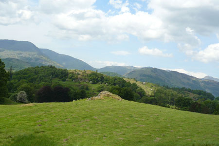
Click image to visit gallery of 6 images.
This is a short, fairly easy Lake District circular walk (for even the least active of children) to the top of one of the smaller Wainwright peaks. Once the open country is reached, there are good views for the adults and plenty of opportunities for the kids to clamber on rocks with no real threat to life and limb. The start is from the roadside parking available on the Langdales road next to the hotel at Skelwith Bridge but get there reasonably early to be sure of a spot.
Walk back along the Langdales road until the junction with the main Coniston to Ambleside road. At the road junction turn left and start walking along a narrow road up a steep hill. Carry on along this road, round a few bends, until you get to another road junction. Turn right along this road for about 20m then look for a footpath to the left.
Follow the footpath past a farm and carry on until the path splits in two. When this happens go down the right hand path and through the gate. You now follow this path as it starts to go up hill again. The path goes next to a stone wall. Ignore the paths climbing the hill on the left as these are much steeper than the one we want.
Not long after the path goes away from the wall, you cross a little stream on a wooden bridge. Carry on for a little bit longer until the path goes down hill to a boggy bit. Turn left at the boggy bit to leave the main path and go on to a stony path that soon starts going up hill again.
You then come to a bit where there is a steep path up through some rocks - great fun for kids to climb up and pretend to be real mountaineers - or there is a path that loops round to the right and is easy walking to get to the same place.
When we got next to some small lakes, me and my sister took it in turns to decide which path we should go on when there were different ones to choose from. Dad didn't mind as long as we were going up in the right direction and it was fun for us because we felt important and between us we got to the top.
This was the first time my sister and me had ever been to the top of a mountain and we couldn't believe how windy it was. Dad says it's not always like that but we think that is just a trick to get us to go up another mountain sometime.
From the top we started back down by following a wide grassy path towards Lake Windermere but we only stayed on this path for about 50m. We then turned right on to a small grass path that went into a little valley. It wasn't long before the path got steeper but when it did, the path also got easier to walk down because there were lots of stones that made it like a staircase.
In the bits without the stone steps, the path got a bit tricky because the little pebbles were loose and kept sliding a little bit. Near to the bottom of the hill the path had a little stream next to it.
At the bottom of the hill you turn left on to another footpath that goes through a small wood then it gets to a lake called Loughrigg Tarn.
You could go round the side of the lake on the stony track but for us it was more fun to go over the stile and on the grassy path closer to the lake. We had to be careful not to scare the sheep and their new lambs. There is another stile at the end of the grass path that takes you back to the stony track. This then goes past a camp site before getting back to the place we saw earlier when we went through a gate.
Carry on and follow the path past the farm again and back to the small roads. You now get back to your car by going down the same road you came up at the start of the walk.
Notes There are a lot of paths visible on the ground on Loughrigg Fell which are not shown on the OS map. Downloading the desired route to a GPS can give some navigational backup as well as allowing the technologically minded kids a chance to show off ! Providing you have some idea of the way to the summit minor, in reality it doesn't much matter which path you follow providing they are heading in the right general direction. Extra care is needed though when starting the descent to ensure you get the right path.
Other walks nearby
| Walk 2715 | Skelwith Bridge & Loughrigg | easy/mod | 5.5 miles |
| Walk 1684 | Lingmoor Fell & Langdale | easy/mod | 7.0 miles |
| Walk 1823 | Fairfield Horseshoe & Loughrigg from High Close | mod/hard | 14.0 miles |
| Walk 1141 | Elterwater circular | easy/mod | 4.0 miles |
| Walk 1059 | Colwith Force and Skelwith Force | easy/mod | 4.8 miles |
| Walk 1134 | Wetherlam and The Carrs | mod/hard | 10.8 miles |
| Walk 2270 | Tilberthwaite and Holme Fell Little Langdale | easy/mod | 5.5 miles |
| Walk 1002 | The Fairfield Horseshoe | mod/hard | 11.0 miles |
| Walk 1170 | Fairfield Horseshoe (short route) | mod/hard | 9.5 miles |
| Walk 1023 | Wansfell Pike & Wansfell | easy/mod | 7.5 miles |
Recommended Books & eBooks
Outdoor Adventures with Children - Lake District
 Guidebook to 40 outdoor adventures in the Lake District with children under 12, including walking, cycling, orienteering, paddling, boating, hostelling and more. Graded activities for varying age ranges or for families with children of different ages.
More information
Walking the Lake District Fells - Keswick
 Part of the Walking the Lake District Fells series, this guidebook covers a wide range of routes to 30 Lakeland summits that can be climbed from Keswick, Whinlatter, Bassenthwaite, Caldbeck, Mungrisdale and Threlkeld, with highlights including Skiddaw and Blencathra. Includes suggestions for longer ridge routes.
More information
Messaging & Social Media
Message Walking Britain and follow the latest news.

Mountain Weather
Stay safe on the mountains with detailed weather forecasts - for iOS devices or for Android devices.