Walk 3758 - printer friendly version
Tynehead and Ashgill Force from near Garrigill Walk
Author - Lou Johnson
Length - 8.2 miles / 13.3 km
Ascent - 900 feet / 273 metres
Grade - easy/mod
Start - OS grid reference NY748407
Lat 54.7605990 + Long -2.3931272
Postcode CA9 3HE (approx. location only)
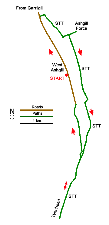
This walk from near Garrigill in Cumbria explores Ashgill Force and the upper reaches of the River South Tyne to its accepted source. The route provides the walker with a detailed visit to Ashgill Force before heading up the valley to pass several more waterfalls as you gradually gain height to reach the watershed with upper Teesdale.
To reach the start drive south through Garrigill and reaching the end of the village bear left onto a no-though road and continue south into the valley. Continue to cross Crossgill Bridge and 200 metres beyond the bridge there is a parking space suitable for a car (grid ref. NY748407). After parking walk back towards Garrigill, cross the bridge, and take the first footpath on the right through a wooden gate (grid ref. NY748408). Follow the walled track, cross Windshaw Bridge over the River South Tyne and turn right onto the South Tyne Trail.
The path follows the river upstream through a gorge. The path then turns left up Ashgill. Reaching a four-way finger post, continue ahead, cross a bridge, and continue up to Ashgill Force, which after heavy rain is an impressive sight. To continue, return to the four-way fingerpost and turn left over the footbridge and continue along the South Tyne Trail. Approaching Hole House Farm the path fades. The onward path crosses an awkward stone stile on your left above the stream.
Pass to the left of Hole House Farm and continue upstream. Continue across a track leading left to Tynehead Farm (grid ref. NY762380). Cross a footbridge, go through gate on the left and continue upstream. Pass ruined buildings and waterfalls to reach a private road which leads to Moor House in Teesdale. Follow this road to reach the source of the Tyne which is marked by a stone sculpture (grid ref. NY753350) and the watershed at 557 metres above sea level.
The return to the start is a relaxing downhill walk initially following the private road to reach a cattle grid and the public road (grid ref. NY757384). Continue down the quiet road for 2.5 kilometres back to the start.
Messaging & Social Media
Message Walking Britain and follow the latest news.

Mountain Weather
Stay safe on the mountains with detailed weather forecasts - for iOS devices or for Android devices.