Looking north from Arenig Fawr towards Snowdon.
Walk Photo 303809
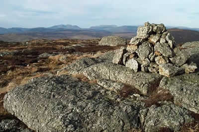
Caption - This cairn is marked on the OS 1:25000 map as a 697m spot height at the northern end of Arenig Fawr's northeast ridge. This view taken looking north was in a period of extremely clear visibility and shows the Snowdon massif very clearly with the Glyders to its right.
Walk 3038 : Wolfhole Crag from Tower Lodge
Photographer : Lou Johnson
Use back button to return to the photo gallery lists.
Further Information
Location Map
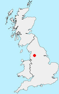
Forest of Bowland
The Forest of Bowland walks cater for walkers of all abilities from easy low-level walks to walks across the hills and moors. All walks are free to download and print and all routes have GPS files. The walks cover the highlights of this area including Pendle Hill, Whin Fell and Dunsop Fell as well the valleys and moors of this beautiful part of England. More Information
Messaging & Social Media
Message Walking Britain and follow the latest news.

Mountain Weather
Stay safe on the mountains with detailed weather forecasts - for iOS devices or for Android devices.