 Walking Britain
Caer Caradoc from Church Stretton
Shropshire Hills Walk
Region - Shropshire Hills
County/Area - Shropshire
Author - Lou Johnson
Length - 3.5 miles / 5.7 km Ascent - 960 feet / 291 metres
Time - 2 hours 30 minutes Grade - easy/mod
Walk Route Description
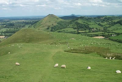
Click image to visit gallery of 3 images.
This appears to be a walk without challenge yet the ascent of this hill is steep hence its grading of "easy to moderate". The reward for your efforts is some excellent exercise and wonderful views to the Long Mynd. In addition the hill is full of history with its natural ramparts being used by iron age man and the Romans as an ideal fort.
The start is the lay-by (Grid ref. SO 466954) on the eastern side of the A49 Shrewsbury to Ludlow road about a mile north of the main road junction in the town centre. From this lay-by head north along the grass verge with Caer Caradoc rising steeply on your right to reach a signed footpath going right across a field and into a wood. You are soon through the wood and crossing further pasture you climb steadily to reach a stile. Take note of this spot as you will return here at the end of the route.
Cross this stile and turn left along the footpath that contours north along the flank of caer Caradoc. After approximately half a mile look out for a rising path forking right. Take this and climb more steeply to the col between Caer Caradoc and Little Caradoc. Turn right to climb more steeply onto the summit of Caer Caradoc. The summit provides superb views - west across the valley to the Long Mynd, southeast to Hope Bowder Hill and northeast to the Lawley and the Wrekin.
Leave the summit rocks and follow the ridge south and then southwest to reach Three Fingers Rock, which is well known feature of this hill. Shortly after this outcrop the path drops steeply to reach a stile. Do not clamber over, instead turning right to follow a footpath that contours around Caer Caradoc to reach the point detailed above. Turn left over the stile and descend across pastures and through the wood to regain the starting point.
Maps 
| Ordnance Survey Explorer 217 | Sheet Map | 1:25k | BUY |
| Get Ordnance Survey Digital Map Subscription | |||
| Latest Ordnance Survey Discounts | |||
Other walks nearby
| Walk 1321 | Caer Caradoc & Hope Bowder Hill from Church Stretton | moderate | 9.0 miles |
| Walk 3048 | Caer Caradoc & The Lawley from Church Stretton | moderate | 10.0 miles |
| Walk 3308 | Ragleth &the Long Mynd from Cardingmill Valley | mod/hard | 11.0 miles |
| Walk 3449 | Ragleth, the Long Mynd & Ratlinghope from Carding Mill | hard | 18.0 miles |
| Walk 1374 | Lightspout Waterfall & Pole Bank from Carding Mill | easy/mod | 5.8 miles |
Start Point Details
Ordnance Survey Grid Ref SO466954
Latitude 52.553808 Longitude -2.7890234
Postcode SY6 7JJ
what3words start vital.overjoyed.treating
Walk description may contain detailed information on the start point for this walk.
Further Information
Shropshire Hills Walking
This National Landscape (formerly AONB) consists of a number of areas of hills centered on Church Stretton. The hills are known for the variety, extensive network of paths and wonderful scenery. The most popular hills are the Long Mynd but others including Wenlock Edge, the Stiperstones and those around Clun are also gaining in popularity.
Walking GuideAccommodation
Find Accommodation nearby by using the regional accommodation lists
Go to regional accommodation lists
Self Catering & Cottage Holidays
Properties throughout the UK & Europe
Messaging & Social Media
Message Walking Britain and follow the latest news.


Mountain Weather
Stay safe on the mountains with detailed weather forecasts - for iOS devices.