Causey Pike from Stoneycroft, near Braithwaite
Lake District Walk
Nat Park - Lake District - Lake District North Western Fells
Wainwrights - Barrow, Causey Pike, Outerside, Scar Crags
County/Area - Cumbria
Author - Lou Johnson
Length - 6.3 miles / 10.2 km Ascent - 2290 feet / 694 metres
Time - 5 hours 30 minutes Grade - moderate
Maps 

| Ordnance Survey Explorer OL4 | Sheet Map | 1:25k | BUY |
| Anquet OS Explorer OL4 | Digital Map | 1:25k | BUY |
| Ordnance Survey Landranger 90 | Sheet Map | 1:50k | BUY |
| Anquet OS Landranger 90 | Digital Map | 1:50k | BUY |
Walk Route Description
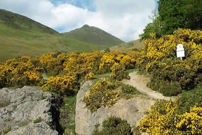
Click image to visit gallery of 5 images.
Causey Pike is of modest height yet its distinctive summit makes it easily recognised from the area around Derwentwater and Keswick. Topped by five knuckles not dissimilar to a clenched fist, it immediately throws out a challenge to be climbed. Backed by the high mountains of the Grasmoor Massif and with far reaching views over much of Lakeland it is a perfect objective for a relatively easy Lake District mountain walk. When combined with the lesser summits of Outerside and Barrow you have a perfect horseshoe which can be enjoyed at leisure with none of the pressures associated with longer and more arduous walks.
The ideal place to park is along the road which runs south from Braithwaite to Stoneycroft. Parking is ample on most days especially near Uzzicar Farm (Grid ref. NY232218). The real walking starts where Stoneycroft Gill crosses the road. Above the summit of Causey Pike beckons. There is a choice of paths. The easier is the direct route climbing to Sleet Hause although the steeper route over Rowling End is preferred by some.
However you reach Sleet Hause you will have already climbed enough for the views to open out. Behind you is a wide reaching panorama over Derwentwater, Skiddaw, Blencathra and the Helvellyn Range. To your right, as you climb, the cirque of mountains surrounding Coledale looks impressive, whilst to your left the view of the beautiful valley of Newlands and the Western Fells improves with every step. From Sleet Hause the path climbs steeply until twenty or so feet below the summit there is a short scramble up a rock gully with plenty of hand holds. Exiting from this you have reached the top of Causey Pike with an extensive 360 degree panorama to enjoy.
The onward path takes you over Scar Crags and down to Sail Pass. Ahead lie Sail and Eel Crag, summits that can be left for another day. Turning right down the main path you soon reach High Moss. Leave the main valley mine road here and head along a feint path to the summit of Outerside. Despite its relatively lowly stature it offers a perfect place to study the wonders of Coledale with the high peaks of Eel Crags and Grisedale Pike dominating the scene. Continuing down to the north-east ridge to Stile End you are confronted with a choice of paths. Keep to the ridge over the subsidiary summit of Stile End and down into the col of Barrow Door.
Ahead lies the final climb of the day to the summit of Barrow. From here you can trace where you have walked before following the north ridge as it gradually descends over grass towards Braithwaite Lodge. On reaching the plantation take turn right along the main path which leads you easily back to where you have parked.
On the day this walk was undertaken there was a strong to gale force easterly wind blowing. The advantage was almost perfect visibility. However the climb from Sleet Hause to the summit of Causey Pike was best described as interesting as each gust threatened to send you hurtling down to Buttermere! However even with a strong wind blowing the final scramble to the summit was perfectly placed as the walls of the gully provide complete protection. On reaching the summit of Causey Pike the air was surprisingly still although strong winds on Outerside and Barrow also added a little extra excitement to what should be an easy walk. One walker met en-route admitted to having been "floored" by the wind on Eel Crags whilst a couple (79 and 69 years old respectively) battled on without problem!
Other walks nearby
| Walk 2036 | Cat Bells from Gutherscale | easy/mod | 4.0 miles |
| Walk 3525 | Cat Bells (Route 2) | easy/mod | 4.0 miles |
| Walk 3119 | The Newlands Horseshoe - Catbells, Dale Head & Hindscarth | mod/hard | 12.0 miles |
| Walk 1120 | Grisedale Pike & Crag Hill fro Braithwaite | mod/hard | 8.5 miles |
| Walk 2038 | Tower Ridge on Eel Crag returning via Sail & Barrow | hard | 6.3 miles |
| Walk 1187 | Robinson & Hindscarth | mod/hard | 6.5 miles |
| Walk 3029 | Derwentwater & Walla Crag | easy/mod | 6.5 miles |
| Walk 3037 | High Seat & Bleaberry Fell from Keswick | moderate | 9.0 miles |
| Walk 2321 | Shores of Derwentwater from Keswick | easy | 3.5 miles |
| Walk 2581 | Lord's Seat & Barf from Whinlatter | moderate | 8.5 miles |
Recommended Books & eBooks
Walking the Lake District Fells - Patterdale
 Part of the Walking the Lake District Fells series, this guidebook covers a wide range of routes to 35 Lakeland summits that can be climbed from Ambleside, Grasmere and Patterdale and the Thirlmere and Ullswater valleys, with highlights including Helvellyn and Fairfield. Suggestions for longer ridge routes are also included.
More information
The Cumbria Way
 A guidebook to the 73 mile Cumbria Way, an easy long-distance walk though the heart of the Lake District National Park, from Ulverston in the south to Carlisle in the north, with good transport links to either end. The route is largely low-level but this guide offers alternative mountain days to climb some of the famous fells en route.
More information
Messaging & Social Media
Message Walking Britain and follow the latest news.

Mountain Weather
Stay safe on the mountains with detailed weather forecasts - for iOS devices or for Android devices.