The Aran Ridge from Cwm Cywarch
Snowdonia/Eryri Walk
Nat Park - Snowdonia - Arans Lake Bala
County/Area - Gwynedd
Author - John Treble
Length - 11.2 miles / 18.2 km Ascent - 4300 feet / 1303 metres
Time - 9 hours 50 minutes Grade - hard
Maps 

| Ordnance Survey Explorer OL23 | Sheet Map | 1:25k | BUY |
| Anquet OS Explorer OL23 | Digital Map | 1:25k | BUY |
| Ordnance Survey Landranger 124 | Sheet Map | 1:50k | BUY |
| Anquet OS Landranger 124 | Digital Map | 1:50k | BUY |
Walk Route Description
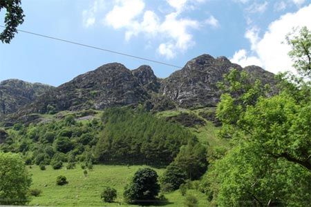
Click image to visit gallery of 12 images.
I don't like out-and-back walks much, so faced with the Aran Ridge, I wondered if there is a way of walking it without walking it twice. The result is this rather long route, which traverses the entire ridge from Glasgwm in the south, to Aran Benllyn and returns via the top of Foel Hafod Fynydd.
It took me 8 hours (including stops for refreshment), but it is worth it for a number of reasons. First and foremost is the extra sense that one gets for the massiveness of the Aran Ridge. Walking along the top of it is pleasant enough, but to really appreciate its height, length, steepness and cragginess, you really need to view it from the top of Foel Hafod Fynydd. From here the whole thing can be taken in a single panoramic sweep. It is possible to climb Foel Hafod Fynydd to see this view, starting from the road at grid ref. SH905213, but that would be another out-and-back Second, during the course of the walk you get to see the main features of the ridge from many different angles. Third, this walk is circular. Of course, given the nature of the ridge, there is a cost to be paid for this. It comes in the form of a rather steep ascent rising 170m up the grassy slope of Drysgol. Coming close to the end of a long outing, this needs to be taken gently. You will be rewarded with the very gently-graded descent back to your car. The walk could be abbreviated a little by omitting Glasgwm and taking the path that joins Cwm Cywarch to Rhydymain, but then you won't be able to claim that you've done the whole ridge!
Park in Cwm Cywarch using the signed car park (grid ref. SH852188). A track heads SSW, joining the path marked on the map at the edge of the grassy area (grid ref. SH853183). Head off west along the obvious track, which leads all the way to the top of Craig Cywarch (grid ref. SH840179). Follow the fence until it turns off to the NW (grid ref. SH837188), then head due north to the top of Glasgwm, which is enlivened by a delightful little lake.
The path to Aran Fawddwy descends Glasgwm to the left of another fence, heading NE. Cross the pass at the bottom, and follow the obvious path, still roughly NE until you arrive (some considerable time later) at the top of Aran Fawddwy. Another mile or so will see you at the top of Aran Benllyn, from where you can admire the placid waters of Llyn Tegid, if you wish. Actually, to do this circular walk, you do not need to go all the way to Aran Benllyn, but since you are up here, you might as well.
Once you've had enough of admiring the view turn around from Aran Bennllyn and after less than half a mile (grid ref. SH865235), descend from the ridge by the steep grassy slope labelled Erw y ddafad-ddu on the 1:25000 map. It is best to stick to the edge of the crag to the north of this slope, since the angle of the slope is a bit less on this side than elsewhere. Head off to the east of the lake at the foot of Aran Fawddwy, then up the ridge, heading east, to the top of Foel Hafod Fynydd (grid ref. SH876227). From here you can marvel at where you have just been.
Turn right, heading straight across the valley in a southerly direction towards the saddle (grid ref. SH877211) to the east of the top of Drysgol. The river at the bottom is easily crossed in a number of places. You will probably be a bit puffed by the time you get to the top of the saddle, but the rest of the way is very relaxing. Head south to find the path that leads down the flank of Pen yr Allt Uchaf directly towards where you parked your car. The head of the path is easily spotted when visibility is good by a kink in the fence. If visibility is not good, you are looking for the low point of the saddle between Drysgol and Waun Goch. Its height is given as 571m at grid ref. SH875205. From here, the path heads off SW and is a delightful muscle-easing gradual grassy descent down the side of a beautiful little valley, with Glasgwm in sight ahead of you. At the bottom you will arrive at a junction of paths. Ignore the waymarked stile on the left to turn right here along a section with walls on both sides. The path soon turns left again to arrive at the road. Turn left, and a short step brings you back to your parking place.
Other walks nearby
| Walk 2937 | Aran Fawddwy northern approach | mod/hard | 8.4 miles |
| Walk 1107 | Waun Oer and Maesglase near Dinas Mawddwy | mod/hard | 11.0 miles |
| Walk 2551 | Rhobell Fawr from near Rhydymain | moderate | 5.7 miles |
| Walk 2811 | Rhobell Fawr and Ddualt from near Rhydymain | moderate | 8.5 miles |
| Walk 1499 | Rhobell Fawr and Dduallt from Llanfachreth | moderate | 12.0 miles |
| Walk 2334 | The Torrent Walk near Dolgellau | easy | 1.6 miles |
| Walk 1646 | The Precipice Walk | easy | 3.5 miles |
| Walk 2475 | The Dyfi Hills Ridge | mod/hard | 9.8 miles |
| Walk 3017 | Aran Benllyn & Aran Fawddwy from Llanuwchllyn | mod/hard | 10.0 miles |
| Walk 2059 | Castell Carndochan near Bala | easy/mod | 2.5 miles |
Recommended Books & eBooks
The Cambrian Way
 Guidebook to the Cambrian Way, a challenging three-week mountain trek through Wales from Cardiff to Conwy. The 470km un-waymarked route is presented from south to north. Often sticking to long, beautiful ridgelines, it crosses wild and rugged terrain and visits many of Wales's highest mountains, including Snowdon.
More information
Great Mountain Days in Snowdonia
 Inspirational guidebook to 40 great mountain day walks and scrambles in Snowdonia. Inspirational routes for all abilities across the National Park with routes up Snowdon and Moel Eilio, the Glyderau, the Carneddau, Eifionydd, Siabod and the Moelwynion, Rhinogydd (the Harlech Dome), Migneint and the Arans and Cadair Idris and the Tarrens.
More information
Messaging & Social Media
Message Walking Britain and follow the latest news.

Mountain Weather
Stay safe on the mountains with detailed weather forecasts - for iOS devices or for Android devices.