Chancery Lane to Trafalgar Square Walk
Walk 1310 - Route Maps
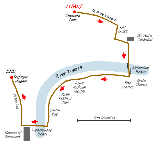
Sketch Map
Suggested Maps 

| Ordnance Survey Explorer 173 | Sheet Map | 1:25k | BUY |
| Anquet OS Explorer 173 | Digital Map | 1:25k | BUY |
| Ordnance Survey Landranger 176 | Sheet Map | 1:50k | BUY |
| Anquet OS Landranger 176 | Digital Map | 1:50k | BUY |
It is recommended you take a map. The preferred scale is 1:25k.
Start Point Details
Ordnance Survey Grid Ref TQ311816
Latitude 51.518115 Longitude -0.11192
Postcode WC1X 8HG
what3words start swim.giving.pirate
Walk description may contain detailed information on the start point for this walk.
Further Information
Walk grading - Learn how each walk is assessed and select a walk to suit your ability and experience by going to Walk Grading Details.
Messaging & Social Media
Message Walking Britain and follow the latest news.

Mountain Weather
Stay safe on the mountains with detailed weather forecasts - for iOS devices or for Android devices.