Minninglow & Roystone Rocks
Peak District Walk
Nat Park - Peak District - Lathkill Dale High Peak
County/Area - Derbyshire
Author - Lou Johnson
Length - 5.8 miles / 9.4 km Ascent - 600 feet / 182 metres
Time - 3 hours 30 minutes Grade - easy/mod
Maps 

| Ordnance Survey Explorer OL24 | Sheet Map | 1:25k | BUY |
| Anquet OS Explorer OL24 | Digital Map | 1:25k | BUY |
Walk Route Description
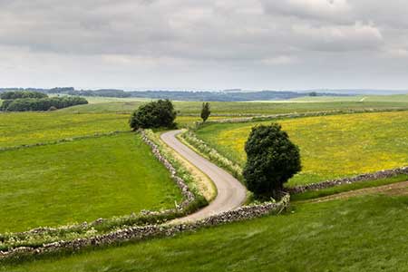
Click image to see photo description.
This walk explores the limestone uplands of the Peak District and uses a section the High Peak Trail which follows a disused railway to reach Minninglow. This small hill is topped by a group of trees and features well-preserved neolithic remains including a tomb and barrows. The route continues into a broad valley to pass below Roystone Rocks which can also be explored if time permits. A gradual climb across the plateau leads you back to the High Peak Trail which is followed back to the start.
The start is the Minninglow High Peak Trail car park (grid ref. SK195582) which lies less than a mile south of the B5012 at Pikehall. After parking walk to the rear of the car park and turn east along the High Peak Trail. Cross Mouldridge Lane and continue along the disused railway. The Trail swings left and then right offering a good view to Minninglow Grange down to your right. At the point where the trail bends right (grid ref. SK206575), turn left onto a concessionary path (signed to Minninglow). Pass through a gate and head uphill through two fields to a marker post. Pass through another gate to reach the edge of the group of trees.
Walk across the hill in a south-easterly direction passing the neolithic remains. Exit the trees to enter a field. Go half right down the field to reach another marker post. Continue down the next field to reach a track. Cross the track onto a footpath (signed Roystone Grange). Continue under the High Peak Trail and descend the grassy path into a broad valley. Pass between two gate posts and continue with a wall on your left. Cross a stile in the wall and maintain direction along a grassy track to a pass through a gate. Bear half left across the next field to pass a former pump house to reach a track (grid ref. SK200566).
Turn right along the track and continue through Roystone Grange Farm. Jut pass the farm you pass Roystone Rocks on your left. This is open access land and if time permits a short walk takes you up to the summit from here the view are a reward for the extra effort. Just under a kilometre from the farm you reach a junction (grid ref. SK198576). Turn left along Minninglow Lane initially climbing gently. At the next junction continue ahead onto a track (signed to Biggin). After 700 metres of easy walking the track forks (grid ref. SK185578). Bear right through the metal gate and follow the track uphill. Another kilometre of easy walking leads to a gate and a junction (grid ref. SK176583). Turn right along a clear track and gently descend to reach the High Peak Trail. Turn right and follow the trail to walk through the Gotham Curve where the railway turned sharp left. Continue ahead through Chapel Plantation and across a lane to return to the start.
Other walks nearby
| Walk 1410 | Minninglow Hill, Roystone Grange and Cardlemere Lane from Gotham | easy/mod | 5.5 miles |
| Walk 2503 | Robin Hood's Stride & Stanton Moor | moderate | 11.0 miles |
| Walk 2559 | Stanton Moor & The Nine Ladies Stones from Winster | moderate | 9.0 miles |
| Walk 3196 | Stanton Moor and Robin Hood's Stride from Winster | easy/mod | 7.0 miles |
| Walk 2136 | Wensley & Brightgate | easy/mod | 6.2 miles |
| Walk 1378 | Carsington Circular | easy | 4.5 miles |
| Walk 1379 | Carsington and Harboro Rocks | easy/mod | 5.8 miles |
| Walk 1369 | Tissington Trail - Hartington to Parsley Hey | easy | 4.0 miles |
| Walk 1569 | Lathkill Dale & Bradford Dale | easy/mod | 8.2 miles |
| Walk 1589 | Lathkill & Bradford Dales (short version) | easy/mod | 6.0 miles |
Recommended Books & eBooks
Walking in Derbyshire
 Walking guidebook to 60 circular day walks in Derbyshire and the Peak District. Includes the Derwent, Wye and Trent river valleys, near Derby, Matlock, Glossop, Bakewell and Ripley. Routes range from easy to moderate and are between 4 and 14km (2 to 10 miles). Walks focus on places of interest, from Stone Age forts to castles to grand estates.
More information
Great Mountain Days in the Pennines
 An inspirational guidebook to 50 classic walks on the rolling Pennine landscape. The graded routes, between 6 and 13 miles in length, cover classic Pennine fells and moorland such as Whernside, Ilkley Moor and Pendle Hill; exploring the North and South Pennines, Yorkshire Dales, Howgills and Dark Peak. Many routes are also suited to fell running.
More information
Messaging & Social Media
Message Walking Britain and follow the latest news.

Mountain Weather
Stay safe on the mountains with detailed weather forecasts - for iOS devices or for Android devices.