Balcombe & Ardingly Reservoir
West Sussex Walk
County/Area - West Sussex
Author - Lou Johnson
Length - 7.8 miles / 12.7 km Ascent - 800 feet / 242 metres
Time - 4 hours 40 minutes Grade - easy/mod
Maps 

| Ordnance Survey Explorer 135 | Sheet Map | 1:25k | BUY |
| Anquet OS Explorer 135 | Digital Map | 1:25k | BUY |
Walk Route Description
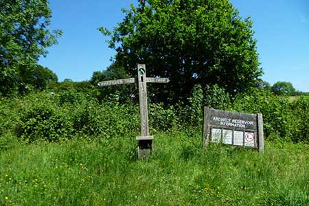
Click image to see photo description.
This West Sussex walk starts from Ardingly Reservoir and loops north to the village of Balcombe. The route continues along sections of reservoir's shoreline path back to the start. The walk includes passing beneath the impressive Balcombe Viaduct which takes the London to Brighton Railway across the Ouse Valley. The route also crosses attractive countryside and passes the Half Moon Inn in Balcombe for refreshments.
The start is the Ardingly Reservoir car park (grid ref. TQ335287) which lies at the foot of the reservoir dam. After parking take the rising path across grass to the west end of the dam. Bear left and pass the boat parking area on your right. Keep ahead passing the disabled parking are on your immediate left. Almost immediately your reach a path junction where you turn left downhill. Cross two footbridges and then turn right along the Sussex Ouse Valley Walk (SOVW). Continue west along the valley soon gaining sight of Balcombe Viaduct. Stay on the path to reach Borderhill Lane (grid ref. TQ324280).
Turn right and after a few metres turn left on to a signed footpath. Continue under the Balcombe Viaduct. Consisting of thirty-seven arches the structure, completed in 1842, is 450 metres long and nearly thirty metres high. Continue ahead along the SOVW soon passing Ryelands Farm on your left. Continue along the clear path to reach Great Bentley Farm on your left. The route then joins the farm's access drive which is followed to the B2036.
Cross the road, walk left and then turn sharp right into Cherry Lane (SOVW sign). Continue ahead up the lane which soon descends to pass a small parking area on the right. Cross the small bridge and take the signed footpath on the left (grid ref. TQ305281). The path leads up the left-hand side of the field and exits onto Rowhill Lane. Turn left and almost immediately right at a fingerpost onto the continuing path. The path heads north climbing gently across a field. Pass to the right of a house at Upper Pilstye and join a grassy track heading north keeping to the right-hand side of the field. The route soon enters Pilstye Wood. Continue ahead at crossing track and descend to the B2036 (grid ref. TQ307295).
Cross the road and walk left. Turn sharp right up access road and continue to a small gate near the last house. The path then crosses a bridge over the railway line and turns left towards Balcombe. The path leads to a field where you keep to the right-hand edge. Leaving the field maintain direction to reach a road (grid ref. TQ39301). Go straight across along Jobes before taking the signed path on the right which leads along the right-hand edge of a recreation field. Leave the field along a narrow lane into Stockcroft Road. Bear left, and then first right to reach the centre of Balcombe.
Cross Haywards Heath Road and walk to the immediate right of the Half Moon Inn. Follow the road as it bends right and then continue ahead to reach the cricket ground which is crossed as indicated by the sign. You soon reach a footpath junction where you fork right and continue to Mill Lane (grid ref. TQ315307). Turn left and follow lane round to the right at the first junction. Continue down to pass Balcombe Mill on your left. 250 metres beyond the mill turn right onto a signed footpath. The onward path continues beside the reservoir for two kilometres to exit at Balcombe Road. Turn right and cross the reservoir and take the first path on the right into tress. The meandering follows the reservoir shoreline to the dam. Continue almost to the end of the dam and bear half-left down to the car park.
Other walks nearby
| Walk 1048 | Ardingly Reservoir | easy/mod | 8.5 miles |
| Walk 2479 | Worth Way from Three Bridges, near Crawley | moderate | 14.0 miles |
| Walk 2335 | Ashdown Forest & Nutley Windmill | easy/mod | 4.7 miles |
| Walk 2486 | Plumpton Green & South Downs | easy/mod | 7.7 miles |
| Walk 3213 | Pyecombe, Devil's Dyke & Upper Beeding | easy/mod | 8.0 miles |
| Walk 3487 | Edburton Hill & Devil's Dyke from Saddlescombe | hard | 10.5 miles |
| Walk 2903 | Stanmer to Streat | moderate | 12.5 miles |
| Walk 3488 | Devil's Dyke Circular | easy | 2.5 miles |
| Walk 1983 | Edburton Hill from Fulking | easy/mod | 6.1 miles |
| Walk 2684 | Falmer to Pyecombe & Blackcap by South Downs Way | moderate | 8.8 miles |
Recommended Books & eBooks
No suggestions for this area.Messaging & Social Media
Message Walking Britain and follow the latest news.

Mountain Weather
Stay safe on the mountains with detailed weather forecasts - for iOS devices or for Android devices.