River Parrett from Pawlett
Somerset Walk
County/Area - Somerset
Author - Lou Johnson
Length - 7.1 miles / 11.5 km Ascent - 220 feet / 67 metres
Time - 3 hours 50 minutes Grade - easy/mod
Maps 

| Ordnance Survey Explorer 140 | Sheet Map | 1:25k | BUY |
| Anquet OS Explorer 140 | Digital Map | 1:25k | BUY |
Walk Route Description
Click image to see photo description.
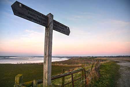
This Somerset walk starts from the village of Pawlett and explores the River Parrett and its estuary. The route uses field paths to reach the river. The walk then follows the England Coast Path upstream alongside the meandering river before turning inland back to the start.
There is limited on-street parking in Pawlett, and the best option is to park at the Sports and Social Club on Gaunts Road (grid ref. ST296428), After parking return to the road and turn right. Continue for 500 metres and turn right onto a path between hedges. Continue to a road and bear left. Go straight ahead at two junctions and then take the footpath on the left through a small gate in a larger set of gates (grid ref. ST289439). The path runs parallel to the hedge on your right. The path soon turns right, and then left and right again staying beside the hedge. Reaching the next corner of the hedge (grid ref. ST286440) veer slightly left across a field crossing Black Rock Rhyme (drainage channel) to reach the England Coast Path.
Turn left with the River Parrett on your right. Across the river is Steart Marsh which is managed by the Wildfowl and Wetlands Trust. The walking is easy and after three kilometres you pass the village of Combwich on the far side of the river. Continue along the riverbank as it bends left and then right. Six kilometres after passing Combwich you near a row of cottages near Brickyard Farm beside the river. Turn left at the fingerpost soon join River Road. Turn left and continue back towards Pawlett. Continue past an industrial unit on the left and houses on the right. Reaching a road junction, turn left into Gaunts Road and return to the start.
Other walks nearby
| Walk 1925 | Plainfield to Wills Neck | easy | 5.0 miles |
| Walk 1856 | Lilstock & East Quantox Head | easy/mod | 8.4 miles |
| Walk 2330 | Quantock Hills from Dead Woman's Ditch | moderate | 9.2 miles |
| Walk 1822 | Hodder's Combe, Bicknoller Post & Higher Hare Knap | easy/mod | 5.8 miles |
| Walk 1924 | Lydeard Hill to Wills Neck | easy | 2.6 miles |
| Walk 2940 | Beacon Hill & Bicknoller Post from Kilve Beach | easy/mod | 7.0 miles |
| Walk 3570 | River Tone from Stoke St Gregory | easy | 5.2 miles |
| Walk 3412 | Dowsborough Fort from Holford | easy/mod | 6.0 miles |
| Walk 1696 | Weacombe Combe, Bicknoller Post, Kilve & Longstone Hill | easy/mod | 7.5 miles |
| Walk 1662 | Wavering Down & Crook Peak from Winscombe | easy/mod | 6.0 miles |
Recommended Books & eBooks
No suggestions for this area.Messaging & Social Media
Message Walking Britain and follow the latest news.

Mountain Weather
Stay safe on the mountains with detailed weather forecasts - for iOS devices or for Android devices.