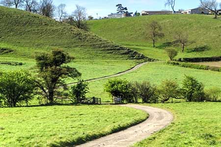
Settrington from North Grimston
Yorkshire Wolds Walk
Region - Yorkshire Wolds
County/Area - North Yorkshire - Yorkshire Wolds
Author - Lou Johnson
Length - 7.3 miles / 11.9 km Ascent - 700 feet / 212 metres
Time - 4 hours 20 minutes Grade - easy/mod
Maps 

| Ordnance Survey Explorer 300 | Sheet Map | 1:25k | BUY |
| Anquet OS Explorer 300 | Digital Map | 1:25k | BUY |
Walk Route Description
Click image to see photo description.
A circular walk from North Grimston in the Yorkshire Wolds. The route explores the countryside to the north of the village and includes upland and valley walking. The walk passes through Settrington with its imposing House and parkland, and a small lake. The onward route climbs onto the Wolds and Settrington Beacon before descending gently back to the start. During the walk sections of the Yorkshire Wolds Way and Centenary Way are followed.
The walk starts from North Grimston where a small carpark on the east side of the Parish Church (grid ref. SE843678). An alternative (for patrons) is to park at the nearby Middleton Arms. After parking, follow the track heading north from the B1248 on the east side of the church. You are now following a section of the Centenary Way. The route crosses fields to reach Bellmanear Farm where the path skirts to the left of the property. Heading north the path crosses fields with a hedge on your left. Just before Kirk Hill you join a track. Which is followed around to the left. The track leads to Back Lane (grid ref. SE836696).
Turn right and continue ahead at the first junction (signed Settrington). At the next junction turn right (signed Settrington House). Continue along the lane soon passing the House on your left and a lake on your right. 800 metres from the road junction you reach a track on the right with a wooden fence opposite (grid ref. SE846703). Follow the track which leads to Wardale Farm. Where the track bends left leave the track and follow the path through a gap in trees. Once through the gap veer left and follow the path with the wood on your left. Continue along the waymarked path past a pond and then climb steeply aiming to the left of Wold House before joining the access drive to a road (grid ref. SE855709).
Turn right along the road and continue to Settrington Beacon, which is the highest point of the walk. At the end of the trees on your right, turn right onto a track (Yorkshire Wolds Way and Centenary Way). After a kilometre, the path turns left (grid ref. SE861695) and shortly after right to run beside a wood on your right. Continue along the clear track past Wood House Farm and back to the B1248 at North Grimston. Turn right and return to the start.
Other walks nearby
| Walk 3515 | Deepdale and the deserted village of Wharram St. Percy | easy | 5.0 miles |
| Walk 3434 | North Grimston, Birdsall & Wharram Percy | moderate | 12.1 miles |
| Walk 1738 | The deserted village of Wharram St Percy | easy | 2.7 miles |
| Walk 2703 | Thixendale & Kirby Underdale | easy/mod | 8.5 miles |
| Walk 3126 | Kirkham Priory & Pretty Wood from Low Hutton | moderate | 11.0 miles |
| Walk 2655 | Wayram To Fridaythorpe Circular | easy/mod | 7.5 miles |
| Walk 2906 | Circular from Wayrham Through Painsthorpe | moderate | 8.5 miles |
| Walk 3733 | Coneysthorpe & Castle Howard from Welburn | easy/mod | 9.0 miles |
| Walk 3740 | Cowlam & Cottam Circular | easy/mod | 8.0 miles |
| Walk 3349 | Pasture Dale, Frendal Dale and Horsedale from Huggate | easy/mod | 9.1 miles |
Recommended Books & eBooks
Trail and Fell Running in the Yorkshire Dales
 Guidebook to 40 of the best trail and fell runs in the Yorkshire Dales National Park. Ranging from 5 to 24 miles, the graded runs start from bases such as Ribblehead, Dent, Sedbergh, Malham and Grassington and take in the region's diverse delights, from castles and waterfalls to iconic mountains such as Whernside, Ingleborough and Pen Y Ghent.
More information
Messaging & Social Media
Message Walking Britain and follow the latest news.

Mountain Weather
Stay safe on the mountains with detailed weather forecasts - for iOS devices or for Android devices.