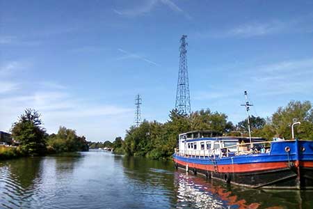
Arlington Peninsula from Saul Junction
Gloucestershire Walk
County/Area - Gloucestershire
Author - Lou Johnson
Length - 6.2 miles / 10.1 km Ascent - 300 feet / 91 metres
Time - 3 hours 20 minutes Grade - easy/mod
Maps 

| Ordnance Survey Explorer OL14 | Sheet Map | 1:25k | BUY |
| Anquet OS Explorer OL14 | Digital Map | 1:25k | BUY |
Walk Route Description
Click image to see photo description.
This Gloucestershire walk from Saul Junction explores part of the Arlington Peninsula which is enclosed on three sides by the River Severn. The walk also follows a section of the Gloucester & Sharpness Canal, uses then Severn Way and climbs Barrow Hill from where a view across the peninsula can be enjoyed.
The walk starts from the Saul Junction car park (grid ref. SO754092) beside the Gloucester & Sharpness Canal. After parking face the canal and turn left past the toilets and information centre. Continue along the canalside path past another car park and cross a footbridge. Walk ahead and pass the Wycliffe College Boat Club and take the signed path off to the left to join the Thames & Severn Way (grid ref. SO756094). This path runs besides the River Frome across pastures to reach Moor Street.
Cross the road and continue along the footpath opposite. Continue with the River Frome on your left to a road (grid ref. SO751104). Turn left along the road (part of the Severn Way) and continue beside the River Severn on the riverside path. After 600 metres the path joins a lane. Reaching a T-junction, turn right and follow the lane with the River Severn on your right. Stay on the lane for 800 metres continuing around a left-hand bend. Take the next footpath on the left (grid ref. SO736107).
The path follows a hedge on your right to Wick Court Farm. Maintain direction past the farm (on your left) and continue along the path to pass a small wood on your right. At the end of the wood (grid ref. SO733101), turn right and cross Barrow Hill to reach Overton Lane. Cross the lane (slightly to the left) to join a signed footpath. This path leads across fields with a hedge on your left to join a track which leads to a road. Go straight across to join a track between hedges. At the end of the enclosed section, cross a track to pick up a path initially across grass. The path the soon follows a hedge (on your right) but soon passes through the hedge to continue with hedge on your right to reach the River Severn.
Turn left along the river along the Severn Way. After two kilometres of riverside walking you reach a small sewage works on your left. Stay with a hedge on your left and continue to the end of a small wood (grid ref. SO741083). The path then bends left beside the wood for 150 metres, turns right for 150 metres and then left again and continues to a road. Turn right and continue to the swing bridge over the Gloucester & Sharpness Canal. Do not cross the bridge and turn left alongside the canal. Continue to the next swing bridge (Sandfield). Cross the road and stay beside the canal back to the car park used at the start of the walk.
Other walks nearby
| Walk 3750 | River Severn from Arlingham | easy | 6.0 miles |
| Walk 1877 | Uley Bury & Cam Long Down | easy/mod | 5.5 miles |
| Walk 1977 | Lasborough & Ozleworth Bottom | easy/mod | 5.8 miles |
| Walk 1258 | The Tyndale Monument | easy/mod | 5.5 miles |
| Walk 3663 | Sudgrove & Edgeworth from Miserden | easy/mod | 6.0 miles |
| Walk 3214 | Symonds Yat, High Meadow Woods & Wye Valley | moderate | 12.0 miles |
| Walk 3302 | Symonds Yat Rock and the Biblins | easy/mod | 4.0 miles |
| Walk 2674 | Source of the River Thames | moderate | 11.3 miles |
| Walk 1337 | Westonbirt Arboretum | moderate | 10.0 miles |
| Walk 1870 | Dymock Daffodil Walk | easy/mod | 9.0 miles |
Recommended Books & eBooks
No suggestions for this area.Messaging & Social Media
Message Walking Britain and follow the latest news.

Mountain Weather
Stay safe on the mountains with detailed weather forecasts - for iOS devices or for Android devices.