Norbury Junction, Gnosall & Aqualate Mere
Staffordshire Walk
County/Area - Staffordshire - Mid Staffordshire
Author - Lou Johnson
Length - 8.1 miles / 13.2 km Ascent - 400 feet / 121 metres
Time - 4 hours 30 minutes Grade - easy/mod
Maps 

| Ordnance Survey Explorer 242 | Sheet Map | 1:25k | BUY |
| Anquet OS Explorer 242 | Digital Map | 1:25k | BUY |
| Ordnance Survey Explorer 243 | Sheet Map | 1:25k | BUY |
| Anquet OS Explorer 243 | Digital Map | 1:25k | BUY |
Walk Route Description
Click image to see photo description.
Starting from Norbury Junction this walk explores a section of the Shropshire Union Canal, follows part of The Way for the Millennium along a disused railway, passes close to Aqualate Mere and walks through the Aqualate Mere National Nature Reserve which is carpeted with Bluebells in Spring. The final section crosses fields back to the start. The route is waymarked and signed.
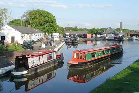
The walk starts at Norbury Junction (Grid ref. SJ792229) where limited parking is available on the road opposite the pub car park. After parking walk to the towpath (canal on your right), pass the pub, cross a bridge over the abandoned branch canal to Wappenshall Junction where it met the Telford to Shrewsbury canal. Continue along the towpath beside the Shropshire Union Canal. Stay on the towpath for 3.5 kilometres to reach the first bridge over the canal (grid ref. SJ818205). Just before the bridge (with white railings beside the towpath), bear right off the tow path and walk up to the disused railway above near Gnosall.
Turn right along the old track bed of what used to the line from Stafford to Wellington. In recent years it has become a footpath and named The Way for the Millennium. This wide path is followed for four kilometres. The first over bridge carries the A518, the next bridge crosses over a lane and the third bridge at Boadhill passes under a lane. Shortly after you cross over another lane. Beyond this point you reach pass extensive greenhouses on your right and at the next bridge leave the old railway and veer left and descend to the lane. Turn right, pass under the bridge, and continue to the A518 at Coley Mill (grid ref. SK781194).
Cross the rod (with care) to gate opposite to join a bridleway. Initially the grassy track follows Coley Brook on your right. The track crosses fields with Aqualate Mere on your left to enter woodland (part of the Aqualate Mere National Nature Reserve). The track bends slightly right and exits the trees and becomes enclosed by hedges. Reaching Guild Lane, turn right. And continue to where the lane turns sharp right (grid ref. SJ785207). At this point turn left along a bridleway and continue ahead where the main track turns sharp right. The enclosed grassy track passes a small wood on the left and enters a field. Walk slightly left to a join a clear track which is followed to Radmore Lane.
Turn right, pass a house on the right, ignore the next signed footpath on the left and continue 150 metres to turn left at the next fingerpost (grid ref. SJ790215). Cross the stile and follow the path across two fields to reach a path junction where you continue ahead along a waymarked path. Initially the path runs beside a hedge on your left before maintain direction across two field to reach Norbury Road at a stile. Turn left, the right at a T-junction. Pass under the canal and follow the road as it bends left. %00 metres along the road you reach Norbury Junction and the start of the walk.
Other walks nearby
| Walk 2353 | Aqualate Mere & Sutton | easy | 5.2 miles |
| Walk 1941 | Outwoods & Beffcote | easy | 4.1 miles |
| Walk 3531 | Cop Mere and the Offleys | easy | 7.0 miles |
| Walk 3591 | Derrington circular from Stafford Castle | easy | 3.6 miles |
| Walk 2099 | Stafford - a town centre stroll | easy | 1.5 miles |
| Walk 1394 | Bednall & Acton Trussell from near Stafford | easy | 6.5 miles |
| Walk 2443 | Tixall from St Thomas Priory near Stafford | easy | 7.0 miles |
| Walk 2199 | Brocton & Walton-on-the-Hill Circular | easy | 3.5 miles |
| Walk 2842 | Sandon Park from Salt | easy | 4.6 miles |
| Walk 2917 | Downs Banks near Barlaston | easy | 2.5 miles |
Recommended Books & eBooks
Walking in the Peak District - White Peak East
 Guidebook describing 42 half-day and day walks in the limestone landscapes of Derbyshire's White Peak, part of the Peak District National Park. One of two volumes, this book covers the east of the region, with potential bases including Bakewell, Eyam, Castleton, Birchover, Matlock and Wirksworth.
More information
Messaging & Social Media
Message Walking Britain and follow the latest news.

Mountain Weather
Stay safe on the mountains with detailed weather forecasts - for iOS devices or for Android devices.