Mastilles Lane & Bordley from Kilnsey
Yorkshire Dales Walk
Nat Park - Yorkshire Dales - Upper Wharfedale
County/Area - North Yorkshire
Author - Robert Peters
Length - 6.8 miles / 11.1 km Ascent - 1100 feet / 333 metres
Time - 4 hours 30 minutes Grade - easy/mod
Maps 

| Ordnance Survey Explorer OL2 | Sheet Map | 1:25k | BUY |
| Anquet OS Explorer OL2 | Digital Map | 1:25k | BUY |
Walk Route Description
Click image to see photo description.
This walk from Kilnsey in Wharfedale explores an area of limestone upland west of the village. The route uses Mastilles Lane to cross Kilnsey Moor and then turns south to the isolated farm of Bordley Green. The walk then continues east across Malham Moor to rejoin Mastilles Lane back to Kilnsey.
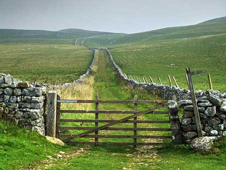
The walk starts from Kilnsey Park, where parking is available as well as refreshments (grid ref. SD975677). After parking walk to the B6160 and turn left into Kilnsey village. Take the first lane on the left into the village and keep straight ahead by a small green. You soon reach the end of the tarmac by a gate and cattle grid where you continue ahead up Mastilles Lane. The track is soon enclosed between walls and climbs steadily. Enclosed by walls, this track gains height steadily for three kilometres across Kilnsey Moor. Once over the summit the track descends to Mastilles Gate (grid ref. SD944662).
Go through the gate and turn left following a clear track with a wall. on your left. After 700 metres you reach a cross track (Malham Moor Lane). Go straight across and continue down to Bordley Green Farm. As you approach the farm you reach a wall corner (grid ref. SD943650). Leave the track here and turn left to join a path initially with a wall on your right. Maintain direction across several fields passing a limestone outcrop on the left which is the highest point on Malham Moor. Just after passing a stone barn on the left (grid ref. SD958647), cross the stile and turn left onto a bridle way heading roughly north. Follow the grassy track to reach a gate on Malham Moor Lane (grid ref. SD960650).
Cross the lane and continue along a grassy path which leads generally northwards. Keep to the left of Green Hall Hill soon picking up a clearer track which leads into an enclosed track. Follow this to re-join Mastilles Lane. Turn right and descend back into Kilnsey village.
Other walks nearby
| Walk 3301 | Conistone to Grassington via the Dib | easy | 5.0 miles |
| Walk 3262 | Copplestone Gate and Conistone Pie from Conistone | easy/mod | 7.0 miles |
| Walk 2423 | Capplestone Gate & Conistone Pie | easy/mod | 6.8 miles |
| Walk 1250 | Great Whernside | moderate | 8.0 miles |
| Walk 1277 | Starbotton & Kettlewell circular | easy/mod | 5.0 miles |
| Walk 1294 | Arncliffe & Kettlewell Circular | moderate | 7.0 miles |
| Walk 1632 | Arncliffe & Starbotton from Kettlewell | moderate | 7.0 miles |
| Walk 1282 | Malham Tarn & Arncliffe | moderate | 12.5 miles |
| Walk 1701 | Bordley Hall & Malham Moor from Threshfield Moor | easy/mod | 7.0 miles |
| Walk 1145 | Grassington, Mastilles Lane & Conistone Dib | moderate | 11.3 miles |
Recommended Books & eBooks
Trail and Fell Running in the Yorkshire Dales
 Guidebook to 40 of the best trail and fell runs in the Yorkshire Dales National Park. Ranging from 5 to 24 miles, the graded runs start from bases such as Ribblehead, Dent, Sedbergh, Malham and Grassington and take in the region's diverse delights, from castles and waterfalls to iconic mountains such as Whernside, Ingleborough and Pen Y Ghent.
More information
Walking in the Yorkshire Dales: South and West
 Part of a two-book set, this guidebook describes 44 walks in the southern and western Yorkshire Dales, including the famous 23 mile Three Peaks circuit over Pen-y-Ghent, Whernside and Ingleborough. The other, mostly circular routes of 3½ to 13 miles cover the scenic region between Sedbergh, Kirkby Lonsdale, Settle, Skipton and Grassington.
More information
Messaging & Social Media
Message Walking Britain and follow the latest news.

Mountain Weather
Stay safe on the mountains with detailed weather forecasts - for iOS devices or for Android devices.