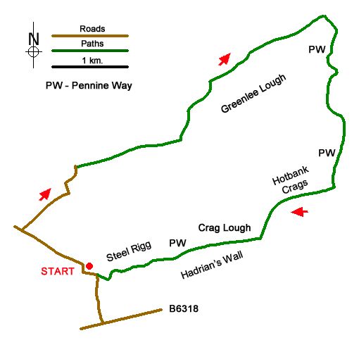
Greenlee Lough and Steel Rigg Walk
Walk 2337 - Route Maps
Route Map
Digital Maps - Copyright © 2011-2024. All rights reserved.
Sketch Map
Suggested Maps 

| Ordnance Survey Explorer OL43 | Sheet Map | 1:25k | BUY |
| Anquet OS Explorer OL43 | Digital Map | 1:25k | BUY |
It is recommended you take a map. The preferred scale is 1:25k.
Start Point Details
Ordnance Survey Grid Ref NY750676
Fatal error: Uncaught TypeError: round(): Argument #1 ($num) must be of type int|float, string given in /home/walkingbritain.co.uk/httpdocs/walk-map.php:265 Stack trace: #0 /home/walkingbritain.co.uk/httpdocs/walk-map.php(265): round() #1 {main} thrown in /home/walkingbritain.co.uk/httpdocs/walk-map.php on line 265