Grey Wethers & Fyfield Down from Hackpen White Horse
Wiltshire Walk
County/Area - Wiltshire
Author - Lou Johnson
Length - 8.5 miles / 13.8 km Ascent - 600 feet / 182 metres
Time - 4 hours 50 minutes Grade - easy/mod
Maps 

| Ordnance Survey Explorer 157 | Sheet Map | 1:25k | BUY |
| Anquet OS Explorer 157 | Digital Map | 1:25k | BUY |
Walk Route Description
Click image to see photo description.
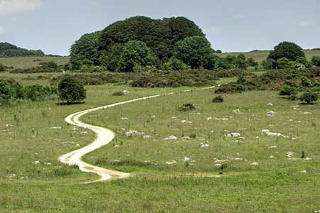
Walk exploring the western edge of the Marlborough Downs which lie east of Avebury. The route includes the Hackpen White Horse, sections of the ancient Ridgeway and White Horse Trail, the Devil's Den burial chamber, and Fyfield Down National Nature Reserve.
The walk starts from the Hackpen White Horse parking area (grid ref. SU129747). Before starting the main walk, a short stroll takes you to the white Horse cut in the west facing escarpment of the Marlborough Downs. Return to the parking area and turn right (south) onto the signed Ridgeway. Continue ahead along the Ridgeway for just under two kilometres to where the path bends right at a path junction (grid ref. SU125729) and fork left onto the White Horse Trail. The path is waymarked and is followed for just over two kilometres to reach a clear cross track, Green Street or Herepath (grid ref. SU143714).
Turn left and almost immediately right to continue along the White Horse Trail. The track runs beside a gallop on your left. The track continues soon having a row of trees on the left. Nearing the end of the trees, the track veers right. Take the next gate on the right (grid ref. SU153703). Follow the bridleway with a fence on your left. After 500 metres turn left downhill keeping the fence on your left. At the bottom of the slope there is a gate on your left (grid ref. SU150698). (If you want to visit the Devil's Den head through the gate to the site of the burial chamber. Return to the gate to continue the walk)
Turn right to follow a grassy track through the Grey Wethers Valley or Valley of Stones. You pass two small stands of trees on your right. Nearing the third group of trees, the grassy track bends gently right and leads to a gate (Grid ref. SU137706). Once through the gate, continue to the far end of Wroughton Copse and turn left on a grassy path down a slope across Fyfield Down (grid ref. SU136710). Continue to Green Street and bear left along the Wessex Ridgeway. Cross a gallop and turn right beside a fence. Follow the path to a stile (grid ref. SU127714) which gives access to the Ridgeway. Turn right and enjoy a relaxing walk of just over three kilometres back to Hackpen White Horse.
Other walks nearby
| Walk 2812 | Avebury, West Kennett and Silbury Hill | easy/mod | 7.0 miles |
| Walk 3417 | Silbury Hill and West Kennett Long Barrow from Avebury | easy | 3.0 miles |
| Walk 3318 | Hackpen Hill & Overton Down | easy/mod | 9.5 miles |
| Walk 2377 | Highlights of Avebury | easy/mod | 8.8 miles |
| Walk 3517 | Avebury & Overton Down | easy/mod | 7.5 miles |
| Walk 2339 | Milk Hill the highest point in Wiltshire | easy | 3.0 miles |
| Walk 1807 | The Southern Escarpment of the Marlborough Downs | easy/mod | 6.5 miles |
| Walk 1928 | Pewsey Downs from Wootton Rivers | easy/mod | 8.0 miles |
| Walk 1733 | Wessex Downs & Kennet & Avon Canal from Pewsey | easy/mod | 8.0 miles |
| Walk 3295 | Pewsey Hill and Fyfield Down | easy/mod | 9.0 miles |
Recommended Books & eBooks
The Kennet and Avon Canal
 Guidebook to walking along the Kennet & Avon Canal. The 94 mile route from Reading to Bristol is split into 7 stages of fairly easy walking and includes the UNESCO World Heritage Site of Bath and Bristol's Floating Harbour. 20 circular walks are also included, ranging from 4¼ to 9 miles, taking in the best sections of the canal.
More information
Messaging & Social Media
Message Walking Britain and follow the latest news.

Mountain Weather
Stay safe on the mountains with detailed weather forecasts - for iOS devices or for Android devices.