Mordiford & Hampton Bishop Circular
Herefordshire Walk
County/Area - Herefordshire
Author - Lou Johnson
Length - 7.6 miles / 12.4 km Ascent - 520 feet / 158 metres
Time - 4 hours 20 minutes Grade - easy/mod
Maps 

| Ordnance Survey Explorer 189 | Sheet Map | 1:25k | BUY |
| Anquet OS Explorer 189 | Digital Map | 1:25k | BUY |
Walk Route Description
Click image to see photo description.
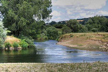
This circular walk visits the villages of Mordiford and Compton Bishop in the Wye valley. The route starts from a popular viewing point offering views to the Black Mountains and across the valley. Mordiford is the confluence of the rivers Wye and Lugg, and both are explored during the walk.
The walk starts from the small car park adjacent to the viewing area above Prior's Frome (grid ref. SO578385). A short path leads from the parking area to the viewing point, which provides a preview of some of the walk. Return to the lane and turn right and turn right again along a gravel track. Bear left towards the footpath finger post (signed Mordiford). Continue for 100 metres and turn right as indicated by the fingerpost. Follow the clear path ahead, cross a track, and continue along the signed path The path runs beside a wood on your left, enters a field with the path running beside a hedge on your left. At the end of this field the path enters trees down to a track where you turn right to a road (grid ref. SO572373).
Turn right along the pavement into Mordiford to the Moon Inn and the B4224. Continue straight ahead and walk through the village and cross the bridge over the River Lugg. Reaching the far end of the bridge, turn sharp left to join a signed footpath. The path runs beside the river to reach the confluence with the Wye. Continue ahead along the riverside path for just over five kilometres to reach the B4224 at Hampton Bishop (grid ref. SO550381). Leave the riverside path at the Bunch of Carrots and drop down to the road. Bear left and after 100 metres, turn right through a kissing gate with adjacent fingerpost just before the bus stop.
Follow the path across the field to join a path running between house to Rectory Road. Turn left and after 150 metres the road bends right. Just after the bens turn left down a tarmac track with fingerpost on your left. Continue ahead and take the first signed footpath on the right which is part of the Three Choirs Way. After crossing two fields the path follows a track. Ignore all side paths and keep ahead along the track with the River Lugg on your left. The track eventually ends with a path continuing for a further 600 metres to reach the B4224. Turn left across the bridge into Mordiford and turn left signed to Dormington. Follow this road for about a kilometre. After passing the entrance to Orchard Farm on your right, turn right along the next track signed as bridleway.
Reaching a T-junction, turn right. Continue past two buildings on your left and follow the signed bridleway and follow the signed path as it heads left and continue the climb back to the starting point.
Other walks nearby
| Walk 2192 | Wye Valley Walk | easy/mod | 6.6 miles |
| Walk 2817 | The Marcle Ridge from Much Marcle | easy/mod | 7.0 miles |
| Walk 1516 | Pershore Circular | easy/mod | 8.3 miles |
| Walk 2601 | Marden & Sutton St.Nicholas from Moreton-on-Lugg | easy/mod | 7.5 miles |
| Walk 3104 | Tillington from Moreton on Lugg | easy/mod | 7.5 miles |
| Walk 1870 | Dymock Daffodil Walk | easy/mod | 9.0 miles |
| Walk 2483 | Cradley Circular | easy/mod | 6.0 miles |
| Walk 2326 | Herefordshire Beacon from Hollybush | easy/mod | 6.5 miles |
| Walk 2664 | Herefordshire Beacon from British Camp car park | easy | 2.0 miles |
| Walk 2380 | The Malverns from the Gullet | moderate | 12.0 miles |
Recommended Books & eBooks
No suggestions for this area.Messaging & Social Media
Message Walking Britain and follow the latest news.

Mountain Weather
Stay safe on the mountains with detailed weather forecasts - for iOS devices or for Android devices.