Hambledon Circular
Hampshire Walk
County/Area - Hampshire
Author - Lou Johnson
Length - 6.1 miles / 9.9 km Ascent - 520 feet / 158 metres
Time - 3 hours 30 minutes Grade - easy/mod
Maps 

| Ordnance Survey Explorer OL3 | Sheet Map | 1:25k | BUY |
| Anquet OS Explorer OL3 | Digital Map | 1:25k | BUY |
Walk Route Description
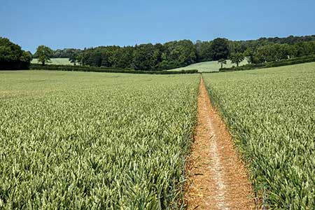
Click image to see photo description.
Circular walk from Hambledon (Hampshire) exploring the rolling countryside lying to the north of the village. The route passes Britain's first vineyard, and the cricket ground at Broadhalfpenny Down which was where cricket was first played. The nearby Bat and Ball inn was where the rules of the game were originally devised.
The start is West Street in Hambledon (grid ref. SU646151) where on-street parking is usually available. However, do park with consideration for local residents. After parking, locate High Street which lies opposite the People's Market. Continue up High Street walking ahead to enter St Peter's and St Paul's churchyard. Take the path running half right to pass the east end of the church on your left. Continue to the exit onto a lane. Turn briefly left and then go right along the path (signed Wayfarer's Walk Circular). Continue ahead soon passing Hambledon Vineyard on your left. Cross a track and continue between the vines to cross a track and stile (grid ref. SU650156).
Turn left along an enclosed path to turn right through a gate. The path briefly passes through trees before heading straight across a field to pass through a gap in the hedge onto Brook Lane. Go straight across with the path keeping to the hedge on your right. Continue into a field again with the hedge on your right. Entering the next field, the path heads straight across to a gate. Join an enclosed path up to Hermitage Farm where you join a driveway that leads to a lane. Turn right and continue for 800 metres ignoring two tracks on the left. Turn left at the next waymarked footpath (yellow arrow - Monarch's Way) and continue along the left-hand edge of a field. Reaching the corner, turn right and follow the path with the hedge on your left. Maintain direction across two more fields passing the original Hambledon cricket field just before reaching a lane (grid ref. SU677169).
Turn right and continue past the Bat and Ball Inn. At the crossroads, turn right (There is no pavement so take care). Reaching the first road junction with a lane on the right, turn left over a stile. The onward path aims for the right-hand end of some trees where you turn right along a track. Cross Broadhalfpenny Down, with its OS trig column, and continue to Scotland Cottage. The path continues slightly left through trees and then runs along a field edge. After about 300 metres, the path turns right through a gap in the trees to join a track. Turn right and then fork left by a small pond. At the next junction turn right towards Glidden Farm still following the Monarch's Way.
Just after a pond on the left, turn left along a track. Pass to the right of a pair of barns and cross fields following a power line. Cross a track and maintain direction following the power lines to join an enclosed path with the stud farm on your right. Cross the access drive and follow the waymarked Monarch's Way to reach a lane by Rose Cottage. Turn right and immediately fork left down a steep lane and follow this down into Hambledon village.
Other walks nearby
| Walk 2662 | Beacon Hill and Warnford | easy/mod | 6.0 miles |
| Walk 2710 | Old Winchester Hill from Exton | easy/mod | 5.5 miles |
| Walk 2533 | East Meon to Old Winchester Hill | moderate | 12.0 miles |
| Walk 2394 | East Meon & Wether Down | easy/mod | 8.0 miles |
| Walk 3260 | Butser Hill Circular | easy/mod | 6.9 miles |
| Walk 1034 | Beacon and Old Winchester Hills on the South Downs | moderate | 10.5 miles |
| Walk 2422 | Butser Hill and Wether Down from Buriton | moderate | 12.5 miles |
| Walk 2043 | Thorney Island from Emsworth | easy/mod | 9.0 miles |
| Walk 3324 | Cheriton Mill & Tichborne from Cheriton | easy | 5.7 miles |
| Walk 2383 | Upham & Owslebury Circular | easy/mod | 6.5 miles |
Recommended Books & eBooks
Walking Hampshire's Test Way
 Guidebook to walking the 71km (44 mile) Test Way in Hampshire from high on the chalk downs of Inkpen Beacon to the Eling Tide Mill near Southampton Water. Following the beautiful, crystal clear River Test, it passes picturesque villages and fascinating historic sites. Also includes 15 day walks to explore this lovely part of pastoral England.
More information
Messaging & Social Media
Message Walking Britain and follow the latest news.

Mountain Weather
Stay safe on the mountains with detailed weather forecasts - for iOS devices or for Android devices.