Red Screes via Dove Crag from Cow Bridge
Lake District Walk
Nat Park - Lake District - Lake District Eastern Fells
Wainwrights - Dove Crag, Red Screes, Middle Dodd
County/Area - Cumbria
Author - Lou Johnson
Length - 8.6 miles / 14 km Ascent - 3000 feet / 909 metres
Time - 7 hours 20 minutes Grade - mod/hard
Maps 

| Ordnance Survey Explorer OL5 | Sheet Map | 1:25k | BUY |
| Anquet OS Explorer OL5 | Digital Map | 1:25k | BUY |
Walk Route Description
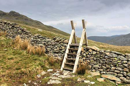
Click image to see photo description.
Red Screes is the final objective of this excellent circular walk from Cow Bridge near Hartsop. The route follows mainly good paths and after following the shores of Brother's Water climbs, steeply in places, up Dovedale to reach the summit of Dove Crag. The walk then continues with a descent to Scandale Pass from where a direct ascent of Red Screes leads directly to the summit. The descent over Middle Dodd is steep and requires care before rejoining the outward route by Hartsop Hall for an easy return to the start.
The start is the car park near Cow Bridge at the head of Brother's Water (grid ref. NY4021340). After parking exit the car park and turn left along the track leading to Hartsop Hall. Pass the Hall on your loeft and continue ahead to pass a group of outbuildings also om your left. Stay on a track heading up the valley soon passing a barn on your immediate left. The track gradually fades, and the route crosses a footbridge over Dovedale Back (grid ref. NY389114). Beyond the footbridge the paths climbs, steeply in places, up Dovedale. Through increasingly rugged terrain to reach a col with Hart Crag to your right and Dove Crag on your left. This is a popular path being part of the Fairfield Horseshoe.
Turn left and complete the short ascent onto Dove Crag from where some of the route can be seen. Descend south off Dove Crag and after 300 metres turn left along a path marked by old fence posts. The route is easy to follow and after heading east the path turns southeast down to Scandale Pass. Continue ahead to join a rising path that leads beside an old wall and leads directly to the Summit of Red Screes with its OS trig column. After enjoying the view head north with steep crags on your eight and descend along the clearly defined ridge to Middle Dodd.
The descent off Middle Dodd needs care as there are some unseen crags when descending. The route follows the clear ridgeline in a northerly direction. The wall provides a reliable guide for the descent and leads to a cross path near the foot of the ridge (grid ref. NY400107). Turn left, cross the bridge over Caiston Beck and follow the feint path which runs parallel to the intake wall on your right. After 700 metres you reach a barn (grid ref. NY398116). Pass through the wall and join a grassy track heading north. You soon re-cross Dovedale Beck and the grassy track leads to the outbuildings near Hartsop Hall. Head through a gap in a wall to rejoin the track used at the start of the walk. All that remains is an easy walk back to the start at Cow Bridge.
Other walks nearby
| Walk 3309 | Hartsop, Hartsop Dodd, Stony Cove Pike & Kirkstone Pass | moderate | 8.5 miles |
| Walk 1228 | Thornthwaite Beacon & High Street | moderate | 6.5 miles |
| Walk 1959 | Gray Crag and Pasture Beck from Hartsop | moderate | 5.5 miles |
| Walk 2585 | Hartsop Dodd, Stony Cove Pike, High St. & The Knott | mod/hard | 10.0 miles |
| Walk 1230 | Birks & Arnison Crag | moderate | 5.5 miles |
| Walk 1520 | Helvellyn & Fairfield Horseshoe from Patterdale | very hard | 13.0 miles |
| Walk 2047 | Place Fell | moderate | 7.5 miles |
| Walk 2425 | Boredale Circular from Patterdale | mod/hard | 11.5 miles |
| Walk 3670 | Angle Tarn and Hayeswater | moderate | 8.3 miles |
| Walk 1156 | Helvellyn via Striding Edge | hard | 9.5 miles |
Recommended Books & eBooks
Hadrian's Wall Path
 Hadrians Wall Path guidebook to walk the 84 mile National Trail. Described in both directions, the main description is west to east between Bowness-on-Solway and Wallsend, Newcastle, with extensions to Maryport and South Shields. With extensive historical information related to this World Heritage site and separate 1:25,000 OS map booklet included.
More information
Walking the Lake District Fells - Langdale
 Part of the Walking the Lake District Fells series, this guidebook covers a wide range of routes to 25 Lakeland summits that can be climbed from the Great Langdale valley, Ambleside and Grasmere, with highlights including Scafell Pike, Bowfell, the Langdale Pikes and Helm Crag (the Lion and the Lamb). Includes suggestions for longer ridge routes.
More information
Messaging & Social Media
Message Walking Britain and follow the latest news.

Mountain Weather
Stay safe on the mountains with detailed weather forecasts - for iOS devices or for Android devices.