Mitchell's Fold & Bromlow Callow
Hill Walk + Stone Circle
Region - Shropshire Hills
County/Area - Shropshire
Author - Lou Johnson
Length - 6.1 miles / 9.9 km Ascent - 800 feet / 242 metres
Time - 3 hours 50 minutes Grade - easy/mod
Maps 

| Ordnance Survey Explorer 236 | Sheet Map | 1:25k | BUY |
| Anquet OS Explorer 236 | Digital Map | 1:25k | BUY |
Walk Route Description
Click image to see photo description.
This circular Shropshire Hills walk includes a stone circle, Bromlow Callow a tree topped hill and an Iron Age hill fort. The area explored lies just north of the England-Wales border and crosses the high ground of Stapeley Hill. The use of the relevant OS 1:25k map will be useful. The walk starts from a small car park (grid ref. SO383901)) which is signed off the A488 a kilometre north of Appletree.
After parking, walk ahead, cross the cattle grid, and continue to the scant remains of Mitchell's Fold stone circle. From the stone circle turn right along a grassy path which descends gently with a fence on your left. Cross a small stream and continue ahead along a clear track passing Upper Stapeley Farm on your left. Where the track forks, keep left and continue pass buildings on your right. Where the track bend right, veer left and follow a path with a fence on your right. The path has some good views especially to the Stiperstones.
The next landmark is the building at Stapeley Holding on your right. Continue ahead keeping fence on your right. Continue to pass Lower Stapeley Farm a short distance over on your right. Bear slightly left and then veer right. The onward path climbs gently across the hillside trending away from the fence on your right to reach a cross path (grid ref. SO316995). Cross the path and aim for the left-hand corner of a plantation to join a clear track. Turn right and follow the track into a plantation. You soon reach a fork in the track. Keep left and continue through the trees to join a tarmac lane just after leaving the plantation. Follow the lane and go straight across at the first junction (signed to Bent Lawnt). Continue up the lane and at the next crossroads turn left (signed to Browlow).
Continue along the lane for just over 600 metres to where a byway descends to the right marked as unsuitable for motor vehicles. Turn left through a wooden gate and follow the rising path to the tree-topped hill of Bromlow Callow. Enter the trees through a kissing gate and exit via another gate. And descend to a road (grid ref. SJ324609). Cross the road to the stile opposite into a field. Bear slightly right, cross into another field and aim for the right-hand corner. After a third field the path leads into trees to reach a track (grid ref. SJ320009).
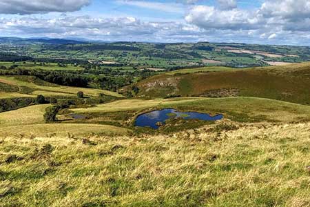
Turn left, pass houses on the left, then fork left off the track. Pass through a gate and take the path on the right-hand edge of a field. Just before a kissing gate, turn right over a stile hidden in the hedge. Continue to a waymark and turn left to cross a stile. Veer left to reach Castle Ring hillfort. Explore the earthworks and then exit on the south side descending to a kissing gate and track. Turn left downhill. Ignore footpath on the left and stay on the track to fork left uphill to bear right through a gate in the fence. Veer right to a waymark then continue right and follow path with fence on your right. Pass the pond and Valley Knoll on your right with a view into Wales.
Just before the field corner take waymarked gate, continue to a kissing gate and head up to a waymarker and a grassy track (grid ref. SO312992). Bear right and follow the grassy path along the hillside with Stapeley Hill up on your left. Continue southwest along the grassy path to reach Mitchell's Fold stone circle after just over a kilometre. Continue ahead back to the start.
Other walks nearby
| Walk 2054 | Linley Hill & Beeches from Wentnor | easy/mod | 7.0 miles |
| Walk 2745 | Betchcott Hills & Pole Bank | moderate | 9.0 miles |
| Walk 1205 | Adstone Hill, Medlicott and the Long Mynd | moderate | 9.5 miles |
| Walk 1180 | Pole Bank (Long Mynd) from Carding Mill | moderate | 6.5 miles |
| Walk 1409 | Haddon Hill and Bodbury Hill | easy/mod | 4.4 miles |
| Walk 2159 | Lightspout Hollow, Pole Bank & Ashes Hollow | moderate | 7.3 miles |
| Walk 3308 | Ragleth and the Long Mynd | mod/hard | 11.0 miles |
| Walk 3449 | Ragleth, the Long Mynd & Ratlinghope | hard | 18.0 miles |
| Walk 1374 | Lightspout Waterfall and Pole Bank | easy/mod | 5.8 miles |
| Walk 3395 | The Stiperstones Ridge | easy/mod | 5.5 miles |
Recommended Books & eBooks
Hillwalking in Shropshire
 Guidebook to 32 walking routes in Shropshire in the West Midlands. The routes range from 3 miles (5km) to 12 miles (19km), taking in highlights such as The Wrekin, Wenlock Edge, Long Mynd and Stiperstones, Castle Ring and Bury Ditches. Many routes start near delightful towns and villages including Church Stretton, Ludlow and Bishops Castle.
More information
Messaging & Social Media
Message Walking Britain and follow the latest news.

Mountain Weather
Stay safe on the mountains with detailed weather forecasts - for iOS devices or for Android devices.