Rockland St Mary Circular
Pub Walk + Waterways Walk
Nat Park - The Broads
County/Area - Norfolk
Author - Lou Johnson
Length - 8.1 miles / 13.2 km Ascent - 300 feet / 91 metres
Time - 4 hours 20 minutes Grade - easy/mod
Maps 

| Ordnance Survey Explorer OL40 | Sheet Map | 1:25k | BUY |
| Anquet OS Explorer OL40 | Digital Map | 1:25k | BUY |
Walk Route Description
Click image to see photo description.
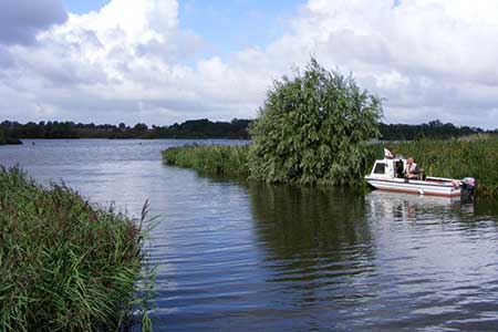
A relaxing circular walk from Rockland St Mary exploring the countryside and waterways in the surrounding area. The route includes Rockland Broad, a section of the River Yare, Rockford Staithes, and the isolated Claxton parish church. Big skies and abundant wildlife are also vital ingredients of this route.
The walk starts from Rockland Staithe carpark (grid ref. TG328046). After parking walk to the main road and bear left. Walk past the head of the moorings and turn left along a track with the moorings on your left. You are now following the Wherryman's Way long distance path. Follow the track which soon becomes a grassy path that runs along the south shore of Rockland Broad. Continue to reach Short Dike (grid ref. TG335051) where the path turns right to follow this waterway. You soon reach the River Yare where the path turns right to follow the river. The riverside path is followed for just over a kilometre to approach the Beauchamp Arms.
Turn right just before crossing a drainage channel and follow a grassy path with the drain on your left. The grassy pay path leads into Mill Lane which in turn leads to the main road by Claxton village green. Turn right along the road. Reaching the end of the pavement, ignore the first track on the left and continue for 200 metres and turn left along a track with adjacent fingerpost "Restricted Byway" (grid ref. TG335037). Follow Folly Lane for 500 metres and just before the first house on the right, turn left onto a footpath. The path runs along the left-hand field edge before entering the churchyard of St Andrew's Church. Keep the church on your and exit onto a lane.
Cross the lane and join the footpath to the left of a flint faced house. The path follows the right-hand edge of a field before passing through a hedge into another field. Which is crossed diagonally to trees on the far side. Continue ahead through the trees to exit into a field where the path runs beside a hedge on your immediate left. Maintain direction through trees to a lane (grid ref. TG 319036). Turn right and just past the house on the left, turn left onto a footpath. The path initially passes through scattered trees and then crosses a field. Reaching the far side of the field the path continues ahead through a smaller field before reaching a road (grid ref. TG319044).
Turn left through Rockland St Mary. After 300 metres turn right onto a paved path with adjacent fingerpost. Continue ahead into a field and turn right. The path follows the right-hand edge of this field soon turning left to continue with a hedge on your right. After 400 metres the path doglegs right and then left before veering left and then right around a small copse. The onwards path then follows the field edge with hedge still on your right to reach Holloway Road (grid ref. TG313057). Turn right and continue to a T-junction. Turn right and then take the first track on your left. Continue ahead through Grange Farm. Reaching a track turn right to rejoin the Wherryman's Way. The path soon runs beside a wood on your left. At the end of the wood, the path turns right and shortly after left and continues to the main road. Turn lefty to return to the car park and Rockland Staithe.
Other walks nearby
| Walk 3348 | River Yare & Claxton from Rockland Staithe | easy | 5.2 miles |
| Walk 2239 | River Bure and Tunstall Dike from Acle | easy | 6.1 miles |
| Walk 2240 | The River Bure & Upton from Acle | easy | 5.0 miles |
| Walk 2320 | Muck Fleet & River Bure from near Oby | easy/mod | 8.7 miles |
| Walk 2129 | River Ant & How Hill from Ludham | easy | 6.7 miles |
| Walk 2839 | St Benet's Abbey & How Hill from Ludham | easy/mod | 8.8 miles |
| Walk 2128 | Stokesby & Muck Fleet from Fleggburgh | easy | 7.1 miles |
| Walk 3694 | River Thurne & Hickling Broad from Potter Heigham | easy/mod | 6.4 miles |
| Walk 2237 | Somerleyton & Herringfleet Hills | easy | 3.5 miles |
| Walk 2075 | Tyrrel's Wood and Boudicca Way | easy/mod | 8.5 miles |
Recommended Books & eBooks
No suggestions for this area.Messaging & Social Media
Message Walking Britain and follow the latest news.

Mountain Weather
Stay safe on the mountains with detailed weather forecasts - for iOS devices or for Android devices.