Askham Fell from Lowther Castle
Moorland Walk + Riverside Walk + Pub Walk
Nat Park - Lake District - Lake District Lesser Fells
County/Area - Cumbria
Author - Lou Johnson
Length - 7.4 miles / 12 km Ascent - 850 feet / 258 metres
Time - 4 hours 30 minutes Grade - easy/mod
Maps 

| Ordnance Survey Explorer OL5 | Sheet Map | 1:25k | BUY |
| Anquet OS Explorer OL5 | Digital Map | 1:25k | BUY |
Walk Route Description
Click image to see photo description.
A varied walk from Askham which lies a few miles south of Penrith and within the Lake District National Park. The route includes the opportunity to visit Lowther Castle, follows a riverside path before passing through the village of Helton. The walk then crosses Askham Fell before returning through the village of Askham to return to the start.
The walk starts from the main car park of Lowther Castle (grid ref. NY523240). Alternatively, parking can usually be found in Askham Village. After parking, exit the parking area at the western end, cross the access road, and continue along the path with the castle wall on your left. Cross a cattle grid and follow the track as it bends sharp left. The track then descends to river level. Once through a gate the path crosses open pastures with the River Lowther on your right. Continue upstream for just over a kilometre and pass through another gate (grid ref. NY521223), Fork right following the river and continue to a road. Turn right, cross Crookwath Bridge and turn left through a gate with adjacent fingerpost signed to Whale.
The path continues with river now on your left. Continue along the riverside path for 600 metres from the road passing through several small gates along the way. Reaching a more substantial gate in a wall, go through the gate and turn left with the field boundary on your left. The path bends left, and fork left and cross a small footbridge. Immediately after the bridge, turn right beside a small stream and then right again along a clearer path. The path soon follows a walled lane which leads to a road (grid ref. NY511218) on the edge of Helton Village. Cross the road to the track opposite and continue to the next road. Turn right through the village and after 250 metres turn left just past a post-box and continue uphill out of the village. After a kilometre you reach open country.
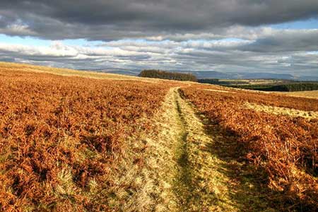
Stay on the road for another 500 metres to reach a very short fingerpost on the right. Continue along the road for a further 75 metres to the next short fingerpost and turn right onto a clear track leading across Askham Fell. Shortly after leaving the road, you pass the Cop Stone. Continue across the moor for another 1200 metres passing other Bronze Age relics on the way. Reaching a fingerpost (grid ref. NY487225), turn right and after 400 metres right again. The route now heads downhill passing a small plantation over to your left. Ahead you have an excellent view to the higher fells of North Pennines.
Keep ahead on the clear track and descend into Askham village with track becoming a road. Continue ahead to road junction with the Queen's Head opposite. Turn right and then first left signed to Lowther. Walk ahead, cross the River Lowther, turn right off the road onto a signed path. Almost immediately fork left and climb steeply through woodland. Just after a left-hand bend, fork right and continue to the track used at the start of the walk. Turn left and retrace your route back to the parking area at Lowther Castle.
Other walks nearby
| Walk 1143 | Hallin Fell | easy | 2.0 miles |
| Walk 1241 | Arthur's Pike & Loadpot Hill | moderate | 9.0 miles |
| Walk 1242 | Bannerdale, Boredale & Beda Head | moderate | 9.0 miles |
| Walk 2631 | Martindale High-level Circuit | mod/hard | 11.0 miles |
| Walk 1152 | The Corpse Road and Selside Pike | moderate | 6.0 miles |
| Walk 2039 | Gowbarrow Fell circular | moderate | 3.5 miles |
| Walk 1109 | Harter Fell & Nan Bield Pass | moderate | 4.5 miles |
| Walk 1269 | High Street & Kidsty Pike | moderate | 7.5 miles |
| Walk 1462 | Mardale Head horseshoe | moderate | 8.0 miles |
| Walk 2364 | Clough Head via Great Dodd from near Dockray | moderate | 8.1 miles |
Recommended Books & eBooks
The Cumbria Way
 A guidebook to the 73 mile Cumbria Way, an easy long-distance walk though the heart of the Lake District National Park, from Ulverston in the south to Carlisle in the north, with good transport links to either end. The route is largely low-level but this guide offers alternative mountain days to climb some of the famous fells en route.
More information
Walking the Lake District Fells - Patterdale
 Part of the Walking the Lake District Fells series, this guidebook covers a wide range of routes to 35 Lakeland summits that can be climbed from Ambleside, Grasmere and Patterdale and the Thirlmere and Ullswater valleys, with highlights including Helvellyn and Fairfield. Suggestions for longer ridge routes are also included.
More information
Messaging & Social Media
Message Walking Britain and follow the latest news.

Mountain Weather
Stay safe on the mountains with detailed weather forecasts - for iOS devices or for Android devices.