Abbeycwmhir Circular
Hill Walk + Woodland Walk + Abbey
County/Area - Powys - Powys Central
Author - Lou Johnson
Length - 7.2 miles / 11.7 km Ascent - 1100 feet / 333 metres
Time - 4 hours 40 minutes Grade - easy/mod
Maps 

| Ordnance Survey Explorer 214 | Sheet Map | 1:25k | BUY |
| Anquet OS Explorer 214 | Digital Map | 1:25k | BUY |
Walk Route Description
Click image to see photo description.
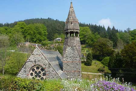
Walk from Abbeycwmhir named after Cwmhir Abbey, a Cistercian abbey built there in 1143. It was the largest abbey in Wales but was never completed. The Abbey was later slighted in 1644, during the English Civil War, although some ruins still remain. The route explores the hills, valleys and forests lying to the west of the village and follows a section of Glyndŵr's Way.
The walk starts from Abbeycwmhir where limited parking is available by the church entrance (grid ref. SO054713). With your back to the church, turn right along the road and ignore the footpath on the right. Keep left where the road forks and continue for a further 700 metres to where the main road bends sharp right. Continue ahead along a lane. After a kilometre you reach a house on the left (Lower Cwmhir). Alternative parking by kissing gate. Take the signed footpath on the right (grid ref. SO039706). Pass through the kissing gate and follow a grassy track which leads up the valley to some buildings at Upper Cwmhir.
Turn left on a rising path between hedges. Keep ahead at junction of tracks and soon enter an open field. Keep to the right-hand edge and continue into the next field. Maintain direction across this field to a stile to enter a plantation. The waymarked path continues to a forestry track. Bear right and soon after fork left off the track to reach a lane (grid ref. SO018719). Turn right and follow the upper lane which climbs steadily into the hills. Keep ahead at all junctions. The track passes through a plantation and exits onto open hillsides. At the edge of the plantation, ignore the track turning sharp right and walk ahead through a gate to follow a track.
Continue along the track to the next gate and just before the small plantation (grid ref. SO024741), turn right here to join Glyndŵr's Way. This long-distance path is well-waymarked and after crossing the flank of Llan-fraith the path follows the ridge of Upper Esgair Hill to start a descent into the valley. Approaching Upper Esgair Farm you join a clear track. Where the track bends right, continue ahead, and follow the path to rejoin the track later. Reaching Lower Esgair Far, follow the track as it bends left and continue down to a lane. Turn right and after 700 metres fork left to continue along Glyndŵrs Way. Descend to a footbridge and follow the waymarks through a planation back to the church in Abbeycwmhir.
Other walks nearby
| Walk 3253 | Warren Hill, Gors Lydan & Moelfre Hill | easy/mod | 6.0 miles |
| Walk 3297 | Crugyn Ci, Esgair Perfedd & Penygarreg - Elan Valley | moderate | 7.5 miles |
| Walk 1898 | Severn Valley from Llanidloes | moderate | 11.3 miles |
| Walk 2498 | Gorllwyn circuit, Elan Valley | easy/mod | 6.8 miles |
| Walk 3674 | Claerwen Valley & Dam from Dolymynach Reservoir | moderate | 7.4 miles |
| Walk 3023 | Great Rhos & the Radnor Forest from New Radnor | moderate | 9.0 miles |
| Walk 3696 | Newtown (Y Drenewydd) & Gregynog Circular | mod/hard | 10.3 miles |
| Walk 3705 | Newtown (Y Drenewydd) & Bettws Cedewain Circular | mod/hard | 10.1 miles |
| Walk 3706 | Newtown (Y Drenewydd), Brimmin Wood & Kerry | moderate | 8.3 miles |
| Walk 3707 | Fachwen Pool from Newtown (Y Drenewydd) | easy/mod | 6.0 miles |
Recommended Books & eBooks
The Cambrian Way
 Guidebook to the Cambrian Way, a challenging three-week mountain trek through Wales from Cardiff to Conwy. The 470km un-waymarked route is presented from south to north. Often sticking to long, beautiful ridgelines, it crosses wild and rugged terrain and visits many of Wales's highest mountains, including Snowdon.
More information
Messaging & Social Media
Message Walking Britain and follow the latest news.

Mountain Weather
Stay safe on the mountains with detailed weather forecasts - for iOS devices or for Android devices.