Upper Brailes Circular
Pub Walk + Hill Walk + Countryside
County/Area - Warwickshire
Author - Lou Johnson
Length - 5.6 miles / 9.1 km Ascent - 620 feet / 188 metres
Time - 3 hours 30 minutes Grade - easy/mod
Maps 

| Ordnance Survey Explorer 191 | Sheet Map | 1:25k | BUY |
| Anquet OS Explorer 191 | Digital Map | 1:25k | BUY |
Walk Route Description
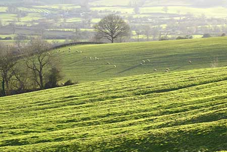
Click image to see photo description.
Starting from the village of Upper Brailes, this walk completes a circuit around Brailes Hill and countinues through Lower Brailes to visit Castle Hill the site of a hill fort. The route follows well-used paths and offers some fine views across the Warwickshire landscape. Refreshments are available at The George (Lower Brailes) and the Gate Inn (Upper Brailes).
The walk starts from a small parking area at the south end of the village where Chapel Lane joins the B4035 (grid ref. SP305395). After parking walk uphill across the grass verge and turn left onto a signed footpath to the right of a wooden gate. The enclosed path passes through a kissing gate and continues across several small fields into an area of scattered bushes on the flank of Gillett's Hill. Continue uphill, cross a stile, enter a field, and follow the path which heads half left over the ridge to pass through a narrow band of trees (Ashen Coppice). Descend to a blue waymark and turn left to follow a bridleway.
The bridleway continues along a clear track. Reaching a gate marked 'private' (grid ref. SP292396) fork right and continue down a field to reach a track. Turn left and follow the track south. After 500 metres turn left at yellow waymarks (grid ref. SP285389). Head up the field into woodland. Exit the trees and bear right on a clear track. When the track bends right continue along the left-hand edge of a field. At the end of the field turn left through a gate (grid ref. SP292382).
Follow a bridleway along the right-hand edge of fields. The path soon becomes a track, passes to the left of New House Barn. 200 metres beyond the barn, the track continues along the left-hand edge of fields and then continues between hedges to reach a lane at Grove End (grid ref. SP306390). Turn left and almost immediately right through at metal gate with adjacent yellow topped post. The onward path crosses fields via metal gates and leads onto Sutton Lane. Turn left and continue to the B4035. Turn right through Lower Brailes. Stay on the B4035 to reach The George. Opposite the inn, turn left up a narrow lane (Butcher's Lane).
After 100 metres turn left on Path 52. Cross a footbridge and cross three fields to reach Castle Hill Lane. (grid ref. SP309398). Cross the lane to a stile and continue to Castle Hill. Leave the hill to the northwest, cross two fields and exit onto Castle Hill (grid ref. SP305403). Turn left and walk to the B4035 and turn left through the village past the Gate Inn back to the start.
Other walks nearby
| Walk 1971 | Gallow Hill, Epwell & Swalcliffe | easy/mod | 7.8 miles |
| Walk 3665 | Honington & Idlicote Circular | easy/mod | 6.0 miles |
| Walk 1981 | Epwell from Sibford Gower | easy/mod | 5.6 miles |
| Walk 3222 | Edge Hill and Upton House | easy/mod | 6.5 miles |
| Walk 2340 | Ilmington Down | easy/mod | 4.3 miles |
| Walk 2408 | Ebrington & Hidcote from Ilmington | easy/mod | 8.0 miles |
| Walk 3249 | Hidcote & Ilmington Down | easy/mod | 8.0 miles |
| Walk 2125 | Edge Hill & Ratley from Radway | easy/mod | 5.4 miles |
| Walk 3212 | Ebrington & Foxcote circular | easy | 3.7 miles |
| Walk 3734 | Compton Verney Circular | easy/mod | 7.2 miles |
Recommended Books & eBooks
No suggestions for this area.Messaging & Social Media
Message Walking Britain and follow the latest news.

Mountain Weather
Stay safe on the mountains with detailed weather forecasts - for iOS devices or for Android devices.