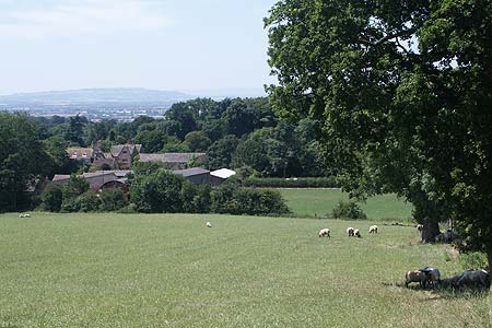
Hidcote & Foxcote from Mickleton
Cotswolds Walk
Region - Cotswolds
County/Area - Gloucestershire & Warwickshire
Author - Daniel Freeman
Length - 7.5 miles / 12.2 km
Ascent - nominal or unknown
Time - 3 hours 50 minutes Grade - easy/mod
Maps 

| Ordnance Survey Explorer 205 | Sheet Map | 1:25k | BUY |
| Anquet OS Explorer 205 | Digital Map | 1:25k | BUY |
| Ordnance Survey Landranger 151 | Sheet Map | 1:50k | BUY |
| Anquet OS Landranger 151 | Digital Map | 1:50k | BUY |
Walk Route Description
Click image to see photo description.
This is an upland walk on undulating paths with magnificent views. It offers the opportunity to visit two of Britain's finest gardens at Hidcote Manor and Kiftsgate Court (the latter is open some days from April to late September and is famous for its rare shrubs). The walk also touches on parts of the Heart of England Way. There are refreshments at Mickleton but not en-route
DIRECTIONS FROM NEAREST TOWN: Evesham - Leave Evesham eastwards on the A44 and in approx. 8 miles turn left on B4081 to Chipping Campden and continue through the village and head for Aston Subedge and Mickleton. At Mickleton continue through village and locate lane on right with red telephone box on left of lane and church board of St Lawrence's of Mickleton.
COACH & CAR PARKING: On street parking in lane by St. Lawrence's Church
PUBLIC TRANSPORT: Public transport is sparse, for details contact 01345 125436 or 01345 425543
ROUTE DESCRIPTION - The start is St. Lawrence's Church in Mickleton (GR SP161435). Walk up the lane described above and in approx. 50 metres you will pass the church on your left. Ignore the foot path on the right but proceed to the gate ahead keeping graveyard on your immediate left. Pass through the gate with the sign "Heart of England Way" and walk across meadow to a small gate. Pass through the gate and proceed on obvious footpath on the right hand side of the field. As path bends to the right, continue across field diagonally to the left to reach stile with yellow footpath arrow. Cross this stile and continue uphill across the field.
Cross over the fence (which used to be a stile but the stile leg is missing) and continue uphill. At the top turn slightly to the right in the direction of the yellow arrow and to the right of a small copse of conifer trees. On the footpath on the ridge of field head for some woods passing through gateway on bridletrack and head straight ahead uphill towards a stone wall with two stone balls on top of two stone pillars.
Turn right passing through a blue gate. Cross over the road and proceed along the road opposite signposted " Hidcote Gardens". Continue up this lane passing through the car park for "Hidcote Manor and Gardens" and proceed straight ahead on farm track passing through a green gate with blue bridleway arrow on the left. Continue uphill on wide bridleway and through a further gate heading towards telephone transmitter aerials. At a fork in bridleway take the right fork and continue keeping the masts on your left whilst admiring the view on your right. Follow the bridleway round to the left and pass by the three telephone masts on your left. Go straight over a lane and continue on the left hand side of the field following a line of electric wires on poles. Q1- What is the name of the electricity company controlling these poles?
Continue on left hand side of field towards two radio masts. At the end of the field bear to the left and drop down through a small culvert passing through a gate. Continue down through the field keeping left of a very large Oak tree. Go through a hunting gate and diagonally cross a lane. Continue uphill on a track and path to the left hand side of the two masts. In approximately 1km, after a short descent, you will see the village of Ilmington down on the left hand side.
Just before path bends round to the left, turn right over a stile beside double five bar gate, following yellow arrow on green. Drop down on left hand side of the field with a hedge on your left to reach a surfaced bridleway. Turn right and walk towards Foxcote Mansion ahead of you. Follow round to your right passing Foxcote Mansion on your left with its black metal fence. Continue on track downhill passing a house on the left and climbing a small hill to pass a larger house on right. Just after this house turn right and follow white arrow on yellow background, climbing gently uphill towards a gate.
Go through this gate and continue on the left hand side of the field with a hedge on your left, passing through a further gate to reach a gateway on the left. Pass through this and in approximately 30m turn left and continue round the left hand side of the field with hedge on your left. Follow the path round on the left hand side of the field turning left then right and to follow yellow arrow on green background. Exit the field through a gap in the hedge and turn right along a farm track. Continue on this track to reach a lane.
Turn right on the lane and follow it round to the left. At the junction where the main road bears round to the right, turn sharp left through two gates and follow a path, keeping a dry stone wall on your right. Then bear left over hummocky ground passing through a metal gate to continue on a clearly defined path towards a village in the distance. Pass through a further iron gate and descend on a track on right hand side of field keeping hedge on your right to join a tarmac road. Go past farm buildings on your right and continue straight ahead through village to a T- junction. On left is a bench seat. Q2 - What is the name inscribed on the seat?
Continue straight over the main road to continue on a footpath through a metal gate. Continue ahead on a well defined footpath and at the next gate turn right. Stay on the right hand side of the field keeping the hedge on your right. After 100 metres turn left and follow field round keeping field on your left and the hedge on right but look out for gap in hedge. Turn right through the gap and cross a wooden bridge over a small stream. Continue straight ahead on left of next field still keeping hedge on your left. Cross over a farm track and with a barn and disused building on your left, turn right on a footpath clearly signed "Heart of England Way". Keeping the hedge on your right proceed through a gap in the hedgerow on a clearly defined path through woodlands with open fields beyond fence on the right to eventually emerge onto left hand side of field with woodlands on your left. In approx. 50 metres turn left, either through the gate or over a stile, and descend down steps to reach a road.
Cross the road and follow a footpath sign to "Heart of England Way" and descend downhill across a field adjacent to a small copse on the right. Continue straight ahead and pass through a gate on left hand side, turn right and keep to the right hand side of the field continuing ahead towards the church. At the bottom of the field in a corner, proceed through a gate and continue on the footpath through a copse to emerge into a small field. Continue straight ahead in the direction of the church spire passing the graveyard on the right. Go through a gate and at the church turn left to reach the end of the walk. Q3 - What is the name of the stables on your right, in front of the church ?
Other walks nearby
| Walk 1749 | Upper Quinton & Hidcote Bartrim from Mickleton | easy/mod | 6.8 miles |
| Walk 3212 | Ebrington & Foxcote circular | easy | 3.7 miles |
| Walk 1308 | Broadway & Chipping Campden | moderate | 11.0 miles |
| Walk 2340 | Ilmington Down | easy/mod | 4.3 miles |
| Walk 2408 | Ebrington & Hidcote from Ilmington | easy/mod | 8.0 miles |
| Walk 3249 | Hidcote & Ilmington Down | easy/mod | 8.0 miles |
| Walk 1359 | Stratford-upon-Avon from Milcote | easy/mod | 7.0 miles |
| Walk 3072 | Broadway, Stanton & Laverton | easy/mod | 7.5 miles |
| Walk 3250 | The Broadway Tower from Broadway | easy/mod | 5.0 miles |
| Walk 3246 | River Avon & Cleeve Prior from Bidford-on-Avon | easy | 4.5 miles |
Recommended Books & eBooks
The Cotswold Way
 Guidebook to walking the Cotswold Way National Trail. Between Chipping Campden and Bath, the 102 mile route explores the Cotswolds AONB. Described in both directions over 13 stages, the Cotswold Way can be walked year round and is suitable for beginner trekkers. Includes separate OS 1:25,000 map booklet of the route.
More information
The Cotswold Way Map Booklet
 Map of the 102 mile (163km) Cotswold Way National Trail, between Chipping Camden and Bath. This booklet is included with the Cicerone guidebook to the trail, and shows the full route on OS 1:25,000 maps. The trail typically takes two weeks to walk, and is suitable for walkers at all levels of experience.
More information
Messaging & Social Media
Message Walking Britain and follow the latest news.

Mountain Weather
Stay safe on the mountains with detailed weather forecasts - for iOS devices or for Android devices.