Moel Siabod & Capel Curig
Snowdonia/Eryri Walk
Nat Park - Snowdonia - Moelwyns Moel Siabod Cnicht
County/Area - Conwy
Author - Peter Smyly
Length - 6.0 miles / 9.8 km Ascent - 2400 feet / 727 metres
Time - 5 hours 20 minutes Grade - moderate
Maps 

| Ordnance Survey Explorer OL17 | Sheet Map | 1:25k | BUY |
| Anquet OS Explorer OL17 | Digital Map | 1:25k | BUY |
| Ordnance Survey Landranger 115 | Sheet Map | 1:50k | BUY |
| Anquet OS Landranger 115 | Digital Map | 1:50k | BUY |
Walk Route Description
Click image to visit gallery of 6 images.
Moel Siabod (2,860 feet) looms large above coniferous forests when seen from the A5 near to Capel Curig from where it looks an inviting prospect. While Snowdon traditionally draws the crowds as bees to a honeypot, on a hot, sunny day in May 2012, there was a crowd of about forty people up there, the numbers swelled by a group of ramblers and another larger group of outdoor enthusiasts. Apart from the obvious exception of Snowdon, I cannot recall seeing so many people at the top of a Welsh mountain before. Along with Cnicht, it is one of the Moelwyn peaks that draws walkers, in contrast to the rest of the range which is largely unknown and where it is possible to walk for miles without seeing a soul.
Moel Siabod is one of those mountains, like Yr Aran, which is isolated from other tops; but this is a fine peak in its own right and one which, in height terms, is not far short of reaching three thousand feet. It is also conspicuous, standing out in pyramid- like form when seen in the distance from different vantage points in the locality.
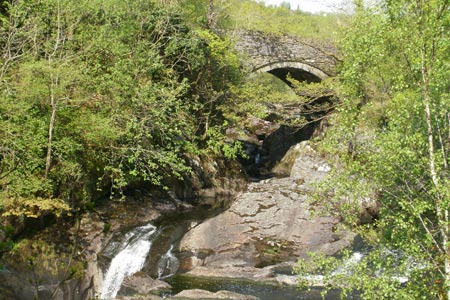
The start of this Snowdonia (Eryri) walk is at the Bryn Glo car park, cross the A5 and a short walk up the other side of the road to the right leads to the bridge of Pont Cyfyng. Cross here over the rushing waters of the Afon Llugwy and take the first turning on the right along a tarmac road up a hill. The road passes through woods before emerging into the open. The way ahead is obvious as the route turns right, then left past a house on the left to reach an unsurfaced road with the walk's objective, Moel Siabod, seen ahead.
The route climbs up, steeply in places, passing a tarn without a name on the left and later, a quarry pool on the right. Once over the brow of the hill ahead, Llyn y Foel comes into view below, a pretty mountain lake with a solitary island. There are various minor paths to the right of the lake which link up later, some of them muddy and boggy. The lake is edged by grass, heather and rocks.
At the far side of Llyn y Foel, the path goes up for a short distance and before it heads downhill again, take a less obvious path to the right among rocks and heather and backed by a rocky shoulder. This path makes its way up round the back of the ridge, avoiding a particularly steep scree type of slope just before the summit plateau. Rock buttresses and crags bar the way on the right as the path makes its way up, sometimes crossing over rock fields until the shoulder from the left is reached, and a fence appears following the line of the ridge. The summit is now seen by turning right but to get there involves some easy basic scrambling over rocks. On a clear day, the summit offers a fine panorama, revealing part or all of the highest three mountain ranges in Wales, the Snowdon range, the Glyderau and some of the Carneddau. A short walk from the summit cairn reveals Llyn y Foel way below to the right and also offers a glimpse of a route, also to the right, which is particularly steep, and which emerges just a short distance from the top.
To complete the route, walk down past the wind shelter and over an area of small boulders to locate a path that diagonally traverses the grassy felllside to the north east. Llynnau Mymbyr and Capel Curig are seen below with the Glyders and the Snowdon range clearly seen. The path passes a dry stone wall and enters the forest. Follow the path down through the trees as it continues to lose height, following it in a easterly direction until it draws level with the Afon Llugwy on the left. The path continues across a field, through woodland and back to Pont Cyfyng from where the start point of the walk is once again reached by walking back along the A5.
Other walks nearby
| Walk 3005 | Clogwen | easy | 2.0 miles |
| Walk 2766 | Capel Pinnacle / Y Pincin | easy | 1.0 miles |
| Walk 2902 | Creigiau Gleision & Llyn Cowlyd from Capel Curig | moderate | 9.5 miles |
| Walk 2200 | Eastern Carneddau | moderate | 8.5 miles |
| Walk 2300 | Glyder Fach | mod/hard | 11.5 miles |
| Walk 1661 | Crimpiau | easy/mod | 4.5 miles |
| Walk 3402 | Moel Siabod circular from Pont Cyfyng | moderate | 6.5 miles |
| Walk 1332 | Gwydir ForestLakes from Tyn Llwyn | easy/mod | 6.5 miles |
| Walk 2285 | Llyn Geirionydd & Llyn Crafnant | easy/mod | 5.5 miles |
| Walk 2592 | Llyn Geirionydd & Llyn Bychan from Llyn Crafnant | moderate | 9.5 miles |
Recommended Books & eBooks
Snowdonia: 30 Low-level and easy walks - South
 Guidebook describing 30 walks in Snowdonia, Wales. Routes are mostly low level and on clear paths and showcase the region's beautiful scenery and rich history and culture. Part of a 2-volume set, this southern volume includes Trawsfynydd, Bala, Dolgellau, Machynlleth, the Harlech Coast and the valleys of the Mawddach and Dyfi.
More information
The Cambrian Way
 Guidebook to the Cambrian Way, a challenging three-week mountain trek through Wales from Cardiff to Conwy. The 470km un-waymarked route is presented from south to north. Often sticking to long, beautiful ridgelines, it crosses wild and rugged terrain and visits many of Wales's highest mountains, including Snowdon.
More information
Messaging & Social Media
Message Walking Britain and follow the latest news.

Mountain Weather
Stay safe on the mountains with detailed weather forecasts - for iOS devices or for Android devices.