Tollesbury Wick Marshes from Tollesbury
Essex Walk
County/Area - Essex
Author - Lou Johnson
Length - 7.2 miles / 11.7 km Ascent - 100 feet / 30 metres
Time - 3 hours 40 minutes Grade - easy
Maps 

| Ordnance Survey Explorer 176 | Sheet Map | 1:25k | BUY |
| Anquet OS Explorer 176 | Digital Map | 1:25k | BUY |
Walk Route Description
Click image to see photo description.
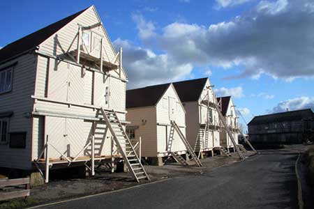
The Essex village of Tollesbury has much to offer the visitor with a bustling marina, restored sail lofts and a preserved lightship. The area to the south-east of the village consists of wide expanses of salt marshes with the River Blackwater beyond. There is a small car park (grid ref. TL963106) and public toilets on Woodrolfe Road which leads east from the B1023 and the village centre.
After parking exit the car park and turn left towards the marina. Before starting the walk, it is a good idea to take the short walk out to the preserved lightship, which lies at the end of a footpath from the road. To start the walk bear right off Woodrolfe Road past the restored sail lofts (on your right). Continue along the south side of the extensive marina and join the signed public footpath (grid ref. TL968102). In initially the path heads northeast following the sea wall but soon turns south-east to reach Shinglehead Point.
The path turns south-west here and continues along the north shore of the River Blackwater to reach Mill Creek. Continue around Mill Creek to pass Left Decoy, a small expanse of water on your right, to reach a path/track junction near Thistly Hard (grid ref. TL957083). Turn right here and walk inland on what is now a clear track. Continue past Decoy Farm on your right and continue along a lane to pass Bohuns Hall, also on your right. You are now on Church Lane and this is followed into the village centre passing the Parish Church on your right. Turn right along High Street, which soon becomes East Street. Bear half left into Woodrolfe Road and return to the car park which is on your left.
Other walks nearby
| Walk 3746 | Bradwell on Sea Circular | easy | 6.5 miles |
| Walk 3556 | Arlesford Creek & Brightlingsea Circular | easy | 6.0 miles |
| Walk 3645 | Burnham-on-Crouch to Fambridge | easy/mod | 9.5 miles |
| Walk 3658 | Manningtree, Flatford Mill and Dedham | easy/mod | 7.1 miles |
| Walk 3724 | River Box from Stoke-by-Nayland | easy | 6.0 miles |
| Walk 3660 | Stour Valley & Dedham from Flatford Mill | easy | 3.5 miles |
| Walk 2366 | The Naze from Walton-on-the-Naze | easy | 6.0 miles |
| Walk 2096 | Alton Water, Stutton & Tattingstone | easy | 5.5 miles |
| Walk 2149 | Circuit of Alton Water | easy/mod | 7.6 miles |
| Walk 1445 | Historic Long Melford | easy/mod | 8.0 miles |
Recommended Books & eBooks
No suggestions for this area.Messaging & Social Media
Message Walking Britain and follow the latest news.

Mountain Weather
Stay safe on the mountains with detailed weather forecasts - for iOS devices or for Android devices.