Bishop Wilton & Millington
Yorkshire Wolds Walk
Region - Yorkshire Wolds
County/Area - East Yorkshire - Yorkshire Wolds
Author - Andy Chaplin
Length - 13.4 miles / 21.8 km Ascent - 1820 feet / 552 metres
Time - 8 hours 30 minutes Grade - moderate
Maps 

| Ordnance Survey Explorer 294 | Sheet Map | 1:25k | BUY |
| Anquet OS Explorer 294 | Digital Map | 1:25k | BUY |
Walk Route Description
Click image to visit gallery of 3 images.
The walk starts near to the Gait Inn at Millington where the beer is good and the food seems popular. This means it can be difficult to get a seat at meal times but there is always plenty of room outside. The walk itself explores the western ridge of the East Yorkshire Wolds looking out towards the Derwent and Ouse valleys as well as some of the Wold Dales on the way back into Millington. It follows sections of the Chalkland Way, Minster Way and Yorkshire Wolds Way.
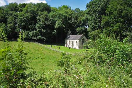
Start in the village (grid ref. SE831517) and take the Minster Way out north-westwards on The Balk. At the junction with the Givendale Hill road go straight over and take the track to Little Givendale Farm then continue along the Minster Way through Given Dale past St Ethelberga church to Great Givendale.
The Chakland Way and the Minster Way combine as you head off along Givendale Lane then turn off and go across-country, with views westwards across the Ouse valley and all the power stations. When you come down onto Pocklington Lane turn right towards Bishop Wilton then right again up Park Lane just when you get to the outskirts of the village.
A path on the right takes you up Milner Wood and around Old Wood, both of which are remarkably lacking in trees. As you turn north towards Crow Wood there is a conveniently placed bench with a view into Worsen Dale, which is a good place for lunch. At the end of the wood, at a junction of paths, turn right and head east towards Beacon Road.
Cross the road and take the path into Deep Dale. At grid ref. SE820556 the Halifax Estate directs you off the track and eastwards up the dale side to The Bence Road on Callis Wold. Turn left on the road then take the first path off on the right heading gradually towards the A166. When you come onto the minor road turn right, pass Greenwick Cottage and continue on to Waterman Hole where you turn right on the Chalkland Way towards Tun Dale.
The Chalkland Way then continues through or across Tun Dale, Frendal Dale, Pasture Dale, Nettle Dale, Millington Dale and Sylvan Dale. With Millington now in view, climb up out of Sylvan Dale and after Warren Farm turn left back onto the Minster Way and follow it down into Millington.
Other walks nearby
| Walk 2655 | Wayram To Fridaythorpe Circular | easy/mod | 7.5 miles |
| Walk 2906 | Circular from Wayrham Through Painsthorpe | moderate | 8.5 miles |
| Walk 3349 | Pasture Dale, Frendal Dale and Horsedale from Huggate | easy/mod | 9.1 miles |
| Walk 1779 | Horse Dale, Holm Dale, Tun Dale and Frendal Dale from Huggate | easy/mod | 9.0 miles |
| Walk 2727 | Pocklington Canal from Allerthorpe Wood | moderate | 11.0 miles |
| Walk 2703 | Thixendale & Kirby Underdale | easy/mod | 8.5 miles |
| Walk 1760 | Pocklington Canal, Melbourne & East Cottingwith | easy/mod | 11.0 miles |
| Walk 1842 | Buttercrambe & Youlthorpe from Stamford Bridge | moderate | 11.8 miles |
| Walk 3515 | Deepdale and the deserted village of Wharram St. Percy | easy | 5.0 miles |
| Walk 3434 | North Grimston, Birdsall & Wharram Percy | moderate | 12.1 miles |
Recommended Books & eBooks
No suggestions for this area.Messaging & Social Media
Message Walking Britain and follow the latest news.

Mountain Weather
Stay safe on the mountains with detailed weather forecasts - for iOS devices or for Android devices.