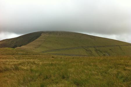
Tarrenhendre from Abergynolwyn
Snowdonia/Eryri Walk
Nat Park - Snowdonia - Cadair Idris
County/Area - Gwynedd
Author - James Martin
Length - 5.0 miles / 8.1 km Ascent - 1650 feet / 500 metres
Time - 4 hours 10 minutes Grade - easy/mod
Maps 

| Ordnance Survey Explorer OL23 | Sheet Map | 1:25k | BUY |
| Anquet OS Explorer OL23 | Digital Map | 1:25k | BUY |
| Ordnance Survey Landranger 124 | Sheet Map | 1:50k | BUY |
| Anquet OS Landranger 124 | Digital Map | 1:50k | BUY |
Walk Route Description
Click image to visit gallery of 4 images.
This Snowdonia (Eryri) walk takes in the 634m summit of Tarrenhendre in Southern Snowdonia, not as popular or busy as other routes around the Cadair Idris range but a good work out with some nice views to boot. This is an out and back walk but can be extended to take in Tarren Y Gesail too should you choose.
Park in the car park for Abergynolwyn station (grid ref. SH671064). From the car park take the path marked as the railway's link path which runs alongside the railway line initially before cutting beneath the tracks and winding away into the forest. The path is relatively clear and after 10 minutes or so you will find yourself exiting the forest onto a clear gravel track. Take a glance back at where you left the forest as I missed the path on the return route!
Head right up the track and when it hairpins around to the left slightly further on, look for the discrete path leading away into ferns on the right. Take this path which meanders up fairly steeply but clearly through ferns and undergrowth. You will hit a fence on the far right hand side of the forest area before cutting back to the left through a fallen wall and eventually out onto another gravel track. Head right here and after a couple of minutes you'll be greeted by a gate (grid ref. SH669058) beyond which the gravel path becomes grass and often faint, leading away to the right almost counter intuitively.
Stick with this path which eventually bears back around to the left and joins another gate. Go through the gate pass a sheepfold and begin to bear off back to the left still following the faint outline of a path as it rises and cuts through sometimes boggy ground. Around 15 minutes after passing the sheepfold you will come over the crest and see a gate ahead in the distance. Head for this, by the time you reach it, the path ahead will have come very clearly into view.
There are a number of gates to navigate through in what appears to be a sheepfold just short of the main ascent. Once through the gates, a track cuts away from left to right that creates almost a scar on the side of the mountain, ignore this track. Beyond this and directly ahead, a clear path adjacent to the fence that takes you up to the summit is clearly visible, as is its gradient! It is tough going for a short while as the steep ascent heads directly upwards, burning your calves in the process.
Eventually it flattens out and after navigating some boggy ground and a stile, a small cairn marking the summit comes into view. The views around should be good on a clear day including the main Cadair Idris ridge and Tarren Y Gesail nearby, the latter of which can be your next stop if time and conditions allow. Unfortunately neither did for me so I returned back via the outward route in little over an hour from the summit. Allow four hours for the complete walk although for strong walkers it is possible in under three hours.
Other walks nearby
| Walk 1643 | Llanfihangel-y-pennant & Castell y Bere | easy/mod | 6.8 miles |
| Walk 3582 | Castell y Bere & Llanfihangel-y-pennant from Abergynolwyn | easy/mod | 5.7 miles |
| Walk 1309 | Tarren y Gesail | moderate | 8.0 miles |
| Walk 2570 | Cadair Idris from Llanfihangel-y-pennant | mod/hard | 10.0 miles |
| Walk 2707 | Tyrrau Mawr and Craig-y-llyn from Llanfihangel-y-pennant | moderate | 9.5 miles |
| Walk 1204 | Cadair Idris Minffordd Path | mod/hard | 6.0 miles |
| Walk 2100 | Circuit of Cadair Idris from Minffordd | mod/hard | 11.0 miles |
| Walk 1851 | Cregennen Lakes & Pared y Cefn-hir | easy/mod | 2.5 miles |
| Walk 3317 | Happy Valley Circular | easy | 4.2 miles |
| Walk 3229 | Mawddach circular | moderate | 9.0 miles |
Recommended Books & eBooks
Snowdonia: 30 Low-level and easy walks - South
 Guidebook describing 30 walks in Snowdonia, Wales. Routes are mostly low level and on clear paths and showcase the region's beautiful scenery and rich history and culture. Part of a 2-volume set, this southern volume includes Trawsfynydd, Bala, Dolgellau, Machynlleth, the Harlech Coast and the valleys of the Mawddach and Dyfi.
More information
The Cambrian Way
 Guidebook to the Cambrian Way, a challenging three-week mountain trek through Wales from Cardiff to Conwy. The 470km un-waymarked route is presented from south to north. Often sticking to long, beautiful ridgelines, it crosses wild and rugged terrain and visits many of Wales's highest mountains, including Snowdon.
More information
Messaging & Social Media
Message Walking Britain and follow the latest news.

Mountain Weather
Stay safe on the mountains with detailed weather forecasts - for iOS devices or for Android devices.