Meldon Hill from Cow Green Reservoir Walk
Walk 3593 - Route Maps & Profile
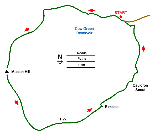
Route Map
Digital Maps - Copyright © 2011-2024. All rights reserved.
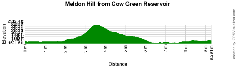
Route Profile
Sketch Map
Suggested Maps 

| Ordnance Survey Explorer OL19 | Sheet Map | 1:25k | BUY |
| Anquet OS Explorer OL19 | Digital Map | 1:25k | BUY |
| Ordnance Survey Explorer OL31 | Sheet Map | 1:25k | BUY |
| Anquet OS Explorer OL31 | Digital Map | 1:25k | BUY |
| Ordnance Survey Landranger 91 | Sheet Map | 1:50k | BUY |
| Anquet OS Landranger 91 | Digital Map | 1:50k | BUY |
It is recommended you take a map. The preferred scale is 1:25k.
Start Point Details
Ordnance Survey Grid Ref NY810309
Latitude 54.672806 Longitude -2.296139
Postcode DL12 0HX
what3words start purple.pacemaker.kite
Walk description may contain detailed information on the start point for this walk.
Further Information
North Pennines
This National Landscape (formerly AONB), the second largest in area, covers some wild and remote landscapes in northern England. The area is dominated by the Pennine hills and includes large areas of undulating heather moors and peat. North Pennines Walking Guide
Walk grading - Learn how each walk is assessed and select a walk to suit your ability and experience by going to Walk Grading Details.
Messaging & Social Media
Message Walking Britain and follow the latest news.

Mountain Weather
Stay safe on the mountains with detailed weather forecasts - for iOS devices or for Android devices.