The Gloup, Deerness Brough & Mull Head Walk
Walk 3652 - Route Maps
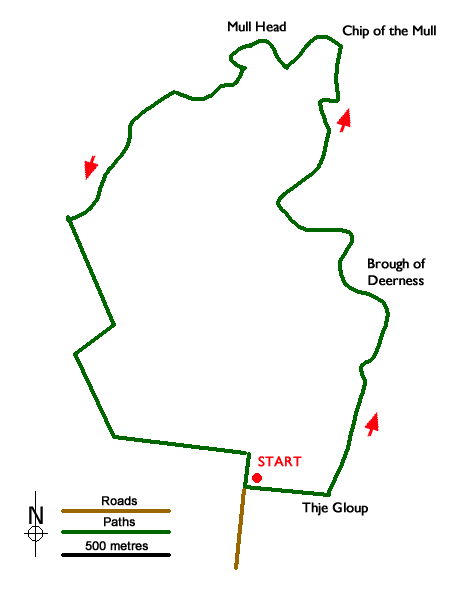
Route Map
Digital Maps - Copyright © 2011-2024. All rights reserved.
Sketch Map
Suggested Maps 

| Ordnance Survey Explorer 461 | Sheet Map | 1:25k | BUY |
| Anquet OS Explorer 461 | Digital Map | 1:25k | BUY |
It is recommended you take a map. The preferred scale is 1:25k.
Start Point Details
Ordnance Survey Grid Ref HY590079
Latitude 58.956327 Longitude -2.714454
Postcode KW17 2QJ
what3words start generated.crumb.ribcage
Walk description may contain detailed information on the start point for this walk.
Further Information
Orkney Islands
The Orkney Islands are an archipelago with about 70 islands, of which 20 are inhabited. Kirkwall, the largest centre is situated on the largest island, Mainland. The islands have been inhabited for at least 8,500 years with many of the oldest and best-preserved Neolithic sites in Europe. Most of the islands are based on underlying Old Red Sandstone and are home to an abundant marine and bird life. The islands are mainly low-lying except for some sharply rising sandstone hills on Mainland, Rousay and Hoy where Ward Hill is the highest point in the islands. Dramatic, rugged cliffs can be found on some western shores and provide an added scenic attraction.
Walk grading - Learn how each walk is assessed and select a walk to suit your ability and experience by going to Walk Grading Details.
Messaging & Social Media
Message Walking Britain and follow the latest news.

Mountain Weather
Stay safe on the mountains with detailed weather forecasts - for iOS devices or for Android devices.