Descending into Cardingmill Valley by a stony stream
Walk Photo 330809
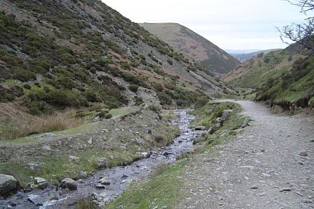
Caption - A stony brook joins the final descent into Cardingmill Valley.
Walk 3308 : Ragleth and the Long Mynd
Photographer : Peter Lane
Use back button to return to the photo gallery lists.
Further Information
Location Map
Shropshire Hills
This National Landscape (formerly AONB) consists of a number of areas of hills centered on Church Stretton. The hills are known for the variety, extensive network of paths and wonderful scenery. The most popular hills are the Long Mynd but others including Wenlock Edge, the Stiperstones and those around Clun are also gaining in popularity. More Information
Messaging & Social Media
Message Walking Britain and follow the latest news.

Mountain Weather
Stay safe on the mountains with detailed weather forecasts - for iOS devices or for Android devices.