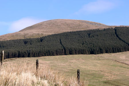
Tarren y Gesail from Abergynolwyn
Snowdonia/Eryri Walk
Nat Park - Snowdonia - Cadair Idris
County/Area - Gwynedd
Author - John Treble
Length - 8.0 miles / 13 km Ascent - 2200 feet / 667 metres
Time - 6 hours 10 minutes Grade - moderate
Maps 

| Ordnance Survey Explorer OL23 | Sheet Map | 1:25k | BUY |
| Anquet OS Explorer OL23 | Digital Map | 1:25k | BUY |
| Ordnance Survey Landranger 124 | Sheet Map | 1:50k | BUY |
| Anquet OS Landranger 124 | Digital Map | 1:50k | BUY |
Walk Route Description
Click image to see photo description.
This is one of Wales' lesser known peaks, which at 666m is probably shunned by many. If you are worried about the number of the beast, just convert it to feet and it won't be beastly any more! Choose a day in spring when visibility is good to do this walk, and you will be rewarded with (1) a ramble through deciduous woodland crammed with celandines, wood anemones, bluebells, primroses and twittering birds; (2) Some interesting late nineteenth century industrial archaeology; and (3) a spectacular view, taking in the sweep of Cardigan Bay, the Dovey estuary and northerly aspect of the Cader Idris ridge. This is an out-and-back walk, but is sufficiently varied that you don't really notice.
To start this Snowdonia (Eryri) walk, park in Abergynolwyn, near the café where you can have a cup of tea when you've finished. (Grid ref. SH678069) Walk past the café up the metalled road which ascends steeply out of the valley. The road turns into a track. Carry on along it, resisting the temptation to turn off into the woods on your right. (Reserve this pleasure for you return trip.) At grid ref. SH690058, another, grassy, track forks away from the main track to the right. It is marked with blue footprint symbol. Follow it, and the blue symbols, through the old quarry, deviating if the fancy takes you to admire the abandoned workings. Sticking to the path will lead you to the big hole in the ground where the bulk of the quarrying was done. This is now fenced off, but you can peer over the fence and take a look at the water in the bottom, and imagine what new species may be evolving in their depths.
About 100yds or so further on, the track is gated and on the left is stile leading to a path through the conifer wood. Take this path, which soon emerges into a rather boggy grassy area, which is the lower slope of Tarren y Gesail. The path rises gradually with woods on either side getting increasingly closer, until a waymarked stile is reached. Ignore this and continue on between two walls, along a path that follows the side of the valley, along the edge of the wood on the left. After a few yards turn around and admire the little arched bridge over the stream below. If you want to inspect this more closely, you can do so by crossing the stile you just ignored. What was it built for? I don't know, but there is a second quarry at the top of the valley, which possibly has something to do with it.
Eventually the wood on your left comes to an end where a gate (secured with a pink bootlace) crosses the path. Go through the gate, remembering to tie as pretty a bow as you can manage, and turn left along the edge of the wood. Continue upwards to the ridge of Tarren y Gesail, which you can follow easily to the triangulation point at the top. Wonderful views from here.
Return by the same route until you reach the fork where the path to the quarry meets the stone track. Carry on down the track to the second stile on the left, which is waymarked to the 'Station'. Climb over the stile and follow the path to a stream. Follow the stream back to have a nice cup of tea at Abergynolwyn.
Other walks nearby
| Walk 1643 | Llanfihangel-y-pennant & Castell y Bere | easy/mod | 6.8 miles |
| Walk 3582 | Castell y Bere & Llanfihangel-y-pennant from Abergynolwyn | easy/mod | 5.7 miles |
| Walk 3230 | Tarrenhendre from Abergynolwyn | easy/mod | 5.0 miles |
| Walk 2570 | Cadair Idris from Llanfihangel-y-pennant | mod/hard | 10.0 miles |
| Walk 2707 | Tyrrau Mawr and Craig-y-llyn from Llanfihangel-y-pennant | moderate | 9.5 miles |
| Walk 1204 | Cadair Idris Minffordd Path | mod/hard | 6.0 miles |
| Walk 2100 | Circuit of Cadair Idris from Minffordd | mod/hard | 11.0 miles |
| Walk 1851 | Cregennen Lakes & Pared y Cefn-hir | easy/mod | 2.5 miles |
| Walk 1172 | Cadair Idris by the Pony Path | mod/hard | 11.0 miles |
| Walk 2668 | Cadair Idris, Craig Cau and Cyfrwy by the Pony Path | mod/hard | 5.3 miles |
Recommended Books & eBooks
Great Mountain Days in Snowdonia
 Inspirational guidebook to 40 great mountain day walks and scrambles in Snowdonia. Inspirational routes for all abilities across the National Park with routes up Snowdon and Moel Eilio, the Glyderau, the Carneddau, Eifionydd, Siabod and the Moelwynion, Rhinogydd (the Harlech Dome), Migneint and the Arans and Cadair Idris and the Tarrens.
More information
The Cambrian Way
 Guidebook to the Cambrian Way, a challenging three-week mountain trek through Wales from Cardiff to Conwy. The 470km un-waymarked route is presented from south to north. Often sticking to long, beautiful ridgelines, it crosses wild and rugged terrain and visits many of Wales's highest mountains, including Snowdon.
More information
Messaging & Social Media
Message Walking Britain and follow the latest news.

Mountain Weather
Stay safe on the mountains with detailed weather forecasts - for iOS devices or for Android devices.