Therfield to Royston & Reed Circular
Hertfordshire Walk
County/Area - Hertfordshire
Author - Donald Morton
Length - 10.0 miles / 16.3 km Ascent - 800 feet / 242 metres
Time - 5 hours 50 minutes Grade - easy/mod
Maps 

| Ordnance Survey Landranger 153 | Sheet Map | 1:50k | BUY |
| Anquet OS Landranger 153 | Digital Map | 1:50k | BUY |
| Ordnance Survey Landranger 154 | Sheet Map | 1:50k | BUY |
| Anquet OS Landranger 154 | Digital Map | 1:50k | BUY |
Walk Route Description
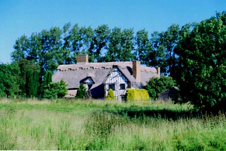
Click image to visit gallery of 5 images.
This Hertfordshire walk is described from Hay Green (Grid Ref TL339368) on the outskirts of Therfield and where it is possible to park at the side of the road alongside the green. If one wishes to use public transport rather than a car the walk can be joined in Royston at the The Cross (see below): on coming out of the station turn right and walk down Kneesworth Street which leads straight down to The Cross in about 1/3rd of a mile.
Starting from Hay Green, walk back along the road to the centre of Therfield where the walk joins the Hertfordshire Way. Opposite the Fox and Duck PH turn left up the road to Kelshall and Sandon, past "Greenside" on the left. Where the road turns sharp right go straight on up the private drive. When you are confronted by the outbuildings belonging to the house on the left, turn right and then left to pass to the right of a gas tank. This brings you to a stile and gate. Once past these, go diagonally over a field in the direction of the beautifully restored Tuthill Manor.
When you reach the fence before it, turn left to a stile left of a water tower. Go over the stile and turn right past the water tower to a lane. Turn right and, opposite Tuthill Court, turn left down an enclosed public footpath (Care!) running down hill by the side of a ditch. Follow the ditch down the hill through the wooded area. Once the path emerges from the trees, the line of the path can be seen clearly and heads for the visible signposts. Once at the signposts, one warning of an approaching rifle range, the path bears left along the field edge with a hedge and bank on the right: the chalky nature of the soil is made obvious by the burrows in the bank; this is the Northern edge of the same chalk saucer, under London's clay, which also emerges on the North Downs and the Chilterns.
Continue past the firing range, along a field break and then straight on along a field edge to the farm ahead. Go straight through the farm yard and soon after notice a tarmac drive on the right. This leads to the gates of Kings Ride stables. To the left of it is the Western end of Therfield Heath. Turn left over it, keeping to the left of the trees that border the drive and later continuing in the same direction with the tall tree boundary of Kings Ride on the right. Follow these trees and when you emerge onto a golf course go through a hedge gap on the right and then diagonally across the grass to reach a well defined track with trees on the right. Turn left and in a short while emerge again into open country.
You are now well and truly on Therfield Heath with wide views over Cambridgeshire to the north. (And the problem is, since this is common land, you can wander where you like - avoiding golf balls - so there are lots of paths and few way marks. If all else fails keep going forward with A505 down on your left but the following description should get you enjoyably to Royston with little danger.) Turn right and go up a path with hedge on the right. At a post above a green turn left and go up towards a wood walking parallel to a fairway in the valley below you on the right. You finish up at seats on the edge of the wood and a stile leading into the wood (Fox Cover Nature Reserve). A few yards into the wood there is a cross track. Turn left on this and follow it as it curves right running about 50 yards from the edge of the wood, to come eventually to a road at a chain stile (Grid Ref TL 337 398). Cross the road slightly left and continue down through woods on the Hertfordshire Way (unusually the sign points your way as well as the way you have come from). Emerge onto the golf course and walk along the edge with wide views over the course on the left, sometimes out in the open, sometimes through bordering scrub. When you enter woods, at any choice of paths keep left to emerge again on the golf course and turn right. When a long green fairway (practice drive) appears in a deep valley on your right, descend into it and up the other side and straight on to a seat which can be seen ahead. Take a seat, rest and admire the scene with Royston ahead and when you get up go straight down the path in front of you, left at a T-junction of paths, and then curve right along the side of a rugby pitch. Once past this, cut across left towards some Edwardian redbrick villas to be seen the other side of a road. When you reach the road turn right to walk into the centre of Royston, passing at the end of the Heath a history information board sketching 4000 years of Heath history. In the centre of Royston you will find another history information board and the base of The Cross built by Lady Roisia de Vere (founder of Royston? and the centre of many legends).
At this point commence the return leg of the walk still on the Hertfordshire Way by turning right and going up King Street past Abbott's Yard, a street lined with a variety of interesting old buildings. At the top where it joins the High Street by The Chequers, cross the road and continue on with The Boar's Head on the left. At a road junction carry straight on up Barkway Road. Turn right into Beldam Avenue and immediately left into Grange Bottom. At the end of this no through road do NOT go up footpath on the left but along the bridleway leading forward from the very end. This enclosed track goes uphill to cross a track as it emerges into open country and continues down a field break. After a bit of walking on a narrow path round The Grange, at a bridle gate turn right onto a track and immediately left up a bridleway between, currently, low hawthorn hedges. Having gone over a tarmac drive and through a gate the bridleway goes through a hedge gap and becomes a field break which joins a tarmac drive. Follow this to a large yard and where the tarmac swings right go straight on up a gravel track at the side of the yard. It is first enclosed then along field edge with hedge on right. Where the most obvious track swings right do not follow it but go straight on. This stretch looking back gives terrific views over Cambridgeshire to the Fens. After about 1/3rd mile come to a lane. Turn right and then left down a lane leading to Reed. Go past Jackson's Lane and follow the road right past a phone box to the A10. Turn right and in less than 100 yards turn left, signed Therfield. Follow this quiet lane, through Reed End, following signs to Therfield back to Hay Green. At the T junction turn right to the suggested parking place.
Other walks nearby
| Walk 1118 | Roe Green and Sandon from Therfield circular | easy/mod | 7.3 miles |
| Walk 2107 | Reed to Nuthampstead Circular | easy/mod | 7.3 miles |
| Walk 1599 | Therfield Heath circular from near Royston | easy/mod | 6.5 miles |
| Walk 1265 | Clothall & Roe Green | easy/mod | 7.3 miles |
| Walk 2220 | Hertfordshire Way from Nuthampstead to Great Hormead | easy/mod | 10.0 miles |
| Walk 1663 | Cottered Warren & Wakeley | easy | 6.4 miles |
| Walk 1503 | Weston & Clothall circular Weston | easy | 5.5 miles |
| Walk 1810 | Graveley and Warren's GreenWeston | easy/mod | 7.0 miles |
| Walk 2970 | The Beane Valley from Walkern to Hertford | moderate | 14.3 miles |
| Walk 2306 | Furneux Pelham Circular | easy/mod | 7.0 miles |
Recommended Books & eBooks
No suggestions for this area.Messaging & Social Media
Message Walking Britain and follow the latest news.

Mountain Weather
Stay safe on the mountains with detailed weather forecasts - for iOS devices or for Android devices.