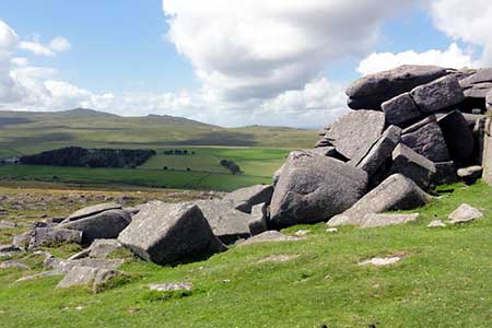
Cosdon Hill & Oke Tor from Belstone
Dartmoor Walk
Nat Park - Dartmoor
County/Area - Devon
Author - Lou Johnson
Length - 10.7 miles / 17.4 km Ascent - 1900 feet / 576 metres
Time - 7 hours 20 minutes Grade - moderate
Maps 

| Ordnance Survey Explorer OL28 | Sheet Map | 1:25k | BUY |
| Anquet OS Explorer OL28 | Digital Map | 1:25k | BUY |
| Ordnance Survey Landranger 191 | Sheet Map | 1:50k | BUY |
| Anquet OS Landranger 191 | Digital Map | 1:50k | BUY |
Walk Route Description
Click image to see photo description.
This Dartmoor walk explores some of the many granite tors in the north-eastern part of the National Park. In fine weather navigation skills required are minimal. However, with poor visibility you will need a good sense of direction. A relevant OS 1:25,000 map is essential.
The start is the small car park on Brenamoor Common (grid ref. SX621938) at the northern edge of the village of Belstone. After parking exit the car park and turn left into the village. Keep straight ahead at the first road junction and then bear left at the next passing the chapel on your left. At grid ref. SX619934 go left onto the signed Tarka Trail. Cross the footbridge over the River Taw and bear left still on the Tarka Trail continuing into Belstone Cleave. The path crosses the river (grid ref. SX628937) and continues along the north bank for some way before re-crossing to the south bank (grid ref. SX631938). Just after this footbridge take the path on your right to leave the Tarka Trail. The path leaves the woodland (grid ref. SX637938), becomes a bridleway and crosses two fields before turning left through woodland and becoming a clear track, which takes you to a metalled road at Ford Farm (grid ref. SX644935).
Here take the second bridleway of two bridleways on your right and continue south and then east to reach a junction of tracks (grid ref. SX645931). Turn left here and follow the bridleway south reaching open country after 800 metres. The onward route then continues between walled fields to enter open country again and the Stone Row at grid ref. SX644915). From here turn left and make for the summit of Cosdon Beacon with its trig point (grid ref. SX636915) following a clear path that is not marked on OS maps.
The next objective is Little Hound Tor which lies to the south. Again there is a path which is not marked on OS maps. Continue roughly southwest to Hound Tor (grid ref. SX628890). The route then turns west to Steeperton Tor (grid ref. SX618887) from where a steeper descent west leads to a clear path heading north to Oke Tor (grid ref. SX612900). From the summit continue north along a clear ridge descending to reach a wider track. The final summit of the day is Belstone Tor (grid ref. SX614920) which is reached on a clear path crossing the Irishman's Wall before the highest point. The final descent of the day takes down clitter strewn slopes to reach the Tarka Trail near Nine Stones stone circle. All that remains is to continue into Belstone village and return to the car park.
Other walks nearby
| Walk 2636 | North Moor crossing from Okehampton to Bellever | mod/hard | 14.5 miles |
| Walk 2639 | Cosdon Beacon from South Zeal | easy/mod | 6.5 miles |
| Walk 1075 | High Willhays & Yes Tor | moderate | 6.5 miles |
| Walk 3004 | Yes Tor, Cranmere Pool and Amicombe Hill from Meldon Reservoir | mod/hard | 12.5 miles |
| Walk 2908 | Great Links Tor & Widgery Cross from the Fox & Hounds | easy/mod | 5.0 miles |
| Walk 2901 | Castle Drogo & Sharp Tor from Fingle Bridge | easy | 3.8 miles |
| Walk 1678 | Bleak House & Great Nodden from Lydford | easy/mod | 7.5 miles |
| Walk 2178 | Rattlebrook Peat Railway | easy/mod | 7.3 miles |
| Walk 2188 | Great Nodden & Great Links Tor | moderate | 6.3 miles |
| Walk 1772 | Hurston, Lettaford & Two Moors Way | moderate | 8.6 miles |
Recommended Books & eBooks
No suggestions for this area.Messaging & Social Media
Message Walking Britain and follow the latest news.

Mountain Weather
Stay safe on the mountains with detailed weather forecasts - for iOS devices or for Android devices.