Bakewell to Edale
Peak District Walk
Nat Park - Peak District - Bakewell Monsal Trail
County/Area - Derbyshire
Author - Paul Taylor
Length - 18.0 miles / 29.3 km Ascent - 3200 feet / 970 metres
Time - 12 hours 10 minutes Grade - mod/hard
Maps 

| Ordnance Survey Explorer OL1 | Sheet Map | 1:25k | BUY |
| Anquet OS Explorer OL1 | Digital Map | 1:25k | BUY |
| Ordnance Survey Explorer OL24 | Sheet Map | 1:25k | BUY |
| Anquet OS Explorer OL24 | Digital Map | 1:25k | BUY |
| Ordnance Survey Landranger 110 | Sheet Map | 1:50k | BUY |
| Anquet OS Landranger 110 | Digital Map | 1:50k | BUY |
| Ordnance Survey Landranger 119 | Sheet Map | 1:50k | BUY |
| Anquet OS Landranger 119 | Digital Map | 1:50k | BUY |
Walk Route Description
Click image to visit gallery of 6 images.
Starting from Bakewell (Grid ref. SK217684) and ending at Edale railway station, this linear Peak District walk is a long one at 18 miles. Walkers are well rewarded for their efforts with many places to stop for refreshment, as well as some fine variations in scenery.
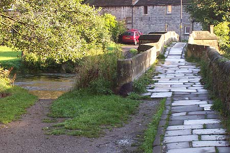
From Bakewell town centre the first 1/4 mile is along the A6 which is followed until you see, to your right, a sign for Holme Bridge and indeed the narrow bridge itself. The bridge was built in 1664 and is a great way to leave the A6 behind and head into countryside, which is what we do. Once over the bridge carry on straight ahead and follow the track uphill passing the architecturally interesting Holme Hall to your right. Soon you are rising up onto open country and come to a choice of directions. Take the left stile following a worn track which eventually heads past a remote cottage (Cracknow House) on your left and through a lovely iron gate from where you head toward Cracknow Wood. Follow the path down through the wood itself and you come to the A6020 road. Turn left and follow the road for 200 metres to the Great Longstone turning which is marked by beautiful iron gates and railings. Sadly there is no view once you reach them as Thornbridge Hall is some 500 metres distant through the trees and cannot be seen. Follow the road under the railway bridge (part of the Monsal Trail) and immediately on the other side take the path up alongside the trail itself but only for a few yards as we take the right turning across fields toward Great Longstone which enters the back of the village. We now walk along the road and as it bends to the left we see a gap straight ahead which leads across the middle of the village cricket pitch and recreation area. Plenty of benches are here for those wanting to stop for a rest!
Continuing across the middle of the pitch we take the central path which leads out of the village across a well worn path through fields until after about 3/4 mile we meet the road at Little Longstone village. Take the road follow it up through the village and passing a beautiful little church, onto Monsal Head.
After sampling the wonderful views here we now head, via a gap in the wall, down the path and at the point where you can branch left, we continue ahead into Upperdale where we meet and follow the road toward Cressbrook. Passing by the mill, built during the late 1830's the road splits into two, of which we take the lower road. The road runs through woodland and gains height. At the point where the road bends sharply to the left we continue along a track which leads directly into Cressbrook Dale which we admire the beauty of all the way along and past the towering Peters Stone and on into Wardlow Mires where we meet the A623.
A well earned rest at either the 'Three Stags Head' or at the roadside cafe is a must before the route continues through Somerset House Farm (to the right of the pub) and through fields toward Stanley House around half a mile ahead of you. At Stanley House we follow the track to the rear until we meet 'Silly Dale' which we follow by taking the obvious path to the left. Once we meet a road the choice is left, right or straight ahead. Take the road ahead and into Grindlow, then Great Hucklow. Once you reach the end of Great Hucklow village at the point where the road bends left we take a dead end road almost straight ahead. In a short while the road turns into a path and the going can get a bit muddy with occasional stagnant pools of water being a temporary distraction to the splendid views all around. The path seems to go missing in places but as the views open up below you head toward the point where the road leads through a narrow cutting (Bradwell Dale) toward Quarters farm and then down to the road itself.
At the road we continue downhill for around 200 metres and past Hazlebadge Hall. At the far end of the Hall is a signpost heading off to the right. Take this path into the field and then diagonally left up the hill toward the back end of Bradwell itself. You can walk along the top of Bradwell Dale itself and eventually you will see an opening leading into the village as you head down the hill. Follow the road down into Bradwell itself past a number of places to refresh yourself. About 200 metres past the Post Office the road bends to the right where it meets a large playing field. We take the road left at this point and at the T Junction we continue ahead along a pathway which leads around the back of, and sometimes along the edge, of the cement works. Continue ahead until reaching a minor road where we take the uphill option. Continue along here and you eventually reach Castleton.
After sampling the various eating options, National Park Visitor Centre, Caverns, and shops we take the path along a brook which runs to the right hand side of the visitor centre, and which then meets Odin Sitch, a narrow river. Follow this for a few metres until you reach another minor road from where we take a left turn onto what becomes Hollowford Road. Heading straight ahead we are looking to reach the path leading uphill to Hollins Cross, midway between Mam Tor to your left, and Lose Hill to your right. After 16 miles the steepest climb is ahead of you, but once on top, fine views lie east toward Stanage Edge, south back to Castleton, west to Mam Tor, and north down into the Vale of Edale and the village itself which is our destination. The route from the top is straightforward and we approach the village itself by passing under the railway and then heading west into the rear of the village. The start of the Pennine Way is from the Old Nags Head.
For those completing the walk, trains run from here, either into Sheffield or otherwise Manchester, via New Mills. For those of you returning to your car, the fast 'Trans Peak' (TP) bus runs along the A6 at New Mills and runs from Manchester to Derby or Nottingham, via Buxton and Bake well. Information on transport can be found in the visitor centres at Castleton or Edale.
Other walks nearby
| Walk 3018 | Cracknowl and the Monsal Trail | easy | 3.5 miles |
| Walk 1945 | Lathkill Dale & Over Haddon circular | easy/mod | 5.7 miles |
| Walk 1827 | Ashford-in-the Water,Magpie Mine & Over Haddon | easy/mod | 7.1 miles |
| Walk 3557 | Chatsworth Park from Calton Lees | easy/mod | 6.5 miles |
| Walk 1569 | Lathkill Dale & Bradford Dale | easy/mod | 8.2 miles |
| Walk 1589 | Lathkill & Bradford Dales (short version) | easy/mod | 6.0 miles |
| Walk 1590 | Monyash & Lathkill Dale | easy/mod | 8.2 miles |
| Walk 1651 | Monsal Trail & Ashford-in-the-Water from Lees Bottom | easy/mod | 8.8 miles |
| Walk 3341 | Brushfield, Miller's Dale & Monsal Head from Lees Bottom | easy/mod | 6.5 miles |
| Walk 2503 | Robin Hood's Stride & Stanton Moor | moderate | 11.0 miles |
Recommended Books & eBooks
Walking in the Peak District - White Peak East
 Guidebook describing 42 half-day and day walks in the limestone landscapes of Derbyshire's White Peak, part of the Peak District National Park. One of two volumes, this book covers the east of the region, with potential bases including Bakewell, Eyam, Castleton, Birchover, Matlock and Wirksworth.
More information
Dark Peak Walks
 Guidebook to 40 walks in the Dark Peak area of the Peak District National Park. 35 circular routes for most abilities, from 8km to 19km, around Edale, Marsden, Fairholmes, Baslow and Castleton, including Kinder Scout and Mam Tor, and 5 longer (25km to 45km) routes highlighting the best of the Gritstone Edges, High Moorland and Deep Valleys.
More information
Messaging & Social Media
Message Walking Britain and follow the latest news.

Mountain Weather
Stay safe on the mountains with detailed weather forecasts - for iOS devices or for Android devices.