Eastbourne to Alfriston by the South Downs Way
South Downs Walk
Nat Park - South Downs
County/Area - East Sussex
Author - Barry Mackie
Length - 12.5 miles / 20.3 km Ascent - 2350 feet / 712 metres
Time - 8 hours 40 minutes Grade - mod/hard
Maps 

| Ordnance Survey Explorer OL25 | Sheet Map | 1:25k | BUY |
| Anquet OS Explorer OL25 | Digital Map | 1:25k | BUY |
| Ordnance Survey Landranger 199 | Sheet Map | 1:50k | BUY |
| Anquet OS Landranger 199 | Digital Map | 1:50k | BUY |
Walk Route Description
Click image to visit gallery of 10 images.
This is the first section of the South Downs Way, a National Trail that extends from Eastbourne, a popular seaside resort in East Sussex, to Winchester, the ancient capital of Britain, in Hampshire. The cliff top walk with its dramatic views is recognised as the finest of its type in South East England.
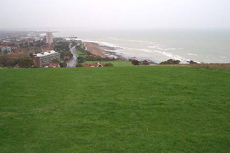
From Eastbourne railway station (Grid ref. TV609990), turn left into Terminus Road, and then take any of the adjacent roads to the seafront. Already there is a choice, either to walk the 1.5 miles west along the road, or to take the bus to the foot of the downs at Beachy Head. We chose the former option and with the light onshore breeze and the fret off the sea, this was a good way to start off.
As the road turns sharply to the right (Grid ref. TV600971), next to St Bede's School, there is a small car park with a refreshment kiosk on the left side. In front of you is an obvious path up the slope from the foot of the downs. Follow this line over the brow of the hill until you reach three faint paths. Take the left path, which soon becomes very narrow, along the side of the hill. Here you are surrounded by gorse and light woodland, but before long emerge onto open downland and then Beachy Head with the lighthouse at the foot of the cliffs. At 162m/535ft above sea level, this is the highest sea facing chalk cliff in Britain. From here, on a clear day, there are wonderful views back towards Eastbourne and into Kent. To the west, possibly a glimpse of the Isle of Wight some 60 miles away, and along the coastline, the next stage of this walk.
The next section is alongside the cliffs. At a safe distance from the edge, head towards the old Belle Tout lighthouse in the distance. Looking ahead from here is really something to think about. No tarmac, concrete or rough path, not even a well trodden scar on the hillside, just the occasional waymarker, and this remains typical for most of the higher sections of the walk, in an area that attracts thousands of visitors every year. Approaching the lighthouse, you get fairly close before the waymarker directs you around its northern flank. Now a private residence, this 850 ton granite structure is most recently famous for being "moved back" from the cliff edge. An information board nearby advises that with the onward march of the sea, it will need to be moved again in about another hundred years.
Continue on to Birling Gap (Grid ref. TV554960), where you can stop for light refreshments, and take the path down the slope towards the car park. Now take the flint road up the opposite slope and onto the start of the Seven Sisters, with your path parallel to, and again a sensible distance from the cliff edge. It will seem like a rollercoaster walking up and down these hills, and there is a fair amount of ascent and decent, but the fabulous scenery makes the effort worthwhile. In places there are deep cracks close to the cliff edge, which serve as a reminder of the relentless power of the sea as it erodes the cliff face at some 30-40cms a year. The Sisters are named (in the order you meet them) Went Hill, Bailey's Hill, Flagstaff Point, Brass Point, Rough Brow, Short Brow and finally Haven Brow, which is the highest of them all.
As you reach the end of the Sisters (now in The Seven Sisters Country Park) in front of you is Cuckmere Haven and the Cuckmere River with its sweeping bends. Follow the waymarked route down the slope and head north alongside the river on a rough track that soon becomes a concrete road. Along here you have a couple of choices. The waymarker directs you up the slope, but if you're feeling a bit tired you can just continue along this road to reach the excellent Visitor Centre (Grid ref. TV519995) on the A259 road, were both routes meet. Also at the Visitor Centre, there are tea rooms and a bicycle hire shop.
To the right of the Centre, the way leads in a northerly direction back up the slope and out of the valley. Pause here to look back at the views and this is the best place to take pictures of the bends in the river. Coming off the brow of the hill, follow the track down the steps to the small hamlet of West Dean and into the edge of Friston Forest. The path now leads in a northerly direction through the forest, then along the edge of the fields with the hedge at first on your left and then on your right, to come out at the minor road (Grid ref. TQ523015).
Turn left here and then a few steps later, right to the village inn at Litlington. Just past the inn take the narrow waymarked path on the left to reach the raised bank of the Cuckmere River. This next section follows the riverbank upstream (north) to the white footbridge over the river, and was quite muddy. An alternative route in worse conditions will be to walk along the road. Cross the white bridge to reach St Andrews Church and the picturesque village of Alfriston. Take the narrow footpath between the houses to the high street, with its good selection of shops and pubs, and the end of this walk. If you need transport from Alfriston back to Eastbourne, then there are bus services but not on Sundays or Bank Holidays. For details of public transport links on the South Downs there is also an extremely useful leaflet available at no cost from the above mentioned Visitor Centre.
Other walks nearby
| Walk 2227 | East Dean Circular | moderate | 11.0 miles |
| Walk 1638 | Beachy Head & Eastbourne | easy/mod | 6.2 miles |
| Walk 1357 | The Seven Sisters from Exceat | moderate | 14.0 miles |
| Walk 3574 | Firle Beacon & Cuckmere Valley | moderate | 10.4 miles |
| Walk 3120 | Alfriston to Rodmell by the South Downs Way | moderate | 9.0 miles |
| Walk 3575 | High and Over White Horse | easy | 2.0 miles |
| Walk 1015 | Ouse Valley & Beddingham Hill | moderate | 12.0 miles |
| Walk 1633 | Charleston Farm & Firle Beacon | easy/mod | 4.6 miles |
| Walk 2419 | Southease, Ditchling Beacon & Lewes | mod/hard | 17.0 miles |
| Walk 1038 | Firle Beacon | moderate | 13.3 miles |
Recommended Books & eBooks
The South Downs Way
 Guidebook to walking the South Downs Way National Trail, a 100 mile (160km) route between Winchester and Eastbourne through the South Downs National Park, described in both directions over 12 stages. Easy walking on ancient and historical tracks, taking in wooded areas, delightful river valleys and pretty villages. With 1:25K OS map booklet.
More information
Walks in the South Downs National Park
 Guidebook with 40 circular walks throughout the South Downs National Park, exploring the beautiful chalk hills between Eastbourne and Winchester. The walks range from under 5 miles to 11 miles, including Beachy Head and the Seven Sisters, Ditchling Beacon and hundreds of prehistoric sites. Accessible all year, but wild flowers best in spring.
More information
Messaging & Social Media
Message Walking Britain and follow the latest news.

Mountain Weather
Stay safe on the mountains with detailed weather forecasts - for iOS devices or for Android devices.