Styhead Tarn and Seathwaite Fell from Seathwaite
Lake District Walk
Nat Park - Lake District - Lake District Western Fells
Wainwrights - Seathwaite Fell
County/Area - Cumbria
Author - Lou Johnson
Length - 7.0 miles / 11.4 km Ascent - 1840 feet / 558 metres
Time - 5 hours 20 minutes Grade - moderate
Maps 

| Ordnance Survey Explorer OL4 | Sheet Map | 1:25k | BUY |
| Anquet OS Explorer OL4 | Digital Map | 1:25k | BUY |
| Ordnance Survey Explorer OL6 | Sheet Map | 1:25k | BUY |
| Anquet OS Explorer OL6 | Digital Map | 1:25k | BUY |
| Ordnance Survey Landranger 90 | Sheet Map | 1:50k | BUY |
| Anquet OS Landranger 90 | Digital Map | 1:50k | BUY |
Walk Route Description
Click image to visit gallery of 9 images.
This Lake District walk takes you into the heart of the mountains and is perfect for a shorter day leaving the major summits for another day. Staring from Seathwaite Farm in upper Borrowdale (Grid ref. NY235122) where parking is available on the verge and a car park. A slightly shorter route that omits Seathwaite Fell can be found at Walk 2182 .
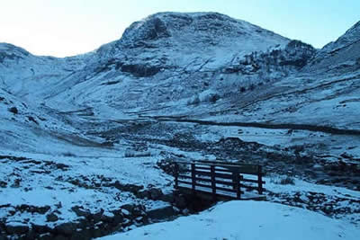
After parking head south along the broad track passing between the farm buildings and cottages. Stay on this track as far as Stockley Bridge (Grid ref. 234109). Cross the bridge, go through the gate and head straight up the partially flagged path to Greenhow Knott. On your right is Taylorgill Force waterfall which drops dramatically from the hanging valley above. Reaching a further gate in a cross wall the gradient eases and most of the climbing is over.
The path turns towards the southwest converging on Styhead Gill. Keep the gill on your right and continue to cross a footbridge (grid ref. NY223102). Once across the Gill continue to reach Styhead Tarn. This is a lovely place to rest awhile as you are surrounded by fine mountain scenery including Great Gable, Scafell Pike and Great End. Make your way up to the stretcher box at Styhead where you turn left to pick up the path leading to Sprinkling Tarn.
The easy climb continues to reach the shores of Sprinkling Tarn. Turn left along the eastern shore following an intermittent path, which leads to the highest point of Seathwaite Fell marked by a small cairn. Sadly this fell is always going to play second fiddle to its grander neighbours but nevertheless it is worth exploring as you get grand views of the surrounding mountain scenery.
Return to the main path turning southeast to continue the climb towards Esk Hause. The path meets Ruddy Gill (Grid ref. 229087) which is in a gully. Drop down to cross the Gill and follow the clear path following the east bank of this stream. You descend amidst dramatic scenery on a well maintained path eventually crossing Ruddy Gill to walk parallel to Grains Gill as far as Stockley Bridge. Cross the bridge and head north along the track used for the first section of the walk to reach the start.
Other walks nearby
| Walk 1065 | Haystacks | moderate | 5.5 miles |
| Walk 1112 | Great Gable | hard | 7.3 miles |
| Walk 1245 | Castle Crag & Grange | easy/mod | 6.0 miles |
| Walk 1175 | Combe Gill Circuit | moderate | 5.5 miles |
| Walk 3328 | Eagle Crag & Seargeant's Crag from Stonethwaite | moderate | 7.0 miles |
| Walk 3133 | Ullscarf and Watendlath from Stonethwaite | mod/hard | 10.0 miles |
| Walk 1693 | Grange & Watendlath from Rosthwaite | easy/mod | 7.6 miles |
| Walk 1444 | Great Gable (Borrowdale route) | hard | 12.0 miles |
| Walk 1153 | The High Stile Ridge | hard | 10.0 miles |
| Walk 1289 | Fleetwith Pike & Haystacks | moderate | 5.5 miles |
Recommended Books & eBooks
Walking the Lake District Fells - Keswick
 Part of the Walking the Lake District Fells series, this guidebook covers a wide range of routes to 30 Lakeland summits that can be climbed from Keswick, Whinlatter, Bassenthwaite, Caldbeck, Mungrisdale and Threlkeld, with highlights including Skiddaw and Blencathra. Includes suggestions for longer ridge routes.
More information
Hadrian's Wall Path
 Hadrians Wall Path guidebook to walk the 84 mile National Trail. Described in both directions, the main description is west to east between Bowness-on-Solway and Wallsend, Newcastle, with extensions to Maryport and South Shields. With extensive historical information related to this World Heritage site and separate 1:25,000 OS map booklet included.
More information
Messaging & Social Media
Message Walking Britain and follow the latest news.

Mountain Weather
Stay safe on the mountains with detailed weather forecasts - for iOS devices or for Android devices.