Curbar, Froggatt & White Edges from Curbar Gap
Peak District Walk
Nat Park - Peak District - Gritstone Edges Higger Tor
County/Area - Derbyshire
Author - Lou Johnson
Length - 8.0 miles / 13 km Ascent - 725 feet / 220 metres
Time - 4 hours 40 minutes Grade - easy/mod
Maps 

| Ordnance Survey Explorer OL24 | Sheet Map | 1:25k | BUY |
| Anquet OS Explorer OL24 | Digital Map | 1:25k | BUY |
| Ordnance Survey Landranger 119 | Sheet Map | 1:50k | BUY |
| Anquet OS Landranger 119 | Digital Map | 1:50k | BUY |
Walk Route Description
Click image to visit gallery of 6 images.
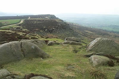
This Peak District walk combines three gritstone edges in the eastern sector of the National Park. The start is the small car park (grid ref SK261747) at Curbar Gap with alternative parking available on the roadside. In fine weather parking is at a premium so an early arrival is recommended.
Leave the car park by the gate on the western perimeter of the car park and follow the wide path that runs parallel with Curbar Edge, which should be on your left. To enjoy the view trend left and follow the less distinct path that keeps nearer to the edge. Extensive views are available to the west across the Derwent Valley to much of the central Peak District.
The walking is easy and Curbar Edge becomes Froggatt Edge. You may hear shouts as climbers tackle the wide variety of pitches on the edge. The path descends gently to reach the A6245. Turn right for a short way along this road before crossing to a signed footpath on the opposite side. This path descends to a stream before climbing to a car park.
Continue parallel to the western side of the car park to walk beside a wall on your right. Take the signed footpath heading half left across the field to reach the main road again. Turn left and pass the Grouse Inn. Just after the road bends left you will see a white gate on your left. Go through this and follow the broad track, which is followed for some way, to reach Longshaw Lodge, where refreshments and toilets are available.
Go past the lodge and take the first track right. This goes behind the lodge and heads south back towards the main road. You pass a couple of benches on your left and just before the car park fork left along a green track. This brings you out to the road at a busy junction. Cross the road to a gate. Ignore this and locate a stile a few yards to the east. Cross this and with the fence on your right climb gently onto White Edge Moor.
This path undulates along White Edge for about 4 km and although the edge is not so dramatic as those used earlier in the walk, the surroundings are pleasant and the views as good. Passing a trig column on your left the path descends with walled enclosures on your right. At the end of the wall turn right and follow the clear path across a stream and back to the Curbar Gap car park.
Other walks nearby
| Walk 1169 | Baslow Edge & Wellington's Monument | easy | 3.5 miles |
| Walk 1014 | Coombs Dale, Longstone Edge & Pilsley from Calver | moderate | 10.0 miles |
| Walk 1273 | Burbage Rocks & Padley Gorge from Hay Wood | moderate | 11.0 miles |
| Walk 2515 | The River Derwent, Curbar, Baslow & Froggatt Edges | easy/mod | 7.5 miles |
| Walk 2520 | Higger Tor & the Longshaw Estate | moderate | 9.0 miles |
| Walk 1539 | Flask Edge and Bar Brook Moor from Shillito Wood | moderate | 9.4 miles |
| Walk 1093 | Higger Tor & Burbage Rocks | easy/mod | 5.3 miles |
| Walk 3557 | Chatsworth Park from Calton Lees | easy/mod | 6.5 miles |
| Walk 3018 | Cracknowl and the Monsal Trail | easy | 3.5 miles |
| Walk 2548 | Stanage Edge from Hathersage | moderate | 8.5 miles |
Recommended Books & eBooks
Dark Peak Walks
 Guidebook to 40 walks in the Dark Peak area of the Peak District National Park. 35 circular routes for most abilities, from 8km to 19km, around Edale, Marsden, Fairholmes, Baslow and Castleton, including Kinder Scout and Mam Tor, and 5 longer (25km to 45km) routes highlighting the best of the Gritstone Edges, High Moorland and Deep Valleys.
More information
Walking in Derbyshire
 Walking guidebook to 60 circular day walks in Derbyshire and the Peak District. Includes the Derwent, Wye and Trent river valleys, near Derby, Matlock, Glossop, Bakewell and Ripley. Routes range from easy to moderate and are between 4 and 14km (2 to 10 miles). Walks focus on places of interest, from Stone Age forts to castles to grand estates.
More information
Messaging & Social Media
Message Walking Britain and follow the latest news.

Mountain Weather
Stay safe on the mountains with detailed weather forecasts - for iOS devices or for Android devices.