Sandwood Bay from Blairmore
Highland Walk
County/Area - Highland - Northern Highland
Author - Lou Johnson
Length - 10.0 miles / 16.3 km Ascent - 1400 feet / 424 metres
Time - 6 hours 20 minutes Grade - moderate
Maps 

| Ordnance Survey Explorer 446 | Sheet Map | 1:25k | BUY |
| Anquet OS Explorer 446 | Digital Map | 1:25k | BUY |
| Ordnance Survey Landranger 9 | Sheet Map | 1:50k | BUY |
| Anquet OS Landranger 9 | Digital Map | 1:50k | BUY |
Walk Route Description
Click image to visit gallery of 9 images.
The far northwest of Scotland is wild, scenically beautiful and far from the crowds. Variants of this walk are given in other publications, which make it a popular excursion for the relatively few visitors to the area. This does make the route quite busy on occasions although you can never expect crowds.
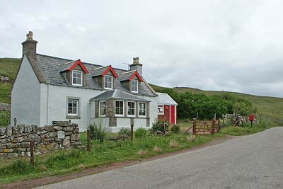
The start is the small car park at Blairmore (Grid ref. NC194600) which is reached by leaving the A838 at Rhiconich and following the B801 to Kinlochbervie where you take a right turn for Oldshoremore and continue to Blairmore.
After parking continue west on the road through Balchrick to reach Sheigra. Ignore the left turn and continue through the hamlet. The road reaches a gate and becomes a track (a former peat road) which is followed as it climbs gently northeast with Cnoc Poll a' Mhurain rising on your left. The peat road eventually peters out and at this point you need to cross un-pathed, rough peat moorland to reach the coast. The most satisfactory route seemed to be on the east side of the stream keeping away from the boggier valley bottom. Continue north to reach the remains of a small circular building by a small lochan (Grid ref. NC 193634).
From the western end of this small lochan a clear path rises north onto the cliff tops and this is followed, rather precariously at times all the way to Sandwood Bay. This stretch of coastline is wild with high cliffs of Torridon sandstone with Am Buchaille (a pointed stack) and evidence of other stacks near the headland. Care is needed for many sections of this path as there are some unexpected and significant drops to the seaward side and some erosion. Children need to be under very tight supervision.
The path leads up and down following the cliffs in true coast path walking to eventually provide a view of Sandwood Bay with its great expanse sandy beach and dunes. The path descends across the cliffs to the western end of the beach.
The onward path leaves the beach about one kilometre from the point where you joined it and immediately to the west of a lochan. Once located the path leads uphill past the few remains of Sandwood Farm to pass a number of lochans dotted across the wild moorland. The path is well maintained and becomes track just past Loch a' Mhuillin. Continue along this track to Loch na Gainimh where you need to look out for a shortcut path on your left that follows the shore. (If you miss this path then turn right at the next junction in the track.)
With a final gentle ascent the cottages of Blairmore come into view. On reaching the road turn right and the car park is on your left.
Other walks nearby
| Walk 2530 | The Foinaven & Arkle Traverse | very hard | 16.5 miles |
| Walk 3261 | Handa Island - Scottish Wildlife Trust | easy | 4.0 miles |
| Walk 1117 | Glas Bheinn & Eas a' Chual Aluinn (waterfall) | mod/hard | 8.5 miles |
| Walk 1317 | Sail Gharbh (Quinag) | moderate | 5.4 miles |
| Walk 1266 | The Old Man of Stoer and the Point of Stoer | easy | 4.5 miles |
| Walk 1312 | Achmelvich Bay and Alltanabradhan | easy | 3.0 miles |
| Walk 3272 | Conival & Ben More Assynt from Inchnadamph | hard | 11.0 miles |
| Walk 1769 | Suilven (North-western approach) | hard | 12.0 miles |
| Walk 1316 | Falls of Kirkaig | easy | 5.8 miles |
| Walk 1319 | The Bone Caves of Inchnadamph | easy | 3.0 miles |
Recommended Books & eBooks
Great Mountain Days in Scotland
 Inspirational guidebook to 50 challenging routes for mountaineers, scramblers, hillwalkers and fell runners, many long enough to backpack over 2 days, especially in winter (12 to 25 miles). A mix of classic routes and unsung gems across Scotland from Galloway to the Outer Hebrides in widely differing wild landscapes. With customised OS mapping.
More information
Walking in Torridon
 This guidebook contains 52 day walks in Torridon, a remote and much-loved area of the Scottish Highlands. Based around Shieldaig and Slioch, the routes are split into 3 sections: easy walks, long and high level walks and mountain ascents over 2000ft including 9 Munros, and 5 outline suggestions for major ridge walks.
More information
Messaging & Social Media
Message Walking Britain and follow the latest news.

Mountain Weather
Stay safe on the mountains with detailed weather forecasts - for iOS devices or for Android devices.