Tom Heights and Tarn Hows from Coniston
Lake District Walk
Nat Park - Lake District - Lake District Southern Fells
County/Area - Cumbria
Author - Lou Johnson
Length - 7.0 miles / 11.4 km Ascent - 1500 feet / 455 metres
Time - 5 hours 0 minutes Grade - easy/mod
Maps 

| Ordnance Survey Explorer OL6 | Sheet Map | 1:25k | BUY |
| Anquet OS Explorer OL6 | Digital Map | 1:25k | BUY |
| Ordnance Survey Landranger 90 | Sheet Map | 1:50k | BUY |
| Anquet OS Landranger 90 | Digital Map | 1:50k | BUY |
Walk Route Description
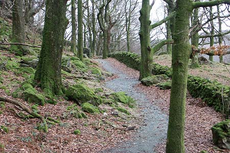
Click image to visit gallery of 9 images.
This varied Lake District walk starts from Coniston with its many shops and cafés before exploring some of the scenic delights to the north east of the village. Tarn Hows is a well known beauty spot and can be busy but off-peak it is a delight to stroll around this beautiful lake.
The start is the main pay and display car park (Grid ref SD303975) in Coniston adjacent to the Tourist Information office. There are other places in the village where you can park for free but these are in short supply certainly in season. Exit the car park and turn left and walk to the main road. Turn right along the main road towards Ambleside. After a short way cross over and take the narrow lane that leads to the Coppermines Valley. Reaching the intake wall (Grid ref SD300979), turn right onto the signed footpath. Keeping the wall on your right, this path leads you below Yew Pike and past the Youth Hostel. At a gate (Grid ref SD302981) turn right and walk down the walled lane to a road.
Go left in front of the cottages at Far End towards the main road. On your left is a signed footpath to Skelwith Bridge and this is followed to reach the main road (Grid ref. SD311995). After a short section alongside the main road and take the second lane on your left signed to Hodge Close. After a short way take the signed footpath on your right signed Skelwith Bridge and continue past Yew Tree Farm, with its spinning gallery, across a bridge to reach the main road once again.
Turn left along the main road and cross to the Glen Mary car park. Do not take the bridleway instead follow the path on the left hand side of Tom Gill as far as the outlet from the Tarn. Turn left on the path which circles the Tarn. To your left Tom Heights is a small fell that offers superb views across the surrounding area to the higher fells beyond and this is our next objective. Like much of the terrain in this area it can be very confusing with many small paths and sheep trods making navigation difficult. The easiest approach is to take a clear path left from the main lakeside path about 300 metres after reaching the tarn. Keep going up to reach the ridge of Tom Heights where you are presented with spectacular views in all directions. There are a number of minor summits and by walking north you will be able to visit them all.
Descending from the northern end of the ridge is hard to describe and you may lose your bearings. However descend east from the final summit on the clear path that leads to a grassy col with a junction of paths. Turn right here and after 20 metres go right again. Take the next path on your left to join a wider path. Turn right and continue to reach the path that circles the Tarn. Turn left and follow this path until you reach a junction (Grid ref. SD333999). Take the left fork and climb up a broad path to a small parking area (Grid ref. SD330995). Cross the road and follow the path through the woods following the wall. After 100 metres, fork right to stay beside the wall.
There are many tracks and paths in the wood and you need to keep losing height and be close to the stream which is on your right at the moment. After 400 metres you will reach another junction. Turn right, cross the stream and continue on the main path ignoring all minor paths continuing to follow the stream which is now on your left. The track crosses the stream again and the path steepens with a few cascades on your right. Reaching a lane, cross over and take the footpath going left that runs parallel with the road. Turn left into the drive for Boon Crag Farm and where this lane bends right go over the stile on your left (Grid ref SD315983) and follow the signed path.
Entering Guard's Wood there are some waymarks although they seem to be missing when you most need them! Despite route finding being problematic, you need to follow the path in a generally westerly direction across the highest point of the wood. (Note - some older OS 1:25000 maps show a different route.) Reaching a wall, cross the stile into a field and exit via a gate. The onward path is now clear and you reach a bridge over Yewdale Beck. Cross the bridge and turn left. After 150 metres turn left again into the village with the car park on your left.
Other walks nearby
| Walk 1911 | Coniston's Magnificent Seven | hard | 13.0 miles |
| Walk 3110 | The Old Man of Coniston & Dow Crag from Torver | mod/hard | 8.5 miles |
| Walk 2033 | Tilberthwaite & Wetherlam | moderate | 5.0 miles |
| Walk 3320 | Grizedale Tarn circular | easy | 2.5 miles |
| Walk 3410 | Latterbarrow from Hawkshead | easy | 4.0 miles |
| Walk 3508 | The Crinkle Crags from Wrynose Pass | easy/mod | 5.0 miles |
| Walk 1134 | Wetherlam and The Carrs | mod/hard | 10.8 miles |
| Walk 2270 | Tilberthwaite and Holme Fell Little Langdale | easy/mod | 5.5 miles |
| Walk 3638 | Satterthwaite Bridge Circular | easy | 3.2 miles |
| Walk 1058 | Beacon Fell & Beacon Tarn Circular | easy/mod | 4.0 miles |
Recommended Books & eBooks
Walking the Lake District Fells - Wasdale
 Part of the Walking the Lake District Fells series, this guidebook covers a wide range of routes to 25 Lakeland summits that can be climbed from the Wasdale, Eskdale and Ennerdale valleys, with highlights including Scafell Pike, Great Gable and Pillar. Suggestions for longer ridge routes are also included.
More information
Great Mountain Days in the Lake District
 An inspirational guidebook to 50 challenging walks on the high fells of the Lake District. The graded circular routes, between 4 and 14 miles in length, cover classic Lakeland summits like Fairfield, Scafell Pike, Great Gable and Blencathra, to the lesser-known High Spy, King's How and Brund Fell.
More information
Messaging & Social Media
Message Walking Britain and follow the latest news.

Mountain Weather
Stay safe on the mountains with detailed weather forecasts - for iOS devices or for Android devices.