Cassiobury Park & Grand Union Canal, Watford
Hertfordshire Walk
County/Area - Hertfordshire
Author - Lou Johnson
Length - 2.0 miles / 3.3 km Ascent - 80 feet / 24 metres
Time - 1 hours 10 minutes Grade - easy
Maps 

| Ordnance Survey Explorer 173 | Sheet Map | 1:25k | BUY |
| Anquet OS Explorer 173 | Digital Map | 1:25k | BUY |
| Ordnance Survey Landranger 166 | Sheet Map | 1:50k | BUY |
| Anquet OS Landranger 166 | Digital Map | 1:50k | BUY |
Walk Route Description
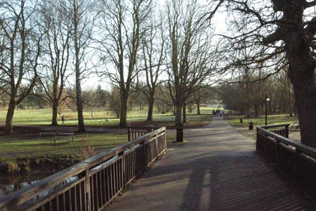
Click image to visit gallery of 9 images.
This short Hertfordshire walk explores Watford's Cassiobury Park together with a section the Grand Union Canal. The start is the entrance to the park near the junction of Langley Way and Parkside Drive (Grid ref. TQ091974). Langley Way is reached by using the A441. Parking is available on the street but do be considerate to local residents.
Follow the enclosed path between houses into Cassiobury Park. Walk ahead to cross the River Gade. Note the weir to your right. The path continues to cross the Grand Union canal. To your right is a lock, which is often a hive of activity as boats move up and down this important canal. Bear left to reach the canal towpath and walk south passing through a pleasant tree lined section.
At the next bridge you may wish to walk further along the canal past some cottages on your right to another lock. Ahead you will see Metropolitan Line trains crossing a viaduct. There are many narrow boats moored in this area with some used as houseboats. After completing your exploration return to the bridge and cross the canal to follow a clear path going east. At the first junction take a lesser path off to your left. This crosses the river by means of a footbridge.
Reaching the far bank, turn left and follow the path. Do not cross the river but continue with the river on your left to reach the miniature railway. Shortly after passing the railway you turn right on a clear path that you used at the start of the walk.
Other walks nearby
| Walk 3122 | Moor Park to Rickmansworth | easy/mod | 7.0 miles |
| Walk 1931 | Rickmansworth circular via Croxley Green and Watford | easy/mod | 7.0 miles |
| Walk 1609 | Hertfordshire Way Aldenham to Bricket Wood | easy | 5.5 miles |
| Walk 3511 | Aldenham to Watling Street Circular | easy | 5.5 miles |
| Walk 3403 | Chipperfield to Kings Langley Circular | easy | 5.0 miles |
| Walk 1507 | Chipperfield Common circular | easy | 2.0 miles |
| Walk 1815 | Hertfordshire Way between Chipperfield and Bovingdon | easy/mod | 7.5 miles |
| Walk 3664 | Northwood Hills to Northolt | moderate | 10.3 miles |
| Walk 1071 | Chalfont & Latimer, Chalfont St Giles & Chorleywood | easy/mod | 12.6 miles |
| Walk 1536 | Sarratt Bottom and Chenies from Little Chalfont | easy/mod | 6.3 miles |
Recommended Books & eBooks
No suggestions for this area.Messaging & Social Media
Message Walking Britain and follow the latest news.

Mountain Weather
Stay safe on the mountains with detailed weather forecasts - for iOS devices or for Android devices.