Wyre Forest National Nature Reserve, Bewdley
Worcestershire Walk
County/Area - Worcestershire & Shropshire
Author - Peter Lane
Length - 3.3 miles / 5.3 km Ascent - 500 feet / 152 metres
Time - 2 hours 10 minutes Grade - easy
Maps 

| Ordnance Survey Explorer 219 | Sheet Map | 1:25k | BUY |
| Anquet OS Explorer 219 | Digital Map | 1:25k | BUY |
| Ordnance Survey Landranger 138 | Sheet Map | 1:50k | BUY |
| Anquet OS Landranger 138 | Digital Map | 1:50k | BUY |
Walk Route Description
Click image to visit gallery of 9 images.
This outstanding short walk through the Wyre Forest Nature Reserve, part of which is a Site of Scientific Special Interest (SSSI), is a great way to get out and explore the woodlands for about an hour. It is a great walk at any time of the year, but spectacular in snow or frost. It provides year round interest away from the popular areas of the Forest.
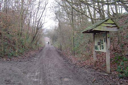
The starting point is a small car park near the bottom of Hop Pole Lane, Bewdley, grid reference SO772763. The approach route by car is part of National Cycle Route 45. Turn left up a muddy track just before you reach the remains of a railway bridge with just the supporting stonework remaining either side of the road. A signboard welcomes you to the Wyre Forest Nature Reserve.
Start at the gate on the opposite side of the parking area to the information board and take the wide muddy path as it twists around to the left until it reaches the corner of the Forest Lodge where you continue along the path as it turns to the right. After a short while, the path now swings left and another path turns off to the right, ignore this path on the right continuing on a bearing of approximately 140 degrees. Coming soon to a cross-roads of paths with a clearing straight ahead visible through the trees, turn right on a bearing of 210 degrees. After a short while another path feeds in from the right. Continue on the current path, keeping the clearing fairly nearby to your left. The path swings left towards some buildings and emerges from the wood at a large open area and a gate.
Through the gateway, turn right along the forest road, passing Uncllys and St George's Farms. Continue past St George's Farm on a North Westerly bearing for about 300 metres until reaching a tree replete with yellow waymarks indicating a cross-roads of footpaths. Turn right here down a wide forest path until reaching a small pond on the right. Just past the small pond another path comes in from the right and very soon a waymark can be seen ahead leading to a stile.
Cross the stile into a field bizarrely landscaped with multiple tussocky mounds, possibly the remnant dwellings of some ancient lost mole civilisation long abandoned after the decline of their empire! Cross over an old railway bridge to a stile, cross, pass Lodge Hill Farm to the left and then cross a stile on the right across a field. At the other end of the field is a signboard welcoming you to the SSSI and another stile. Enter and take the path on the left as it descends gracefully down to Dowles Brook and Knowles Mill.
At the mill, a footbridge takes you over the brook. Turn right and walk along the brook for about 900 metres and emerge after a pleasant stroll at the roadway that returns uphill to Hop Pole Lane and the parking area on the right.
Other walks nearby
| Walk 2288 | Pound Green and Dowles Brook from Hawkbatch | easy | 5.0 miles |
| Walk 2466 | The Severn Valley from Trimpley Reservoir | easy | 6.0 miles |
| Walk 3217 | Bewdley and Snuffmill Dingle | easy | 5.0 miles |
| Walk 1933 | Wyre Forest & River Severn from Upper Arley | easy/mod | 7.6 miles |
| Walk 2248 | Wimperhill Wood and Longdon Orchard, Wyre Forest | easy | 4.0 miles |
| Walk 1603 | Shatterford Wood and Castle Hill circular | easy/mod | 5.5 miles |
| Walk 3504 | Highley to Bewdley along the River Severn | easy/mod | 7.0 miles |
| Walk 2092 | Highley from the Severn Valley Country Park | easy/mod | 4.5 miles |
| Walk 3662 | Abberley Circular | easy/mod | 4.8 miles |
| Walk 1099 | Abberley Hills - Worcestershire Way Circular | easy/mod | 4.0 miles |
Recommended Books & eBooks
No suggestions for this area.Messaging & Social Media
Message Walking Britain and follow the latest news.

Mountain Weather
Stay safe on the mountains with detailed weather forecasts - for iOS devices or for Android devices.