Whitendale from Dunsop Bridge
Forest of Bowland Walk
Region - Forest of Bowland
County/Area - Lancashire
Author - Mike Bexley
Length - 8.0 miles / 13 km Ascent - 595 feet / 180 metres
Time - 4 hours 40 minutes Grade - moderate
Maps 

| Ordnance Survey Explorer OL41 | Sheet Map | 1:25k | BUY |
| Anquet OS Explorer OL41 | Digital Map | 1:25k | BUY |
| Ordnance Survey Landranger 103 | Sheet Map | 1:50k | BUY |
| Anquet OS Landranger 103 | Digital Map | 1:50k | BUY |
Walk Route Description
Click image to see photo description.
This walk visits the remote valleys and fells of The Forest of Bowland in Lancashire. The route described here can be extended - see walk 2556 - if the weather is kind or you feel like more exercise. Especially after a period of rain, conditions under foot are can be wet but do not let this deter you as the feeling of solitude is well worth the effort.
The walk starts in the beautiful village of Dunsop Bridge (Grid ref. SD661501) where car parking is available. Exit the car park (passing the toilet block) and cross over the road to the Telephone Box to discover you are in the centre of The British Isles! The phone box has a unique number to commemorate this feature.
Cross over the road again to pass the petrol station and post office turning right down the lane prior to the bridge. Continue along the lane (heading north) through fields, behind the cottages then over the River Dunsop. On reaching the west bank turn right and follow the road passing Bishops House (grid ref. 655515).
As you go further into the valley you should see lots of bird life. Look out for the Buzzards high above you and Oyster Catchers near the river. You will eventually come to a concrete Salmon Ladder, do not cross over the bridge but continue along the road ignoring the footbridge on your right. The road then climbs to meet a road from coming in from the right. There is a finger post sign indicating local farms.
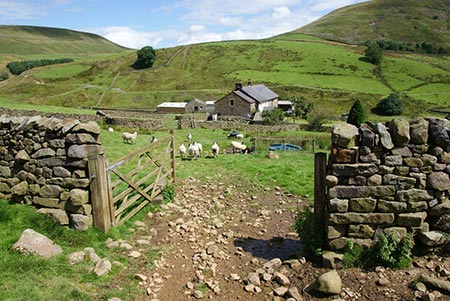
Leave the road here and take the bridleway that contours across the western flank of Middle Knoll looking down on both Brennand Farms. This bridleway terminates at a gate just before a brook (Grid ref 649547). Go over the stile on the right. The onward path is very wet and at times not visible. It passes a fenced lake on the left and ends with a very short steep descent to the picturesque Whitendale Farm (Grid ref 661550).
Walk straight on, to the right of the accommodation, through the farm gate then turn right at the end of the wall to follow the path on the other side of the river to the Salmon Ladder and back to your start.
Other walks nearby
| Walk 2594 | Totridge Fell & Fiendsdale Head, Forest of Bowland | moderate | 11.0 miles |
| Walk 1218 | Fiensdale Head & Bleasdale Water | moderate | 10.0 miles |
| Walk 2384 | Hodder Valley from Whitewell | easy/mod | 6.8 miles |
| Walk 2216 | Slaidburn Village Trail - Ribble Valley | easy | 0.8 miles |
| Walk 3329 | Stocks Reservoir from Slaidburn | moderate | 11.5 miles |
| Walk 2452 | Dunsop Head from Slaidburn | easy/mod | 7.0 miles |
| Walk 3038 | Wolfhole Crag from Tower Lodge | moderate | 9.0 miles |
| Walk 1902 | Saddle Fell, Fair Snape Fell & Parlick from Chipping | moderate | 8.0 miles |
| Walk 2505 | Fair Snape Fell from Fell Foot, Forest of Bowland | moderate | 6.0 miles |
| Walk 3730 | Stocks Reservoir Circular | easy/mod | 7.0 miles |
Recommended Books & eBooks
Walking in the Forest of Bowland and Pendle
 A guidebook to 40 diverse circular day walks suitable for walkers with navigational skills. The Forest of Bowland and Pendle are two of north west England's upland AONBs, perfect for walkers who enjoy exploring rough hilly, sometimes pathless terrain. The routes include Ward's Stone, Pendle Hill, Longridge Fell and Fair Snape Fell.
More information
Walking on the West Pennine Moors
 This guidebook describes 30 walks on the West Pennine Moors, around Blackburn, Darwen, Chorley and Bolton, home to some of the most inspiring and exhilarating walking country. The walks range from short, easy rambles to more challenging hikes covering a variety of terrain, all of it easily accessible for day walking.
More information
Messaging & Social Media
Message Walking Britain and follow the latest news.

Mountain Weather
Stay safe on the mountains with detailed weather forecasts - for iOS devices or for Android devices.